Photos • Location

This article relies largely or entirely on a
single source. (April 2021) |
41°56′54″N 124°12′11″W / 41.94833°N 124.20306°W
Khoonkhwuttunne | |
|---|---|
Former settlement | |
 Khoonkhwuttunne Location in California | |
| Coordinates: 41°56′54″N 124°12′11″W / 41.94833°N 124.20306°W | |
| Country | United States |
| State | California |
| County | Del Norte County |
| Elevation | 33 ft (10 m) |
Khoonkhwuttunne (also, Qo-on-qwut-tunne) is a former Tolowa settlement in Del Norte County, California, located at the mouth of the Smith River. It lay at an elevation of 33 feet (10 m).
References
External links
Municipalities and communities of
Del Norte County, California, United States | ||
|---|---|---|
| City | 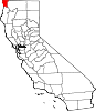 | |
| CDPs | ||
|
Unincorporated communities | ||
|
Indian reservations | ||
|
Ghost towns | ||
|
| This Del Norte County, California-related article is a stub. You can help Wikipedia by expanding it. |
This article relies largely or entirely on a
single source. (April 2021) |
41°56′54″N 124°12′11″W / 41.94833°N 124.20306°W
Khoonkhwuttunne | |
|---|---|
Former settlement | |
Khoonkhwuttunne Location in California | |
| Coordinates: 41°56′54″N 124°12′11″W / 41.94833°N 124.20306°W | |
| Country | United States |
| State | California |
| County | Del Norte County |
| Elevation | 33 ft (10 m) |
Khoonkhwuttunne (also, Qo-on-qwut-tunne) is a former Tolowa settlement in Del Norte County, California, located at the mouth of the Smith River. It lay at an elevation of 33 feet (10 m).
References
External links
Municipalities and communities of
Del Norte County, California, United States | ||
|---|---|---|
| City | | |
| CDPs | ||
|
Unincorporated communities | ||
|
Indian reservations | ||
|
Ghost towns | ||
|
| This Del Norte County, California-related article is a stub. You can help Wikipedia by expanding it. |