Photos • Location
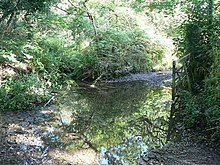
A ford by Kerthen Wood Haven


Kerthen Wood, or Kirthen Wood, is a hamlet near Townshend in Cornwall, England. [1] [2] It is in the civil parish of Crowan [3]
- ^ Ordnance Survey: Landranger map sheet 203 Land's End & Isles of Scilly (St Ives & Lizard Point) (Map). Ordnance Survey. 2009. ISBN 978-0-319-23289-7.
- ^ "Ordnance Survey: 1:50,000 Scale Gazetteer" (csv (download)). www.ordnancesurvey.co.uk. Ordnance Survey. 1 January 2016. Retrieved 2 March 2016.
- ^ "Magic Map Application". Defra. Retrieved 2 March 2016.
| Unitary authorities | |
|---|---|
| Major settlements (cities in italics) |
|
| Rivers | |
| Topics | |
50°09′01″N 5°23′03″W / 50.15032°N 5.3842644°W
|
| This Cornwall location article is a stub. You can help Wikipedia by expanding it. |