| Lake Kastraki | |
|---|---|
| Τ. Λίμνη Καστρακίου ( Greek) | |
 | |
| Location | Aetolia-Acarnania, Greece |
| Coordinates | 38°48′N 21°22′E / 38.800°N 21.367°E |
| Type | Artificial Lake |
| Primary inflows | Acheloos |
| Primary outflows | Acheloos |
| Basin countries | Greece |
| Surface area | 28 km2 (11 sq mi) |
| Water volume | 0.95 km3 (770,000 acre⋅ft) |
| Surface elevation | 144 m (472 ft) |
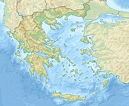
Lake Kastraki ( Greek: Λίμνη Καστρακίου) is an artificial lake near Kastraki in Aetolia-Acarnania, western Greece. The lake is drained by the river Acheloos, and fed by the rivers Acheloos and Inachos. [1] It was formed by the Kastraki Dam, completed in 1969. Its area is about 28 km2 and its maximum capacity is 950,000,000 m³ of water. It is used for the generation of hydroelectric power by DEI. [2]
Gallery
References
- ^ Marinos, Paul G. (1997). Engineering geology and the environment: proceedings : International Symposium on Engineering Geology and the Environment : Athens, Greece, 23-27 June, 1997. Vol. 3. Taylor & Francis. ISBN 90-5410-880-0.
- ^ Kastraki Hydroelectric Project
External links
| Lake Kastraki | |
|---|---|
| Τ. Λίμνη Καστρακίου ( Greek) | |
 | |
| Location | Aetolia-Acarnania, Greece |
| Coordinates | 38°48′N 21°22′E / 38.800°N 21.367°E |
| Type | Artificial Lake |
| Primary inflows | Acheloos |
| Primary outflows | Acheloos |
| Basin countries | Greece |
| Surface area | 28 km2 (11 sq mi) |
| Water volume | 0.95 km3 (770,000 acre⋅ft) |
| Surface elevation | 144 m (472 ft) |
Lake Kastraki ( Greek: Λίμνη Καστρακίου) is an artificial lake near Kastraki in Aetolia-Acarnania, western Greece. The lake is drained by the river Acheloos, and fed by the rivers Acheloos and Inachos. [1] It was formed by the Kastraki Dam, completed in 1969. Its area is about 28 km2 and its maximum capacity is 950,000,000 m³ of water. It is used for the generation of hydroelectric power by DEI. [2]
Gallery
References
- ^ Marinos, Paul G. (1997). Engineering geology and the environment: proceedings : International Symposium on Engineering Geology and the Environment : Athens, Greece, 23-27 June, 1997. Vol. 3. Taylor & Francis. ISBN 90-5410-880-0.
- ^ Kastraki Hydroelectric Project

