Karasor Basin
Қарасор ойысы | |
|---|---|
 Karasor Depression
Sentinel-2 image | |
 Karasor Basin Location in Kazakhstan | |
| Coordinates: 49°53′N 75°23′E / 49.88°N 75.38°E | |
| Location | Karaganda Region, Kazakhstan |
| Part of | Kazakh Uplands |
| Area | |
| • Total | ca 9,000 km2 (3,500 sq mi) |
| Dimensions | |
| • Length | ca 130 km (81 mi) |
| • Width | ca 70 km (43 mi) |
| Elevation | ca 620 m (2,030 ft) |
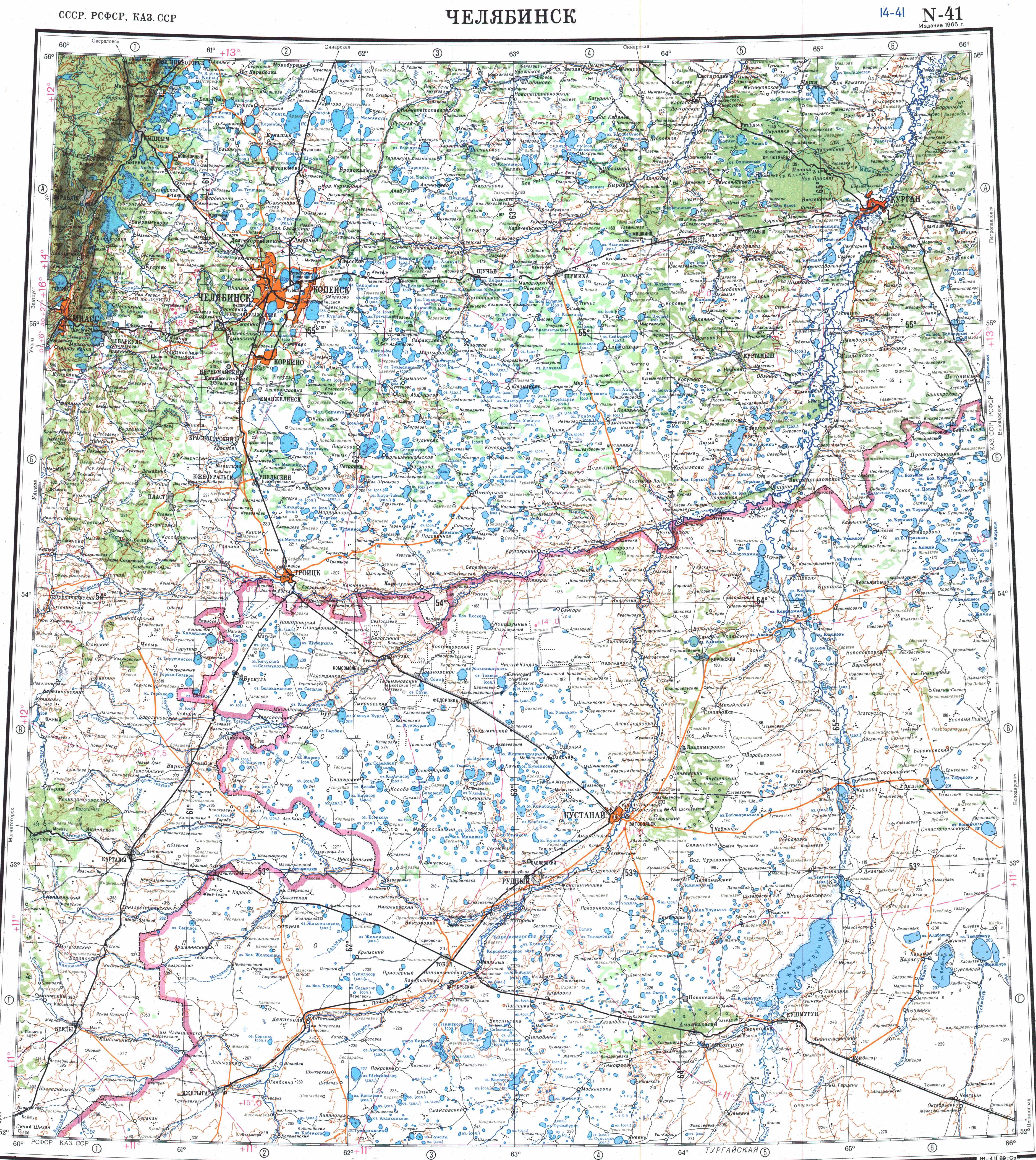
The Karasor Basin ( Kazakh: Қарасор ойысы; Russian: Карасорская впадина) or Karasor Depression, is a depression in Karkaraly District, Karaganda Region, Kazakhstan. [1] [2]
The Karasor Basin includes a 37,286 hectares (92,140 acres) Important Bird Area. [3]
Geography
The Karasor Depression is an endorheic basin in the Kazakh Uplands. It extends roughly from east to west for a length of approximately 130 km (81 mi) to the southeast of the Ayr and Zheltau ranges, and north of the Karkaraly Range and the Kyzyltas. Fourteen rivers flow into the basin, the largest of which are the 159 kilometers (99 mi) long Taldy and the 156 kilometers (97 mi) long Zharly. The Karasor Basin is covered in snow approximately between October and April every year. Most rivers and rivulets flow only following the melting of the snows, breaking up into disconnected pools or drying out completely during the summer. [4]
Karasor, the largest lake, lies in a central position at the bottom of the depression. There are three other major lakes in the basin, Saumalkol, Katynkol and Balyktykol, as well as numerous smaller lakes and sors. The water of all the lakes is saline; Saumalkol in the west is a dead lake, having the highest salt concentration, while Balyktykol has the lowest. The salinity of Karasor and Taldykol exceeds the values of average sea water. Parts of the depressions between the surrounding hills are occupied by salt pans. [3] [1]
Ancient lake
Karasor was a much larger lake in the past. There are traces of high water levels reaching 640 m (2,100 ft) in the banks of Karasor and adjacent Saumalkol and Katynkol lakes, indicating that the former extension of lake Karasor reached 740 km2 (290 sq mi) —about five times larger, with a depth between 22 m (72 ft) and 25 m (82 ft) —almost five times deeper. At that time the water of river Nura reached the ancient lake from the west. [2] [5] [4]
Flora and fauna
The landscape of the basin area is hilly steppe,. There are plowed agricultural fields with clayey and loamy soils. The vegetation in the basin includes spear grass, wormwood, Siberian peashrub, Neotrinia splendens and fescue. [6] [7] [3] [8]
See also
References
- ^ a b Google Earth
- ^ a b Jilili Abuduwaili, Gulnura Issanova, Galymzhan Saparov. Hydrology and Limnology of Central Asia, Springer, Berlin 2019, ISBN 978-9811309281
- ^ a b c "Karasor Lake - BirdLife Data Zone". Archived from the original on 2024-03-29. Retrieved 2024-03-29.
- ^ a b "L-42 Topographic Chart (in Russian)". Archived from the original on 8 October 2023. Retrieved 29 March 2024.
- ^ Kazakhstan National Encyclopedia / Ch. ed. B.O. Jakyp. — Almaty: «Kazakh encyclopedia» ZhSS, 2011. ISBN 9965-893-64-0 (T.Z.), ISBN 9965-893-19-5
- ^ Jilili Abuduwaili, Gulnura Issanova, Galymzhan Saparov, Hydrology and Limnology of Central Asia. pp. 177-181
- ^ "News of the National Academy of Sciences of the Republic of Kazakhstan" (PDF). Archived (PDF) from the original on 2023-05-22. Retrieved 2024-03-31.
- ^ Gel dyyeva G.V. 1974: Landscapes of the Karasor Basin, central Kazakhstan. Voprosy Geografii Kazakhstana 16, Geografiya prirodnykh resursov Kazakhstana): 51
External links
-
 Media related to
Karasor Basin at Wikimedia Commons
Media related to
Karasor Basin at Wikimedia Commons
Karasor Basin
Қарасор ойысы | |
|---|---|
|
Karasor Depression
Sentinel-2 image | |
Karasor Basin Location in Kazakhstan | |
| Coordinates: 49°53′N 75°23′E / 49.88°N 75.38°E | |
| Location | Karaganda Region, Kazakhstan |
| Part of | Kazakh Uplands |
| Area | |
| • Total | ca 9,000 km2 (3,500 sq mi) |
| Dimensions | |
| • Length | ca 130 km (81 mi) |
| • Width | ca 70 km (43 mi) |
| Elevation | ca 620 m (2,030 ft) |
The Karasor Basin ( Kazakh: Қарасор ойысы; Russian: Карасорская впадина) or Karasor Depression, is a depression in Karkaraly District, Karaganda Region, Kazakhstan. [1] [2]
The Karasor Basin includes a 37,286 hectares (92,140 acres) Important Bird Area. [3]
Geography
The Karasor Depression is an endorheic basin in the Kazakh Uplands. It extends roughly from east to west for a length of approximately 130 km (81 mi) to the southeast of the Ayr and Zheltau ranges, and north of the Karkaraly Range and the Kyzyltas. Fourteen rivers flow into the basin, the largest of which are the 159 kilometers (99 mi) long Taldy and the 156 kilometers (97 mi) long Zharly. The Karasor Basin is covered in snow approximately between October and April every year. Most rivers and rivulets flow only following the melting of the snows, breaking up into disconnected pools or drying out completely during the summer. [4]
Karasor, the largest lake, lies in a central position at the bottom of the depression. There are three other major lakes in the basin, Saumalkol, Katynkol and Balyktykol, as well as numerous smaller lakes and sors. The water of all the lakes is saline; Saumalkol in the west is a dead lake, having the highest salt concentration, while Balyktykol has the lowest. The salinity of Karasor and Taldykol exceeds the values of average sea water. Parts of the depressions between the surrounding hills are occupied by salt pans. [3] [1]
Ancient lake
Karasor was a much larger lake in the past. There are traces of high water levels reaching 640 m (2,100 ft) in the banks of Karasor and adjacent Saumalkol and Katynkol lakes, indicating that the former extension of lake Karasor reached 740 km2 (290 sq mi) —about five times larger, with a depth between 22 m (72 ft) and 25 m (82 ft) —almost five times deeper. At that time the water of river Nura reached the ancient lake from the west. [2] [5] [4]
Flora and fauna
The landscape of the basin area is hilly steppe,. There are plowed agricultural fields with clayey and loamy soils. The vegetation in the basin includes spear grass, wormwood, Siberian peashrub, Neotrinia splendens and fescue. [6] [7] [3] [8]
See also
References
- ^ a b Google Earth
- ^ a b Jilili Abuduwaili, Gulnura Issanova, Galymzhan Saparov. Hydrology and Limnology of Central Asia, Springer, Berlin 2019, ISBN 978-9811309281
- ^ a b c "Karasor Lake - BirdLife Data Zone". Archived from the original on 2024-03-29. Retrieved 2024-03-29.
- ^ a b "L-42 Topographic Chart (in Russian)". Archived from the original on 8 October 2023. Retrieved 29 March 2024.
- ^ Kazakhstan National Encyclopedia / Ch. ed. B.O. Jakyp. — Almaty: «Kazakh encyclopedia» ZhSS, 2011. ISBN 9965-893-64-0 (T.Z.), ISBN 9965-893-19-5
- ^ Jilili Abuduwaili, Gulnura Issanova, Galymzhan Saparov, Hydrology and Limnology of Central Asia. pp. 177-181
- ^ "News of the National Academy of Sciences of the Republic of Kazakhstan" (PDF). Archived (PDF) from the original on 2023-05-22. Retrieved 2024-03-31.
- ^ Gel dyyeva G.V. 1974: Landscapes of the Karasor Basin, central Kazakhstan. Voprosy Geografii Kazakhstana 16, Geografiya prirodnykh resursov Kazakhstana): 51
External links
-
Media related to
Karasor Basin at Wikimedia Commons