Kamrangirchar Thana
কামরাঙ্গীরচর থানা | |
|---|---|
|
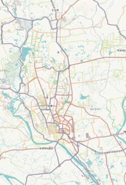
Expandable map of vicinity of Kamrangirchar Thana | |
| Coordinates: 23°43′05″N 90°22′04″E / 23.71799°N 90.36780°E | |
| Country | |
| Division | Dhaka Division |
| District | Dhaka District |
| Established as a thana | 1998 |
| Area | |
| • Total | 3.63 km2 (1.40 sq mi) |
| Elevation | 23 m (75 ft) |
| Population (2011)
[2] | |
| • Total | 93,601 |
| • Density | 25,785/km2 (66,780/sq mi) |
| Time zone | UTC+6 ( BST) |
| Area code | 1211 [3] |
Kamrangirchar ( Bengali: কামরাঙ্গীরচর) is a Thana of Dhaka District in the Division of Old Dhaka, Bangladesh.
Geography
Kamrangirchar is bounded by Hazaribagh Thana and Lalbagh Thana on the north, Lalbagh Thana and Chawkbazar Thana on the east and Keraniganj Upazila on the south and west. Its total area is 3.63 km2 (1.40 sq mi). [4]
Demographics
According to 2011 census, Kamrangirchar Thana has a population of 93,601 with average household size of 4.3 members, and an average literacy rate of 57.6% vs national average of 51.8% literacy. [2]
Trivia
- A 2006 survey [5] of slums in Bangladesh found that the single largest concentration of slums in the Dhaka Metropolitan Area was in Kamrangirchar, and reported that of the (approx) 300,000 people living there, 265,000 are slum dwellers.
See also
References
- ^ "Geographic coordinates of Dhaka, Bangladesh". DATEANDTIME.INFO. Retrieved 7 July 2016.
- ^ a b Bangladesh Bureau of Statistics (2011). "Population & Housing Census" (PDF). Bangladesh Government. Archived from the original (PDF) on 3 September 2017. Retrieved 17 April 2015.
- ^ "ঢাকা পোস্টকোড". ডাক অধিদপ্তর. Retrieved 2024-01-17.
- ^ "Kamrangirchar Thana". Banglapedia. Retrieved 2024-01-18.
- ^ Measure Evaluation / NIPORT (2006) Slums of urban Bangladesh: mapping and census, 2005. Centre for Urban Studies / Measure Evaluation / National Institute of Population Research and Training. Accessed 9 June 2007 [1]


