Kajola
Rock city | |
|---|---|
 A landscape of Kajola L.G.A | |
| Country | |
| State | Oyo State |
| Government | |
| • Local Government Chairman and the Head of the Local Government Council | Adebare Muraina Afolabi ( PDP) |
| Time zone | UTC+1 ( WAT) |
|
| |
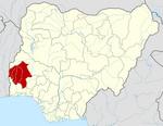
Kajola is a Local Government Area in Oyo State, Nigeria. Its headquarters are in the town of Okeho.
Other major towns in Kajola LG are Ilero, Imia, Ilua, Ayetoro-oke, Isemi ile, Iwere-oke, and Ilaji-oke.
It has an area of 609 km2 and a population of 200,997 at the 2006 census.
The first Local Government chairman was Chief Michael Adegbite.
The postal code of the area is 202. [1]
Geography
Kajola Local Government Area has an average temperature of 28 degrees Celsius with a total area of 609 square kilometers. The region has dense forests and an average humidity of 60%. In Kajola Local Government Area, the average wind speed is 11 km/h. [2]
Economy
Kajola Local Government Area's primary economic activity is farming, with the region cultivating crops like melon, pepper, and okara. The LGA hosts several markets where locals purchase and sell a wide range of goods, demonstrating the area's thriving trade. The residents of Kajola LGA also engage in significant economic activities such as hunting, crafting, and textile weaving and dying. [2]
References
- ^ "Post Offices- with map of LGA". NIPOST. Archived from the original on 2009-10-07. Retrieved 2009-10-20.
- ^ a b "Kajola Local Government Area". www.manpower.com.ng. Retrieved 2024-02-17.
Kajola
Rock city | |
|---|---|
 A landscape of Kajola L.G.A | |
| Country | |
| State | Oyo State |
| Government | |
| • Local Government Chairman and the Head of the Local Government Council | Adebare Muraina Afolabi ( PDP) |
| Time zone | UTC+1 ( WAT) |
|
| |
Kajola is a Local Government Area in Oyo State, Nigeria. Its headquarters are in the town of Okeho.
Other major towns in Kajola LG are Ilero, Imia, Ilua, Ayetoro-oke, Isemi ile, Iwere-oke, and Ilaji-oke.
It has an area of 609 km2 and a population of 200,997 at the 2006 census.
The first Local Government chairman was Chief Michael Adegbite.
The postal code of the area is 202. [1]
Geography
Kajola Local Government Area has an average temperature of 28 degrees Celsius with a total area of 609 square kilometers. The region has dense forests and an average humidity of 60%. In Kajola Local Government Area, the average wind speed is 11 km/h. [2]
Economy
Kajola Local Government Area's primary economic activity is farming, with the region cultivating crops like melon, pepper, and okara. The LGA hosts several markets where locals purchase and sell a wide range of goods, demonstrating the area's thriving trade. The residents of Kajola LGA also engage in significant economic activities such as hunting, crafting, and textile weaving and dying. [2]
References
- ^ "Post Offices- with map of LGA". NIPOST. Archived from the original on 2009-10-07. Retrieved 2009-10-20.
- ^ a b "Kajola Local Government Area". www.manpower.com.ng. Retrieved 2024-02-17.
