Krishnarajanagara | |
|---|---|
 Krishnarajanagara Location in Karnataka, India  Krishnarajanagara Krishnarajanagara (India) | |
| Coordinates: 12°26′14″N 76°22′50″E / 12.43722°N 76.38056°E | |
| Country | |
| State | |
| District | Mysore |
| Taluk | Krishnarajanagara |
| Yadathore | 1934 |
| Founded by | Krishnaraja Wodeyar IV |
| Government | |
| • Body | Town Municipal Council |
| Area | |
| • Town | 8.6 km2 (3.3 sq mi) |
| • Rural | 596.02 km2 (230.12 sq mi) |
| Elevation | 786 m (2,579 ft) |
| Population (2011) | |
| • Town | 35,805 |
| • Density | 4,200/km2 (11,000/sq mi) |
| • Rural | 216,852 |
| Languages | |
| • Official | Kannada |
| Time zone | UTC+5:30 ( IST) |
| PIN | 571602 |
| Telephone code | 08223 |
| Vehicle registration | KA-45, KA-09, KA-55 |
| Website |
krnagaratown |
Krishnarajanagara is a town in Mysore district in the Indian state of Karnataka. It is also the administrative center of Krishnarajanagara Taluk.
Geography
Krishnarajanagara is located on the northern part of Mysore district, west of the Krishna Raja Sagara Reservoir. It has an average elevation of 786 metres above sea level. [1] NH-373, also known as SH-57 passes through the town of K.R.Nagara.
Climate
Krishnarajanagara has Tropical Savanna Climate under the Köppen climate classification. On average, the town receives the least amount of rainfall in January, and the most in October.
| Climate data for Krishnarajanagara | |||||||||||||
|---|---|---|---|---|---|---|---|---|---|---|---|---|---|
| Month | Jan | Feb | Mar | Apr | May | Jun | Jul | Aug | Sep | Oct | Nov | Dec | Year |
| Mean daily maximum °C (°F) | 28 (82) |
30.2 (86.4) |
32.4 (90.3) |
32.7 (90.9) |
30.8 (87.4) |
26.7 (80.1) |
25.5 (77.9) |
25.7 (78.3) |
26.8 (80.2) |
26.8 (80.2) |
26.3 (79.3) |
26.5 (79.7) |
28.2 (82.7) |
| Daily mean °C (°F) | 21.8 (71.2) |
23.7 (74.7) |
25.9 (78.6) |
26.4 (79.5) |
25.3 (77.5) |
23 (73) |
22.3 (72.1) |
22.2 (72.0) |
22.6 (72.7) |
22.5 (72.5) |
21.8 (71.2) |
21.1 (70.0) |
23.2 (73.8) |
| Mean daily minimum °C (°F) | 15.8 (60.4) |
17.4 (63.3) |
19.7 (67.5) |
21.6 (70.9) |
21.6 (70.9) |
20.8 (69.4) |
20.4 (68.7) |
20.1 (68.2) |
19.8 (67.6) |
19.2 (66.6) |
17.8 (64.0) |
16.1 (61.0) |
19.2 (66.5) |
| Average rainfall mm (inches) | 3 (0.1) |
4 (0.2) |
11 (0.4) |
48 (1.9) |
106 (4.2) |
129 (5.1) |
126 (5.0) |
106 (4.2) |
99 (3.9) |
151 (5.9) |
70 (2.8) |
20 (0.8) |
873 (34.5) |
| Source: Climate-Data.org [2] | |||||||||||||
Demographics
According to the 2011 India census, Krishnarajanagara had a population of 35,805. Its gender ratio is relatively balanced, with 17,900 male residents and 17,905 female residents. Krishnarajanagara has an average literacy rate of 78.2%. with male literacy being 81.8%, and female literacy being 74.5%. In Krishnarajanagara, 9.9% of the population is under 6 years of age. [3]
Galleries
-
 Taluk boundary before creation of Saligrama Taluk
 -
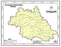 Taluk boundary same as Assembly Constituency as per 2011 Census before creation of Saligrama Taluk
 -
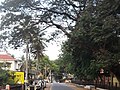 C.M. Road within the town
 -
 Kandenahalli Bridge on the northeast of the town
_2011.jpg)
_Vidhana_Sabha_Constituency.jpg)


See also
References
- ^ "Krishnarajanagara topographic map, elevation, terrain". Topographic maps. Retrieved 22 March 2023.
- ^ "Krishnarajanagara climate: Temperature Krishnarajanagara & Weather By Month - Climate-Data.org". en.climate-data.org. Retrieved 22 March 2023.
- ^ "Basic Population Figures of India, States, Districts, Sub-District and Village, 2011". Retrieved 21 March 2023.
|
| This article related to a location in Mysore district, Karnataka, India is a stub. You can help Wikipedia by expanding it. |
Krishnarajanagara | |
|---|---|
Krishnarajanagara Location in Karnataka, India Krishnarajanagara Krishnarajanagara (India) | |
| Coordinates: 12°26′14″N 76°22′50″E / 12.43722°N 76.38056°E | |
| Country | |
| State | |
| District | Mysore |
| Taluk | Krishnarajanagara |
| Yadathore | 1934 |
| Founded by | Krishnaraja Wodeyar IV |
| Government | |
| • Body | Town Municipal Council |
| Area | |
| • Town | 8.6 km2 (3.3 sq mi) |
| • Rural | 596.02 km2 (230.12 sq mi) |
| Elevation | 786 m (2,579 ft) |
| Population (2011) | |
| • Town | 35,805 |
| • Density | 4,200/km2 (11,000/sq mi) |
| • Rural | 216,852 |
| Languages | |
| • Official | Kannada |
| Time zone | UTC+5:30 ( IST) |
| PIN | 571602 |
| Telephone code | 08223 |
| Vehicle registration | KA-45, KA-09, KA-55 |
| Website |
krnagaratown |
Krishnarajanagara is a town in Mysore district in the Indian state of Karnataka. It is also the administrative center of Krishnarajanagara Taluk.
Geography
Krishnarajanagara is located on the northern part of Mysore district, west of the Krishna Raja Sagara Reservoir. It has an average elevation of 786 metres above sea level. [1] NH-373, also known as SH-57 passes through the town of K.R.Nagara.
Climate
Krishnarajanagara has Tropical Savanna Climate under the Köppen climate classification. On average, the town receives the least amount of rainfall in January, and the most in October.
| Climate data for Krishnarajanagara | |||||||||||||
|---|---|---|---|---|---|---|---|---|---|---|---|---|---|
| Month | Jan | Feb | Mar | Apr | May | Jun | Jul | Aug | Sep | Oct | Nov | Dec | Year |
| Mean daily maximum °C (°F) | 28 (82) |
30.2 (86.4) |
32.4 (90.3) |
32.7 (90.9) |
30.8 (87.4) |
26.7 (80.1) |
25.5 (77.9) |
25.7 (78.3) |
26.8 (80.2) |
26.8 (80.2) |
26.3 (79.3) |
26.5 (79.7) |
28.2 (82.7) |
| Daily mean °C (°F) | 21.8 (71.2) |
23.7 (74.7) |
25.9 (78.6) |
26.4 (79.5) |
25.3 (77.5) |
23 (73) |
22.3 (72.1) |
22.2 (72.0) |
22.6 (72.7) |
22.5 (72.5) |
21.8 (71.2) |
21.1 (70.0) |
23.2 (73.8) |
| Mean daily minimum °C (°F) | 15.8 (60.4) |
17.4 (63.3) |
19.7 (67.5) |
21.6 (70.9) |
21.6 (70.9) |
20.8 (69.4) |
20.4 (68.7) |
20.1 (68.2) |
19.8 (67.6) |
19.2 (66.6) |
17.8 (64.0) |
16.1 (61.0) |
19.2 (66.5) |
| Average rainfall mm (inches) | 3 (0.1) |
4 (0.2) |
11 (0.4) |
48 (1.9) |
106 (4.2) |
129 (5.1) |
126 (5.0) |
106 (4.2) |
99 (3.9) |
151 (5.9) |
70 (2.8) |
20 (0.8) |
873 (34.5) |
| Source: Climate-Data.org [2] | |||||||||||||
Demographics
According to the 2011 India census, Krishnarajanagara had a population of 35,805. Its gender ratio is relatively balanced, with 17,900 male residents and 17,905 female residents. Krishnarajanagara has an average literacy rate of 78.2%. with male literacy being 81.8%, and female literacy being 74.5%. In Krishnarajanagara, 9.9% of the population is under 6 years of age. [3]
Galleries
-
Taluk boundary before creation of Saligrama Taluk
-
Taluk boundary same as Assembly Constituency as per 2011 Census before creation of Saligrama Taluk
-
C.M. Road within the town
-
Kandenahalli Bridge on the northeast of the town
See also
References
- ^ "Krishnarajanagara topographic map, elevation, terrain". Topographic maps. Retrieved 22 March 2023.
- ^ "Krishnarajanagara climate: Temperature Krishnarajanagara & Weather By Month - Climate-Data.org". en.climate-data.org. Retrieved 22 March 2023.
- ^ "Basic Population Figures of India, States, Districts, Sub-District and Village, 2011". Retrieved 21 March 2023.
|
| This article related to a location in Mysore district, Karnataka, India is a stub. You can help Wikipedia by expanding it. |