Jalsoor
Jalsur | |
|---|---|
village | |
 Hanging Bridge | |
 Jalsoor Location in Karnataka, India  Jalsoor Jalsoor (India) | |
| Coordinates: 12°35′42″N 75°20′10″E / 12.5949°N 75.3361°E | |
| Country | |
| State | Karnataka |
| District | Dakshina Kannada |
| Talukas | Sullia |
| Government | |
| • Body | Grama Panchayath |
| Area | |
| • Total | 14.52 km2 (5.61 sq mi) |
| Elevation | 99 m (325 ft) |
| Population (2011) | |
| • Total | 6,623 |
| • Density | 460/km2 (1,200/sq mi) |
| Languages | |
| • Official | Kannada, Tulu and Arebhashe |
| Time zone | UTC+5:30 ( IST) |
| PIN | 574239 |
| Telephone code | 08257 |
| ISO 3166 code | IN-KA |
| Vehicle registration | KA 21 |
| Nearest city | Mangalore |
| Sex ratio | 1:1 ♂/ ♀ |
| Literacy | 100%% |
| Lok Sabha constituency | Mangalore |
| Vidhan Sabha constituency | Sullia |
| Climate | cool ( Köppen) |
Jalsoor is a village in Dakshina Kannada district in the south Indian state of Karnataka. [1] [2] This village is major junction connecting three district headquarters; Madikeri, Mangaluru and Kasaragodu. It is one of the main place of trade and transaction in Sullia taluk. Former chief Minister of Karnataka, D.V Sadananda Gowda hails from this village.
Demographics
As of 2001 [update] India census, Jalsoor had a population of 6368 with 3176 males and 3192 females. [1]
Image gallery
-
 Panjikal School
 -
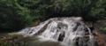 Kemanaballi Waterfalls
 -
 Jalsoor Junction
 -
 Jalsoor Mosque


.jpg)
.jpg)
See also
References
- ^ a b Village code= 2722900 "Census of India : Villages with population 5000 & above". Registrar General & Census Commissioner, India. Archived from the original on 11 February 2008. Retrieved 18 December 2008.
- ^ "Yahoomaps India :". Archived from the original on 18 December 2008. Retrieved 18 December 2008. Jalsoor, Dakshina Kannada, Karnataka
External links
|
| This article related to a location in Dakshina Kannada district, Karnataka, India is a stub. You can help Wikipedia by expanding it. |
Jalsoor
Jalsur | |
|---|---|
village | |
|
Hanging Bridge | |
Jalsoor Location in Karnataka, India Jalsoor Jalsoor (India) | |
| Coordinates: 12°35′42″N 75°20′10″E / 12.5949°N 75.3361°E | |
| Country | |
| State | Karnataka |
| District | Dakshina Kannada |
| Talukas | Sullia |
| Government | |
| • Body | Grama Panchayath |
| Area | |
| • Total | 14.52 km2 (5.61 sq mi) |
| Elevation | 99 m (325 ft) |
| Population (2011) | |
| • Total | 6,623 |
| • Density | 460/km2 (1,200/sq mi) |
| Languages | |
| • Official | Kannada, Tulu and Arebhashe |
| Time zone | UTC+5:30 ( IST) |
| PIN | 574239 |
| Telephone code | 08257 |
| ISO 3166 code | IN-KA |
| Vehicle registration | KA 21 |
| Nearest city | Mangalore |
| Sex ratio | 1:1 ♂/ ♀ |
| Literacy | 100%% |
| Lok Sabha constituency | Mangalore |
| Vidhan Sabha constituency | Sullia |
| Climate | cool ( Köppen) |
Jalsoor is a village in Dakshina Kannada district in the south Indian state of Karnataka. [1] [2] This village is major junction connecting three district headquarters; Madikeri, Mangaluru and Kasaragodu. It is one of the main place of trade and transaction in Sullia taluk. Former chief Minister of Karnataka, D.V Sadananda Gowda hails from this village.
Demographics
As of 2001 [update] India census, Jalsoor had a population of 6368 with 3176 males and 3192 females. [1]
Image gallery
-
Panjikal School
-
Kemanaballi Waterfalls
-
Jalsoor Junction
-
Jalsoor Mosque
See also
References
- ^ a b Village code= 2722900 "Census of India : Villages with population 5000 & above". Registrar General & Census Commissioner, India. Archived from the original on 11 February 2008. Retrieved 18 December 2008.
- ^ "Yahoomaps India :". Archived from the original on 18 December 2008. Retrieved 18 December 2008. Jalsoor, Dakshina Kannada, Karnataka
External links
|
| This article related to a location in Dakshina Kannada district, Karnataka, India is a stub. You can help Wikipedia by expanding it. |