Jahnatal | |
|---|---|
 Holy Trinity Church in Ostrau | |
Location of Jahnatal within Mittelsachsen district 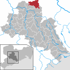 | |
 Jahnatal  Jahnatal | |
| Coordinates: 51°12′N 13°10′E / 51.200°N 13.167°E | |
| Country | Germany |
| State | Saxony |
| District | Mittelsachsen |
| Subdivisions | 37 |
| Government | |
| • Mayor (2023–30) | Dirk Schilling [1] ( CDU) |
| Area | |
| • Total | 70.96 km2 (27.40 sq mi) |
| Elevation | 215 m (705 ft) |
| Population (2022-12-31)
[2] | |
| • Total | 4,761 |
| • Density | 67/km2 (170/sq mi) |
| Time zone | UTC+01:00 ( CET) |
| • Summer ( DST) | UTC+02:00 ( CEST) |
| Postal codes | 04749 |
| Dialling codes | 034324, 034362 |
| Vehicle registration | FG |
Jahnatal is a municipality in the district of Mittelsachsen in Saxony in Germany. It was established on 1 January 2023 with the merger of the municipalities of Ostrau and Zschaitz-Ottewig. [3]
Geography
Jahnatal is located 8 km (5.0 mi) north of the town of Döbeln and about 17 km (11 mi) south of Riesa, in the valley of Jahna and the surrounding ridges in the north-west of Lommatzscher Pflege.
Boroughs
Jahnatal consists of the following villages (Ortsteile):
- Auerschütz
- Auterwitz
- Baderitz
- Beutig
- Binnewitz
- Clanzschwitz
- Delmschütz
- Döhlen
- Dürrweitzschen
- Glaucha
- Goselitz
- Jahna
- Kattnitz
- Kiebitz
- Lüttewitz
- Lützschnitz
- Merschütz
- Mischütz
- Möbertitz
- Münchhof
- Niederlützschera
- Noschkowitz
- Oberlützschera
- Obersteina
- Ostrau
- Ottewig
- Pulsitz
- Rittmitz
- Schlagwitz
- Schmorren
- Schrebitz
- Sömnitz
- Töllschütz
- Trebanitz
- Zschaitz
- Zschochau
- Zunschwitz
History
On 1 January 2023, the municipalities of Ostrau and Zschaitz-Ottewig merged to form the new municipality of Jahnatal. [3]
References
- ^ Wahlergebnisse 2023, Statistisches Landesamt des Freistaates Sachsen. Retrieved 6 July 2023.
- ^ "Einwohnerzahlen nach Gemeinden als Excel-Arbeitsmappe" (XLS) (in German). Statistisches Landesamt des Freistaates Sachsen. 2024.
- ^ a b "Gemeindefusion Ostrau/Zschaitz-Ottewig" (PDF). Jahnataler Echo Jahrgang 18 Nr. 1. 26 January 2022. pp. 5–7. Retrieved 9 January 2023.
|
| This Mittelsachsen location article is a stub. You can help Wikipedia by expanding it. |
Jahnatal | |
|---|---|
|
Holy Trinity Church in Ostrau | |
Location of Jahnatal within Mittelsachsen district | |
Jahnatal Jahnatal | |
| Coordinates: 51°12′N 13°10′E / 51.200°N 13.167°E | |
| Country | Germany |
| State | Saxony |
| District | Mittelsachsen |
| Subdivisions | 37 |
| Government | |
| • Mayor (2023–30) | Dirk Schilling [1] ( CDU) |
| Area | |
| • Total | 70.96 km2 (27.40 sq mi) |
| Elevation | 215 m (705 ft) |
| Population (2022-12-31)
[2] | |
| • Total | 4,761 |
| • Density | 67/km2 (170/sq mi) |
| Time zone | UTC+01:00 ( CET) |
| • Summer ( DST) | UTC+02:00 ( CEST) |
| Postal codes | 04749 |
| Dialling codes | 034324, 034362 |
| Vehicle registration | FG |
Jahnatal is a municipality in the district of Mittelsachsen in Saxony in Germany. It was established on 1 January 2023 with the merger of the municipalities of Ostrau and Zschaitz-Ottewig. [3]
Geography
Jahnatal is located 8 km (5.0 mi) north of the town of Döbeln and about 17 km (11 mi) south of Riesa, in the valley of Jahna and the surrounding ridges in the north-west of Lommatzscher Pflege.
Boroughs
Jahnatal consists of the following villages (Ortsteile):
- Auerschütz
- Auterwitz
- Baderitz
- Beutig
- Binnewitz
- Clanzschwitz
- Delmschütz
- Döhlen
- Dürrweitzschen
- Glaucha
- Goselitz
- Jahna
- Kattnitz
- Kiebitz
- Lüttewitz
- Lützschnitz
- Merschütz
- Mischütz
- Möbertitz
- Münchhof
- Niederlützschera
- Noschkowitz
- Oberlützschera
- Obersteina
- Ostrau
- Ottewig
- Pulsitz
- Rittmitz
- Schlagwitz
- Schmorren
- Schrebitz
- Sömnitz
- Töllschütz
- Trebanitz
- Zschaitz
- Zschochau
- Zunschwitz
History
On 1 January 2023, the municipalities of Ostrau and Zschaitz-Ottewig merged to form the new municipality of Jahnatal. [3]
References
- ^ Wahlergebnisse 2023, Statistisches Landesamt des Freistaates Sachsen. Retrieved 6 July 2023.
- ^ "Einwohnerzahlen nach Gemeinden als Excel-Arbeitsmappe" (XLS) (in German). Statistisches Landesamt des Freistaates Sachsen. 2024.
- ^ a b "Gemeindefusion Ostrau/Zschaitz-Ottewig" (PDF). Jahnataler Echo Jahrgang 18 Nr. 1. 26 January 2022. pp. 5–7. Retrieved 9 January 2023.
|
| This Mittelsachsen location article is a stub. You can help Wikipedia by expanding it. |