Jackson Township | |
|---|---|
 Jackson Township Location in Arkansas  Jackson Township Jackson Township (the United States) | |
| Coordinates: 36°25′03″N 91°05′13″W / 36.417455°N 91.086920°W [1] | |
| Country | United States |
| State | Arkansas |
| County | Randolph |
| Area | |
| • Total | 17.728 sq mi (45.92 km2) |
| • Land | 17.669 sq mi (45.76 km2) |
| • Water | 0.059 sq mi (0.15 km2) |
| Elevation | 479 ft (146 m) |
| Population | |
| • Total | 241 |
| • Density | 14/sq mi (5.2/km2) |
| Time zone | UTC-6 ( CST) |
| • Summer ( DST) | UTC-5 ( CDT) |
| FIPS code [2] [3] | 05-91878 |
| GNIS ID [2] [3] | 69026 |
Jackson Township is a township in Randolph County, Arkansas, United States. [4] Its total population was 241 as of the 2010 United States Census, [1] [5] a decrease of 10.41 percent from 269 in 2000. [6] [7]

According to the 2010 Census, Jackson Township is located at 36°25′03″N 91°05′13″W / 36.417455°N 91.086920°W (36.417455, -91.086920). [1] It has a total area of 17.728 square miles (45.92 square kilometers); of which 17.669 sq mi (45.76 km2) is land and 0.059 sq mi (0.15 km2) is water (0.33%). [1] As per the USGS National Elevation Dataset, the elevation is 479 feet (146 m). [2]
References
- ^ a b c d e f "County Subdivisions (2010): Arkansas". 2010 Census Gazetteer Files. United States Census Bureau. Archived from the original ( TXT) on May 31, 2014. Retrieved May 31, 2014.
- ^ a b c d "Feature ID 69026: Township of Jackson (Randolph County, Arkansas)". Geographic Names Information System. United States Geological Survey. Retrieved May 31, 2014.
- ^ a b "FIPS55 Data: Arkansas". FIPS55 Data. United States Geological Survey. February 23, 2006. Archived from the original ( TXT) on June 18, 2006. Retrieved May 31, 2014.
- ^ "Summary Population and Housing Characteristics, CPH-1-5, Arkansas" ( PDF). 2010 Census of Population and Housing. United States Census Bureau. September 2012. Retrieved May 31, 2014.
- ^ "2010 Demographic Profile (DP-1): Jackson township, Randolph County, Arkansas". American FactFinder. United States Census Bureau. Archived from the original on February 12, 2020. Retrieved May 31, 2014.
- ^ "2000 Demographic Profile (DP-1): Jackson township, Randolph County, Arkansas". American FactFinder. United States Census Bureau. Archived from the original on February 12, 2020. Retrieved May 31, 2014.
- ^ "County Subdivisions (2000)". 2000 Census Gazetteer Files. United States Census Bureau. Archived from the original ( Zipped TXT) on May 31, 2014. Retrieved May 31, 2014.
External links
- "2010 Census Block Map: Jackson Township, Arkansas" (PDF). Arkansas 2010 Census Block Maps - County Subdivisions. U.S. Census Bureau.
- "2013 Boundary and Annexation Survey (BAS) Map: Randolph County, Arkansas" (PDF). Boundary and Annexation Survey (BAS) Shapefiles and Maps. U.S. Census Bureau. Archived from the original (PDF) on May 31, 2014. Retrieved May 31, 2014.
- "2010 Census County Subdivision Maps: Arkansas" (PDF). County Subdivision Maps. U.S. Census Bureau.
Municipalities and communities of
Randolph County, Arkansas, United States | ||
|---|---|---|
| Cities | 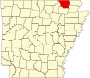 | |
| Towns | ||
| Townships | ||
| CDP | ||
|
Other unincorporated communities | ||
| Ghost town | ||
Jackson Township | |
|---|---|
Jackson Township Location in Arkansas Jackson Township Jackson Township (the United States) | |
| Coordinates: 36°25′03″N 91°05′13″W / 36.417455°N 91.086920°W [1] | |
| Country | United States |
| State | Arkansas |
| County | Randolph |
| Area | |
| • Total | 17.728 sq mi (45.92 km2) |
| • Land | 17.669 sq mi (45.76 km2) |
| • Water | 0.059 sq mi (0.15 km2) |
| Elevation | 479 ft (146 m) |
| Population | |
| • Total | 241 |
| • Density | 14/sq mi (5.2/km2) |
| Time zone | UTC-6 ( CST) |
| • Summer ( DST) | UTC-5 ( CDT) |
| FIPS code [2] [3] | 05-91878 |
| GNIS ID [2] [3] | 69026 |
Jackson Township is a township in Randolph County, Arkansas, United States. [4] Its total population was 241 as of the 2010 United States Census, [1] [5] a decrease of 10.41 percent from 269 in 2000. [6] [7]
According to the 2010 Census, Jackson Township is located at 36°25′03″N 91°05′13″W / 36.417455°N 91.086920°W (36.417455, -91.086920). [1] It has a total area of 17.728 square miles (45.92 square kilometers); of which 17.669 sq mi (45.76 km2) is land and 0.059 sq mi (0.15 km2) is water (0.33%). [1] As per the USGS National Elevation Dataset, the elevation is 479 feet (146 m). [2]
References
- ^ a b c d e f "County Subdivisions (2010): Arkansas". 2010 Census Gazetteer Files. United States Census Bureau. Archived from the original ( TXT) on May 31, 2014. Retrieved May 31, 2014.
- ^ a b c d "Feature ID 69026: Township of Jackson (Randolph County, Arkansas)". Geographic Names Information System. United States Geological Survey. Retrieved May 31, 2014.
- ^ a b "FIPS55 Data: Arkansas". FIPS55 Data. United States Geological Survey. February 23, 2006. Archived from the original ( TXT) on June 18, 2006. Retrieved May 31, 2014.
- ^ "Summary Population and Housing Characteristics, CPH-1-5, Arkansas" ( PDF). 2010 Census of Population and Housing. United States Census Bureau. September 2012. Retrieved May 31, 2014.
- ^ "2010 Demographic Profile (DP-1): Jackson township, Randolph County, Arkansas". American FactFinder. United States Census Bureau. Archived from the original on February 12, 2020. Retrieved May 31, 2014.
- ^ "2000 Demographic Profile (DP-1): Jackson township, Randolph County, Arkansas". American FactFinder. United States Census Bureau. Archived from the original on February 12, 2020. Retrieved May 31, 2014.
- ^ "County Subdivisions (2000)". 2000 Census Gazetteer Files. United States Census Bureau. Archived from the original ( Zipped TXT) on May 31, 2014. Retrieved May 31, 2014.
External links
- "2010 Census Block Map: Jackson Township, Arkansas" (PDF). Arkansas 2010 Census Block Maps - County Subdivisions. U.S. Census Bureau.
- "2013 Boundary and Annexation Survey (BAS) Map: Randolph County, Arkansas" (PDF). Boundary and Annexation Survey (BAS) Shapefiles and Maps. U.S. Census Bureau. Archived from the original (PDF) on May 31, 2014. Retrieved May 31, 2014.
- "2010 Census County Subdivision Maps: Arkansas" (PDF). County Subdivision Maps. U.S. Census Bureau.
Municipalities and communities of
Randolph County, Arkansas, United States | ||
|---|---|---|
| Cities | | |
| Towns | ||
| Townships | ||
| CDP | ||
|
Other unincorporated communities | ||
| Ghost town | ||