Jabłów | |
|---|---|
Village | |
 Church | |
 Jabłów | |
| Coordinates: 50°47′20″N 16°10′10″E / 50.78889°N 16.16944°E | |
| Country | |
| Voivodeship | Lower Silesian |
| County | Wałbrzych |
| Gmina | Stare Bogaczowice |
Jabłów [ˈjabwuf] is a village in the administrative district of Gmina Stare Bogaczowice, within Wałbrzych County, Lower Silesian Voivodeship, in south-western Poland. [1]
It lies approximately 7 kilometres (4 mi) south of Stare Bogaczowice, 9 kilometres (6 mi) west of Wałbrzych, and 72 kilometres (45 mi) south-west of the regional capital Wrocław.
Gallery
-
 House with the garden
 -
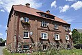 Brick house
 -
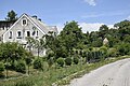
 Houses by the road
.jpg)
.jpg)
.jpg)
References
| Seat | ||
|---|---|---|
| Other villages | ||
| International | |
|---|---|
| National | |
|
| This Wałbrzych County location article is a stub. You can help Wikipedia by expanding it. |
Jabłów | |
|---|---|
Village | |
|
Church | |
Jabłów | |
| Coordinates: 50°47′20″N 16°10′10″E / 50.78889°N 16.16944°E | |
| Country | |
| Voivodeship | Lower Silesian |
| County | Wałbrzych |
| Gmina | Stare Bogaczowice |
Jabłów [ˈjabwuf] is a village in the administrative district of Gmina Stare Bogaczowice, within Wałbrzych County, Lower Silesian Voivodeship, in south-western Poland. [1]
It lies approximately 7 kilometres (4 mi) south of Stare Bogaczowice, 9 kilometres (6 mi) west of Wałbrzych, and 72 kilometres (45 mi) south-west of the regional capital Wrocław.
Gallery
-
House with the garden
-
Brick house
-
Houses by the road
References
| Seat | ||
|---|---|---|
| Other villages | ||
| International | |
|---|---|
| National | |
|
| This Wałbrzych County location article is a stub. You can help Wikipedia by expanding it. |