Photos • Location
Izmény | |
|---|---|
Village | |
| Coordinates: 46°18′53″N 18°24′49″E / 46.31472°N 18.41361°E | |
| Country | |
| Region | Southern Transdanubia |
| County | Tolna |
| District | Bonyhád |
| Area | |
| • Total | 13.73 km2 (5.30 sq mi) |
| Population (2022)
[1] | |
| • Total | 468 |
| • Density | 34/km2 (88/sq mi) |
| Time zone | UTC+1 ( CET) |
| • Summer ( DST) | UTC+2 ( CEST) |
| Postal code | 7353 |
| Area code | +36 74 |
| KSH code | 27711 [1] |
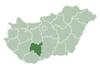
Izmény is a village in Tolna county, Hungary.
References
- ^ a b c "Izmény". Detailed Gazetteer of Hungary. Hungarian Central Statistical Office. Retrieved 2024-01-16.


