This article has multiple issues. Please help
improve it or discuss these issues on the
talk page. (
Learn how and when to remove these template messages)
|
Izačić
Изачић | |
|---|---|
Village | |
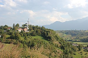
 Panorama of Izačić | |
| Coordinates: 44°52′N 15°47′E / 44.867°N 15.783°E | |
| Country | Bosnia and Herzegovina |
| Entity | Federation of Bosnia and Herzegovina |
| Canton | Una-Sana |
| Municipality | Bihać |
| Area | |
| • Total | 2.24 sq mi (5.80 km2) |
| Time zone | UTC+1 ( CET) |
| • Summer ( DST) | UTC+2 ( CEST) |
Izačić ( Serbian Cyrillic: Изачић) is a village in Bosnia and Herzegovina. [1]
Izačić is a part of the region of the Federation of Bosnia and Herzegovina within Bosnia and Herzegovina. It is located roughly 3 km (1.9 mi) east of the border with Croatia. The eastern region lies mainly in a valley between a hill (with a sub-village called Mušići) below Mount Plješevica and Prtošanj hill. Between these are a stream and springs.[ citation needed] The area is rich with natural springs and drinking water.[ citation needed] The southern part lies on a flat area, and is abundant with agricultural goods.[ citation needed]
The village is most famous for being the site of Operation Tiger in 1994.
References
- ^ Official results from the book: Ethnic composition of Bosnia-Herzegovina population, by municipalities and settlements, 1991. census, Zavod za statistiku Bosne i Hercegovine - Bilten no.234, Sarajevo 1991.
This article has multiple issues. Please help
improve it or discuss these issues on the
talk page. (
Learn how and when to remove these template messages)
|
Izačić
Изачић | |
|---|---|
Village | |
 Panorama of Izačić | |
| Coordinates: 44°52′N 15°47′E / 44.867°N 15.783°E | |
| Country | Bosnia and Herzegovina |
| Entity | Federation of Bosnia and Herzegovina |
| Canton | Una-Sana |
| Municipality | Bihać |
| Area | |
| • Total | 2.24 sq mi (5.80 km2) |
| Time zone | UTC+1 ( CET) |
| • Summer ( DST) | UTC+2 ( CEST) |
Izačić ( Serbian Cyrillic: Изачић) is a village in Bosnia and Herzegovina. [1]
Izačić is a part of the region of the Federation of Bosnia and Herzegovina within Bosnia and Herzegovina. It is located roughly 3 km (1.9 mi) east of the border with Croatia. The eastern region lies mainly in a valley between a hill (with a sub-village called Mušići) below Mount Plješevica and Prtošanj hill. Between these are a stream and springs.[ citation needed] The area is rich with natural springs and drinking water.[ citation needed] The southern part lies on a flat area, and is abundant with agricultural goods.[ citation needed]
The village is most famous for being the site of Operation Tiger in 1994.
References
- ^ Official results from the book: Ethnic composition of Bosnia-Herzegovina population, by municipalities and settlements, 1991. census, Zavod za statistiku Bosne i Hercegovine - Bilten no.234, Sarajevo 1991.
