| Mayda | |
|---|---|
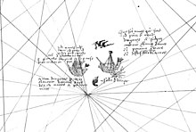
 Mayda as seen on the 1367 Pizigani brothers' map | |
| In-universe information | |
| Type | Phantom island |
Mayda (variously known as Maida, Mayd, Mayde, Brazir, Mam, Asmaida, Asmayda, Bentusle, Las Maidas Bolunda and Vlaanderen [1] [2]) is a non-existent island in the North Atlantic that has been shown on several published maps at various points in history. It was most often represented as being crescent-shaped and its position has varied widely over time. Early maps drew the island west of Brittany and southwest of Ireland, but it later moved towards the Americas ( Newfoundland, Bermuda, West Indies).
The island first appeared under the name of Brazir, on the Pizigani brothers' 1367 map. It was crescent-shaped and sited southwest of the island of Brasil, on the same latitude of southern Brittany. [3]
It appeared as Asmaidas on a map of the New World accompanying Waldseemüller's 1513 edition of Ptolemy's Geography. [4]
Ortelius (in Theatrum Orbis Terrarum) placed a crescent-shaped island in the traditional location of Mayda with the name "Vlaenderen" ("Flanders"). [5]
Submerged land of the appropriate shape has been found in the area of early maps ( 46°23′N 37°20′W / 46.383°N 37.333°W) at a depth of 20 fathoms (120 ft; 37 m) which suggested to one author that Mayda may have existed. [6]
The island is the namesake of Mayda Insula, an island in the Kraken Mare on Saturn's moon Titan. [7]
- Pizigani brothers map (1367) as Brazir [8] [3]
- Catalan map (1375) as Mam [9]
- Pinelli map (1384) as Jonzele/I.Onzele [9]
- Pizzigano Map (1424) either as Ventura or Ymana.
- Bianco world map (1448) as Bentusla [9]
- Waldseemüller map (1513) as Asmaidas [10]
- Prunes map (1553) as Mayda [11]
- Nicolay map (1560) as I man orbolunda [5]
- The island of Mayda is a principal location in the novel A Web of Air by Philip Reeve.
- ^ Babcock, William H. (1915). "The so-called mythical islands of the Atlantic in Mediæval maps". Scottish Geographical Magazine. 31 (10): 531–541. doi: 10.1080/00369221508734208.
- ^ Babcock, p.81
- ^ a b Babcock, p. 83
- ^ Babcock, p. 82
- ^ a b Ramsay, p. 219
- ^ Ramsay, p. 220
- ^ "Mayda Insula". Gazetteer of Planetary Nomenclature. International Astronomical Union (IAU) Working Group for Planetary System Nomenclature (WGPSN). April 11, 2008. Retrieved June 28, 2017.
- ^ Ramsay, p. 216
- ^ a b c Ramsay, p. 217
- ^ Ramsay, p. 217-8
- ^ Ramsay, p. 218
- Hamilton-Paterson, James (1992). The Great Deep. The Sea and its Thresholds. New York: Random House. ISBN 978-0-679-40596-2.
- Babcock, William Henry (1922). Legendary Islands of the Atlantic: A Study in Medieval Geography. Research Series. Vol. Issue 8. American Geographical Society of New York.
{{ cite book}}:|volume=has extra text ( help) - Ramsay, Raymond (1972). "The Maybe of Mayda". No Longer on the Map: discovering places that never were. New York: Viking Press. ISBN 0-670-51433-0.
| Mayda | |
|---|---|
 Mayda as seen on the 1367 Pizigani brothers' map | |
| In-universe information | |
| Type | Phantom island |
Mayda (variously known as Maida, Mayd, Mayde, Brazir, Mam, Asmaida, Asmayda, Bentusle, Las Maidas Bolunda and Vlaanderen [1] [2]) is a non-existent island in the North Atlantic that has been shown on several published maps at various points in history. It was most often represented as being crescent-shaped and its position has varied widely over time. Early maps drew the island west of Brittany and southwest of Ireland, but it later moved towards the Americas ( Newfoundland, Bermuda, West Indies).
The island first appeared under the name of Brazir, on the Pizigani brothers' 1367 map. It was crescent-shaped and sited southwest of the island of Brasil, on the same latitude of southern Brittany. [3]
It appeared as Asmaidas on a map of the New World accompanying Waldseemüller's 1513 edition of Ptolemy's Geography. [4]
Ortelius (in Theatrum Orbis Terrarum) placed a crescent-shaped island in the traditional location of Mayda with the name "Vlaenderen" ("Flanders"). [5]
Submerged land of the appropriate shape has been found in the area of early maps ( 46°23′N 37°20′W / 46.383°N 37.333°W) at a depth of 20 fathoms (120 ft; 37 m) which suggested to one author that Mayda may have existed. [6]
The island is the namesake of Mayda Insula, an island in the Kraken Mare on Saturn's moon Titan. [7]
- Pizigani brothers map (1367) as Brazir [8] [3]
- Catalan map (1375) as Mam [9]
- Pinelli map (1384) as Jonzele/I.Onzele [9]
- Pizzigano Map (1424) either as Ventura or Ymana.
- Bianco world map (1448) as Bentusla [9]
- Waldseemüller map (1513) as Asmaidas [10]
- Prunes map (1553) as Mayda [11]
- Nicolay map (1560) as I man orbolunda [5]
- The island of Mayda is a principal location in the novel A Web of Air by Philip Reeve.
- ^ Babcock, William H. (1915). "The so-called mythical islands of the Atlantic in Mediæval maps". Scottish Geographical Magazine. 31 (10): 531–541. doi: 10.1080/00369221508734208.
- ^ Babcock, p.81
- ^ a b Babcock, p. 83
- ^ Babcock, p. 82
- ^ a b Ramsay, p. 219
- ^ Ramsay, p. 220
- ^ "Mayda Insula". Gazetteer of Planetary Nomenclature. International Astronomical Union (IAU) Working Group for Planetary System Nomenclature (WGPSN). April 11, 2008. Retrieved June 28, 2017.
- ^ Ramsay, p. 216
- ^ a b c Ramsay, p. 217
- ^ Ramsay, p. 217-8
- ^ Ramsay, p. 218
- Hamilton-Paterson, James (1992). The Great Deep. The Sea and its Thresholds. New York: Random House. ISBN 978-0-679-40596-2.
- Babcock, William Henry (1922). Legendary Islands of the Atlantic: A Study in Medieval Geography. Research Series. Vol. Issue 8. American Geographical Society of New York.
{{ cite book}}:|volume=has extra text ( help) - Ramsay, Raymond (1972). "The Maybe of Mayda". No Longer on the Map: discovering places that never were. New York: Viking Press. ISBN 0-670-51433-0.