Hoogeloon | |
|---|---|
Village | |
 Hoogeloon, aerial photograph | |
 Hoogeloon Location in the province of North Brabant in the Netherlands  Hoogeloon Hoogeloon (Netherlands) | |
| Coordinates: 51°23′56″N 5°16′7″E / 51.39889°N 5.26861°E | |
| Country | Netherlands |
| Province | North Brabant |
| Municipality | Bladel |
| Area | |
| • Total | 13.64 km2 (5.27 sq mi) |
| Elevation | 28 m (92 ft) |
| Population (2021)
[1] | |
| • Total | 2,215 |
| • Density | 160/km2 (420/sq mi) |
| Time zone | UTC+1 ( CET) |
| • Summer ( DST) | UTC+2 ( CEST) |
| Postal code | 5528
[1] |
| Dialing code | 0497 |
Hoogeloon is a Dutch village in the commune of Bladel, in North Brabant. Hoogeloon is situated 4 km north of Hapert and is around 20 km west of Eindhoven.
History
Close to the village of Hoogeloon there are many tumulus dating from the Bronze Age, and among the largest in Benelux. To the east of the town are the remains of a Roman villa.
Hoogeloon used to be the capital of the municipality of Hoogeloon, Hapert en Casteren. In 1997, it merged into Bladel. [3]
The spoken language is Kempenlands (an East Brabantian dialect, which is very similar to colloquial Dutch).
An Ancient Roman mixing tap has been found at Hoogeloon. [4]
Gallery
-
 King Kyrié, King of the kabouters, sits in the central square of Hoogeloon
 -
 St Pancratius Church
 -
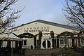 Landgoed de Biestheuvel
 -
 Farm in Hoogeloon


References
- ^ a b c "Kerncijfers wijken en buurten 2021". Central Bureau of Statistics. Retrieved 15 April 2022.
- ^ "Postcodetool for 5528AA". Actueel Hoogtebestand Nederland (in Dutch). Het Waterschapshuis. Retrieved 15 April 2022.
- ^ "Hoogeloon". Plaatsengids (in Dutch). Retrieved 15 April 2022.
-
^ P. A. C. Schut (2012). Hot, cold or mixed? A Roman mixer tap from Hoogeloon (The Netherlands). pp. 319–327.
ISBN
978-961-6420-88-4.
Wikidata
Q106823262.
{{ cite book}}:|journal=ignored ( help)
|
| This North Brabant location article is a stub. You can help Wikipedia by expanding it. |
Hoogeloon | |
|---|---|
Village | |
|
Hoogeloon, aerial photograph | |
Hoogeloon Location in the province of North Brabant in the Netherlands Hoogeloon Hoogeloon (Netherlands) | |
| Coordinates: 51°23′56″N 5°16′7″E / 51.39889°N 5.26861°E | |
| Country | Netherlands |
| Province | North Brabant |
| Municipality | Bladel |
| Area | |
| • Total | 13.64 km2 (5.27 sq mi) |
| Elevation | 28 m (92 ft) |
| Population (2021)
[1] | |
| • Total | 2,215 |
| • Density | 160/km2 (420/sq mi) |
| Time zone | UTC+1 ( CET) |
| • Summer ( DST) | UTC+2 ( CEST) |
| Postal code | 5528
[1] |
| Dialing code | 0497 |
Hoogeloon is a Dutch village in the commune of Bladel, in North Brabant. Hoogeloon is situated 4 km north of Hapert and is around 20 km west of Eindhoven.
History
Close to the village of Hoogeloon there are many tumulus dating from the Bronze Age, and among the largest in Benelux. To the east of the town are the remains of a Roman villa.
Hoogeloon used to be the capital of the municipality of Hoogeloon, Hapert en Casteren. In 1997, it merged into Bladel. [3]
The spoken language is Kempenlands (an East Brabantian dialect, which is very similar to colloquial Dutch).
An Ancient Roman mixing tap has been found at Hoogeloon. [4]
Gallery
-
King Kyrié, King of the kabouters, sits in the central square of Hoogeloon
-
St Pancratius Church
-
Landgoed de Biestheuvel
-
Farm in Hoogeloon
References
- ^ a b c "Kerncijfers wijken en buurten 2021". Central Bureau of Statistics. Retrieved 15 April 2022.
- ^ "Postcodetool for 5528AA". Actueel Hoogtebestand Nederland (in Dutch). Het Waterschapshuis. Retrieved 15 April 2022.
- ^ "Hoogeloon". Plaatsengids (in Dutch). Retrieved 15 April 2022.
-
^ P. A. C. Schut (2012). Hot, cold or mixed? A Roman mixer tap from Hoogeloon (The Netherlands). pp. 319–327.
ISBN
978-961-6420-88-4.
Wikidata
Q106823262.
{{ cite book}}:|journal=ignored ( help)
|
| This North Brabant location article is a stub. You can help Wikipedia by expanding it. |