Hazel Green | |
|---|---|
| Nickname: Trimble's Store | |
 Hazel Green Location within the state of Kentucky  Hazel Green Hazel Green (the United States) | |
| Coordinates: 37°47′51″N 83°25′0″W / 37.79750°N 83.41667°W | |
| Country | United States |
| State | Kentucky |
| County | Wolfe |
| Area | |
| • Total | 1.08 sq mi (2.79 km2) |
| • Land | 1.08 sq mi (2.79 km2) |
| • Water | 0.00 sq mi (0.01 km2) |
| Elevation | 922 ft (281 m) |
| Population (
2020) | |
| • Total | 173 |
| • Density | 160.78/sq mi (62.10/km2) |
| Time zone | UTC-5 ( Eastern (EST)) |
| • Summer ( DST) | UTC-4 (EDT) |
| ZIP codes | 41332 |
| FIPS code | 21-35398 |
| GNIS feature ID | 493953 |
Hazel Green (also Trimbles Store) is a census-designated place and unincorporated community in Wolfe County, Kentucky, United States. It lies along Routes 191 and 205 northeast of the city of Campton, the county seat of Wolfe County. [2] Its elevation is 922 feet (281 m). [3] It has a post office with the ZIP code 41332. [4]
A post office was established as Hazle Green [sic] in 1829, and named for the hazel shrubs prevalent in the area. The name of the post office was officially changed to its present spelling in 1889. [5]
Demographics
| Census | Pop. | Note | %± |
|---|---|---|---|
| 2020 | 173 | — | |
| U.S. Decennial Census [6] | |||
Notable people
- Joseph L. Bristow, U.S. senator from Kansas, born in Hazel Green [7]
- Pete Center, baseball player.
- South Trimble U.S. House of Representatives -Longest serving Clerk of the House of Representatives
- John A. Huff, MD, revolutionary Hospitalist, born in Hazel Green [8]
References
- ^ "2020 U.S. Gazetteer Files". United States Census Bureau. Retrieved March 18, 2022.
- ^ Rand McNally. The Road Atlas '06. Chicago: Rand McNally, 2006, p. 43.
- ^ U.S. Geological Survey Geographic Names Information System: Hazel Green, Kentucky, Geographic Names Information System, 1979-09-20. Accessed 2008-01-03.
- ^ USPS – Cities by ZIP Code
- ^ Rennick, Robert M. (1987). Kentucky Place Names. University Press of Kentucky. p. 135. ISBN 0813126312. Retrieved April 28, 2013.
- ^ "Census of Population and Housing". Census.gov. Retrieved June 4, 2016.
- ^ Onofrio, Jan (2000). Kansas Biographical Dictionary (Second ed.). St. Claire Shores, MI: Somerset Publishers. pp. 49–50. ISBN 978-0-4030-9313-7 – via Google Books.
- ^ |url= https://projectgratitude.com/john-huff
External links
- Digitized images from the Pearl Day Bach Photographic Collection, 1893-1961 housed at the University of Kentucky Libraries Special Collections Research Center
Municipalities and communities of
Wolfe County, Kentucky, United States | ||
|---|---|---|
| City | 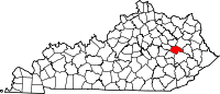 | |
| CDP | ||
|
Other unincorporated communities | ||
| International | |
|---|---|
| National | |
|
| This Wolfe County, Kentucky state location article is a stub. You can help Wikipedia by expanding it. |
Hazel Green | |
|---|---|
| Nickname: Trimble's Store | |
Hazel Green Location within the state of Kentucky Hazel Green Hazel Green (the United States) | |
| Coordinates: 37°47′51″N 83°25′0″W / 37.79750°N 83.41667°W | |
| Country | United States |
| State | Kentucky |
| County | Wolfe |
| Area | |
| • Total | 1.08 sq mi (2.79 km2) |
| • Land | 1.08 sq mi (2.79 km2) |
| • Water | 0.00 sq mi (0.01 km2) |
| Elevation | 922 ft (281 m) |
| Population (
2020) | |
| • Total | 173 |
| • Density | 160.78/sq mi (62.10/km2) |
| Time zone | UTC-5 ( Eastern (EST)) |
| • Summer ( DST) | UTC-4 (EDT) |
| ZIP codes | 41332 |
| FIPS code | 21-35398 |
| GNIS feature ID | 493953 |
Hazel Green (also Trimbles Store) is a census-designated place and unincorporated community in Wolfe County, Kentucky, United States. It lies along Routes 191 and 205 northeast of the city of Campton, the county seat of Wolfe County. [2] Its elevation is 922 feet (281 m). [3] It has a post office with the ZIP code 41332. [4]
A post office was established as Hazle Green [sic] in 1829, and named for the hazel shrubs prevalent in the area. The name of the post office was officially changed to its present spelling in 1889. [5]
Demographics
| Census | Pop. | Note | %± |
|---|---|---|---|
| 2020 | 173 | — | |
| U.S. Decennial Census [6] | |||
Notable people
- Joseph L. Bristow, U.S. senator from Kansas, born in Hazel Green [7]
- Pete Center, baseball player.
- South Trimble U.S. House of Representatives -Longest serving Clerk of the House of Representatives
- John A. Huff, MD, revolutionary Hospitalist, born in Hazel Green [8]
References
- ^ "2020 U.S. Gazetteer Files". United States Census Bureau. Retrieved March 18, 2022.
- ^ Rand McNally. The Road Atlas '06. Chicago: Rand McNally, 2006, p. 43.
- ^ U.S. Geological Survey Geographic Names Information System: Hazel Green, Kentucky, Geographic Names Information System, 1979-09-20. Accessed 2008-01-03.
- ^ USPS – Cities by ZIP Code
- ^ Rennick, Robert M. (1987). Kentucky Place Names. University Press of Kentucky. p. 135. ISBN 0813126312. Retrieved April 28, 2013.
- ^ "Census of Population and Housing". Census.gov. Retrieved June 4, 2016.
- ^ Onofrio, Jan (2000). Kansas Biographical Dictionary (Second ed.). St. Claire Shores, MI: Somerset Publishers. pp. 49–50. ISBN 978-0-4030-9313-7 – via Google Books.
- ^ |url= https://projectgratitude.com/john-huff
External links
- Digitized images from the Pearl Day Bach Photographic Collection, 1893-1961 housed at the University of Kentucky Libraries Special Collections Research Center
Municipalities and communities of
Wolfe County, Kentucky, United States | ||
|---|---|---|
| City | | |
| CDP | ||
|
Other unincorporated communities | ||
| International | |
|---|---|
| National | |
|
| This Wolfe County, Kentucky state location article is a stub. You can help Wikipedia by expanding it. |