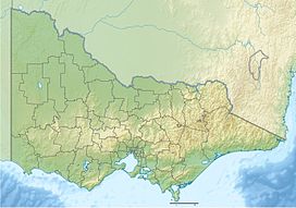
| Hayes Hill | |
|---|---|
Victoria, Australia | |
| Highest point | |
| Elevation | 280 m (920 ft) |
| Coordinates | 37°32′21″S 145°00′18″E / 37.539167°S 145.004994°E |
| Geography | |
| Location | Victoria, Australia |
Hayes Hill is a small scoria cone in Donnybrook, approximately 30 km north of Melbourne, Victoria, Australia. [1] It is on the eastern edge of the Newer Volcanics Province.
Hayes Hill is considered a regionally significant geological site as a source of the lava flows that follow the ancestral Merri and Darebin Creeks and Yarra River through the northern suburbs of Melbourne into the CBD. [2] [3]
- ^ Hanks, Walter (1955), "Newer Volcanic vents and lava fields between Wallan and Yuroke, Victoria", Proceedings of the Royal Society of Victoria, 67 (1): 1–16
- ^ Rosengren, Neville J. (1994), Eruption points of the newer volcanics province of Victoria : an inventory and evaluation of scientific significance, National Trust of Australia (Victoria) : Geological Society of Australia, Victorian Division, retrieved 27 June 2020
- ^ "Hayes Hill". Victorian Resources Online. Agriculture Victoria. Retrieved 27 June 2020.
