Photos • Location

Harmon, Oklahoma | |
|---|---|
 Harmon | |
| Coordinates: 36°08′41″N 99°33′37″W / 36.14472°N 99.56028°W | |
| Country | United States |
| State | Oklahoma |
| County | Ellis |
| Elevation | 2,497 ft (761 m) |
| Time zone | UTC-6 ( Central (CST)) |
| • Summer ( DST) | UTC-5 (CDT) |
| Area code | 580 |
| GNIS feature ID | 1093546 [1] |
Harmon is an unincorporated community in Ellis County, Oklahoma, United States. [1] Harmon is located on U.S. Route 60, 12 miles (19 km) east of Arnett.
Olin Branstetter (1929-2011), businessman and Oklahoma state legislator, was born in Harmon. [2]
References
Municipalities and communities of
Ellis County, Oklahoma, United States | ||
|---|---|---|
| Towns | 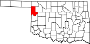 | |
|
Unincorporated communities | ||
| Ghost town | ||
|
| This Oklahoma state location article is a stub. You can help Wikipedia by expanding it. |
Harmon, Oklahoma | |
|---|---|
Harmon | |
| Coordinates: 36°08′41″N 99°33′37″W / 36.14472°N 99.56028°W | |
| Country | United States |
| State | Oklahoma |
| County | Ellis |
| Elevation | 2,497 ft (761 m) |
| Time zone | UTC-6 ( Central (CST)) |
| • Summer ( DST) | UTC-5 (CDT) |
| Area code | 580 |
| GNIS feature ID | 1093546 [1] |
Harmon is an unincorporated community in Ellis County, Oklahoma, United States. [1] Harmon is located on U.S. Route 60, 12 miles (19 km) east of Arnett.
Olin Branstetter (1929-2011), businessman and Oklahoma state legislator, was born in Harmon. [2]
References
Municipalities and communities of
Ellis County, Oklahoma, United States | ||
|---|---|---|
| Towns | | |
|
Unincorporated communities | ||
| Ghost town | ||
|
| This Oklahoma state location article is a stub. You can help Wikipedia by expanding it. |