Hariharpur Gadhi
हरिहरपुर गढी | |
|---|---|
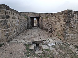
 Gate of Hariharpur Gadhi Darbar | |
| Coordinates: 27°19′0″N 85°29′0″E / 27.31667°N 85.48333°E | |
| Country | |
| Province | Bagmati Province |
| District | Sindhuli District |
| Population (1991) | |
| • Total | 3,113 |
| Time zone | UTC+5:45 ( Nepal Time) |
| Website |
hariharpurgadhimun |
Hariharpur Gadhi is a Gaunpalika and former village development committee in Sindhuli District in Bagmati Province of central Nepal. At the time of the 1991 Nepal census it had a population of 3,113 people living in 437 individual households. [1]
At the time of the 2011 Nepal census, Hariharpurgadhi Rural Municipality had a population of 27,727. Of these, 66.6% spoke Tamang, 13.5% Nepali, 9.0% Danwar, 3.8% Magar, 2.9% Rai, 2.7% Majhi, 0.6% Newar, 0.3% Pahari, 0.2% Sign language, 0.1% Bhojpuri, 0.1% Maithili and 0.1% other languages as their first language. [2]
In terms of ethnicity/caste, 67.0% were Tamang, 9.1% Danuwar, 6.5% Magar, 3.7% Kami, 3.2% Majhi, 3.0% Rai, 2.5% Pahari, 1.1% Chhetri, 1.0% Newar, 0.9% Hill Brahmin, 0.8% Damai/Dholi, 0.2% Ghale, 0.2% Gharti/ Bhujel, 0.2% Sarki, 0.1% Badi, 0.1% other Dalit and 0.3% others. [3]
In terms of religion, 68.8% were Buddhist, 23.6% Hindu, 5.4% Prakriti, 1.9% Christian and 0.4% others. [4]
In terms of literacy, 50.6% could read and write, 3.6% could only read and 45.8% could neither read nor write. [5]
Hariharpur Gadhi
हरिहरपुर गढी | |
|---|---|
 Gate of Hariharpur Gadhi Darbar | |
| Coordinates: 27°19′0″N 85°29′0″E / 27.31667°N 85.48333°E | |
| Country | |
| Province | Bagmati Province |
| District | Sindhuli District |
| Population (1991) | |
| • Total | 3,113 |
| Time zone | UTC+5:45 ( Nepal Time) |
| Website |
hariharpurgadhimun |
Hariharpur Gadhi is a Gaunpalika and former village development committee in Sindhuli District in Bagmati Province of central Nepal. At the time of the 1991 Nepal census it had a population of 3,113 people living in 437 individual households. [1]
At the time of the 2011 Nepal census, Hariharpurgadhi Rural Municipality had a population of 27,727. Of these, 66.6% spoke Tamang, 13.5% Nepali, 9.0% Danwar, 3.8% Magar, 2.9% Rai, 2.7% Majhi, 0.6% Newar, 0.3% Pahari, 0.2% Sign language, 0.1% Bhojpuri, 0.1% Maithili and 0.1% other languages as their first language. [2]
In terms of ethnicity/caste, 67.0% were Tamang, 9.1% Danuwar, 6.5% Magar, 3.7% Kami, 3.2% Majhi, 3.0% Rai, 2.5% Pahari, 1.1% Chhetri, 1.0% Newar, 0.9% Hill Brahmin, 0.8% Damai/Dholi, 0.2% Ghale, 0.2% Gharti/ Bhujel, 0.2% Sarki, 0.1% Badi, 0.1% other Dalit and 0.3% others. [3]
In terms of religion, 68.8% were Buddhist, 23.6% Hindu, 5.4% Prakriti, 1.9% Christian and 0.4% others. [4]
In terms of literacy, 50.6% could read and write, 3.6% could only read and 45.8% could neither read nor write. [5]

