You can help expand this article with text translated from
the corresponding article in Vietnamese. Click [show] for important translation instructions.
|
Hòa Lợi | |
|---|---|
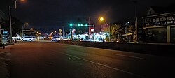
 Hoà Lợi intersection at night | |
|
| |
| Country | |
| Province | Bình Dương |
| Town | Bến Cát |
| Founded | December 29, 2013 |
| Area | |
| • Total | 6.58 sq mi (17.05 km2) |
| Population (2021) | |
| • Total | 39.414 [1] |
| • Density | 5,990/sq mi (2,312/km2) |
| Time zone | UTC+07:00 (Indochina Time) |
| Website |
ubndhoaloi |
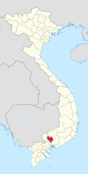
Hòa Lợi is a ward (phường) of Bến Cát town in Bình Dương Province, Vietnam. [2]
References
-
^
Công văn số 157/TB-SYT: Đánh giá cấp độ dịch Covid-19 trên địa bàn tỉnh Bình Dương (tính đến 18g00’ ngày 03 tháng 11 năm 2021).
"Dân số đến 03 tháng 11 năm 2021 - tỉnh Bình Dương" (PDF).
{{
cite web}}
: CS1 maint: numeric names: authors list ( link) - ^ "Administrative subdivisions". General Statistics Office of Vietnam. To find information at reference, go to row 74, then row 721, and it is listed on row 25849.
You can help expand this article with text translated from
the corresponding article in Vietnamese. Click [show] for important translation instructions.
|
Hòa Lợi | |
|---|---|
 Hoà Lợi intersection at night | |
|
| |
| Country | |
| Province | Bình Dương |
| Town | Bến Cát |
| Founded | December 29, 2013 |
| Area | |
| • Total | 6.58 sq mi (17.05 km2) |
| Population (2021) | |
| • Total | 39.414 [1] |
| • Density | 5,990/sq mi (2,312/km2) |
| Time zone | UTC+07:00 (Indochina Time) |
| Website |
ubndhoaloi |
Hòa Lợi is a ward (phường) of Bến Cát town in Bình Dương Province, Vietnam. [2]
References
-
^
Công văn số 157/TB-SYT: Đánh giá cấp độ dịch Covid-19 trên địa bàn tỉnh Bình Dương (tính đến 18g00’ ngày 03 tháng 11 năm 2021).
"Dân số đến 03 tháng 11 năm 2021 - tỉnh Bình Dương" (PDF).
{{
cite web}}
: CS1 maint: numeric names: authors list ( link) - ^ "Administrative subdivisions". General Statistics Office of Vietnam. To find information at reference, go to row 74, then row 721, and it is listed on row 25849.
