Greenwood is an unincorporated community in Charles Mix County, in the U.S. state of South Dakota. [1]
History
A post office called Greenwood was established in 1859, and remained in operation until 1965. [2] The community was named for a grove of trees near the original town site. [3]
References
- ^ U.S. Geological Survey Geographic Names Information System: Greenwood, Charles Mix County, South Dakota
-
^ "Charles Mix County". Jim Forte Postal History.
{{
cite web}}
: Missing or empty|url=( help) - ^ Federal Writers' Project (1940). South Dakota place-names, v.1-3. University of South Dakota. p. 40.
Municipalities and communities of
Charles Mix County, South Dakota, United States | ||
|---|---|---|
| Cities | 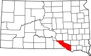 | |
| Towns | ||
| CDPs | ||
|
Other communities | ||
| Indian reservation | ||
42°55′23″N 98°23′18″W / 42.92306°N 98.38833°W
|
| This South Dakota state location article is a stub. You can help Wikipedia by expanding it. |
Greenwood is an unincorporated community in Charles Mix County, in the U.S. state of South Dakota. [1]
History
A post office called Greenwood was established in 1859, and remained in operation until 1965. [2] The community was named for a grove of trees near the original town site. [3]
References
- ^ U.S. Geological Survey Geographic Names Information System: Greenwood, Charles Mix County, South Dakota
-
^ "Charles Mix County". Jim Forte Postal History.
{{
cite web}}
: Missing or empty|url=( help) - ^ Federal Writers' Project (1940). South Dakota place-names, v.1-3. University of South Dakota. p. 40.
Municipalities and communities of
Charles Mix County, South Dakota, United States | ||
|---|---|---|
| Cities | | |
| Towns | ||
| CDPs | ||
|
Other communities | ||
| Indian reservation | ||
42°55′23″N 98°23′18″W / 42.92306°N 98.38833°W
|
| This South Dakota state location article is a stub. You can help Wikipedia by expanding it. |