Greenville Township, LaMoure County, North Dakota | |
|---|---|
 Greenville Township, LaMoure County, North Dakota Location within the state of North Dakota | |
| Coordinates: 46°24′23″N 98°5′13″W / 46.40639°N 98.08694°W | |
| Country | United States |
| State | North Dakota |
| County | LaMoure |
| Area | |
| • Total | 36.02 sq mi (93.3 km2) |
| • Land | 36.02 sq mi (93.3 km2) |
| • Water | 0.09 sq mi (0.2 km2) |
| Elevation | 1,486 ft (453 m) |
| Population | |
| • Total | 80 |
| • Density | 2.2/sq mi (0.8/km2) |
| Time zone | UTC-6 ( Central (CST)) |
| • Summer ( DST) | UTC-5 (CDT) |
| Area code | 701 |
| FIPS code | 38-33460 [3] |
| GNIS feature ID | 1036894 [4] |
Greenville Township is a rural township in LaMoure County in the U.S. state of North Dakota. Its population at the 2000 Census was 80, [2] with an estimated population of 67 as of 2009. [5] There are no organized communities within the township; it is entirely farmland with occasional homes.
References
- ^
a
b
U.S. Census Bureau. Census 2000, Summary File 1.
"GCT-PH1. Population, Housing Units, Area, and Density: 2000 - County -- Subdivision and Place". American FactFinder. <
http://factfinder2.census.gov>. Retrieved January 31, 2008.
{{
cite web}}
: CS1 maint: numeric names: authors list ( link) - ^
a
b
U.S. Census Bureau. Census 2000.
"Census Demographic Profiles, Greenville Township" (PDF). CenStats Databases. Retrieved January 31, 2009.
{{
cite web}}
: CS1 maint: numeric names: authors list ( link)[ dead link] - ^ "U.S. Census website". United States Census Bureau. Retrieved January 31, 2008.
- ^ "US Board on Geographic Names". United States Geological Survey. October 25, 2007. Retrieved January 31, 2008.
- ^ U.S. Census Bureau (2010). "Incorporated Places and Minor Civil Divisions: North Dakota". 2009 Population Estimates. Archived from the original (CSV) on June 27, 2010. Retrieved June 22, 2010.
Municipalities and communities of
LaMoure County, North Dakota, United States | ||
|---|---|---|
| Cities | 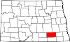 | |
| Townships | ||
|
Unincorporated communities | ||
|
| This North Dakota location article is a stub. You can help Wikipedia by expanding it. |
Greenville Township, LaMoure County, North Dakota | |
|---|---|
Greenville Township, LaMoure County, North Dakota Location within the state of North Dakota | |
| Coordinates: 46°24′23″N 98°5′13″W / 46.40639°N 98.08694°W | |
| Country | United States |
| State | North Dakota |
| County | LaMoure |
| Area | |
| • Total | 36.02 sq mi (93.3 km2) |
| • Land | 36.02 sq mi (93.3 km2) |
| • Water | 0.09 sq mi (0.2 km2) |
| Elevation | 1,486 ft (453 m) |
| Population | |
| • Total | 80 |
| • Density | 2.2/sq mi (0.8/km2) |
| Time zone | UTC-6 ( Central (CST)) |
| • Summer ( DST) | UTC-5 (CDT) |
| Area code | 701 |
| FIPS code | 38-33460 [3] |
| GNIS feature ID | 1036894 [4] |
Greenville Township is a rural township in LaMoure County in the U.S. state of North Dakota. Its population at the 2000 Census was 80, [2] with an estimated population of 67 as of 2009. [5] There are no organized communities within the township; it is entirely farmland with occasional homes.
References
- ^
a
b
U.S. Census Bureau. Census 2000, Summary File 1.
"GCT-PH1. Population, Housing Units, Area, and Density: 2000 - County -- Subdivision and Place". American FactFinder. <
http://factfinder2.census.gov>. Retrieved January 31, 2008.
{{
cite web}}
: CS1 maint: numeric names: authors list ( link) - ^
a
b
U.S. Census Bureau. Census 2000.
"Census Demographic Profiles, Greenville Township" (PDF). CenStats Databases. Retrieved January 31, 2009.
{{
cite web}}
: CS1 maint: numeric names: authors list ( link)[ dead link] - ^ "U.S. Census website". United States Census Bureau. Retrieved January 31, 2008.
- ^ "US Board on Geographic Names". United States Geological Survey. October 25, 2007. Retrieved January 31, 2008.
- ^ U.S. Census Bureau (2010). "Incorporated Places and Minor Civil Divisions: North Dakota". 2009 Population Estimates. Archived from the original (CSV) on June 27, 2010. Retrieved June 22, 2010.
Municipalities and communities of
LaMoure County, North Dakota, United States | ||
|---|---|---|
| Cities | | |
| Townships | ||
|
Unincorporated communities | ||
|
| This North Dakota location article is a stub. You can help Wikipedia by expanding it. |