Photos • Location


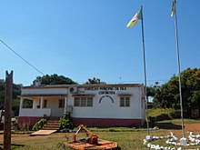
Gorongosa is a town and the administrative center of Gorongosa District of Mozambique, situated on the country's main north-south highway (the EN1). [1] Mount Gorongosa is north of the town, and Gorongosa National Park is a few kilometers east of the town.
- ^ "Perfil do Distrito do Gorongosa" (PDF) (in Portuguese). Ministry of State Administration. 2005. Retrieved 6 November 2016.
18°41′S 34°04′E / 18.683°S 34.067°E