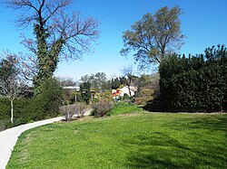
Gonen
גּוֹנֵן | |
|---|---|
 | |
| Etymology: Defended | |
| Coordinates: 33°7′21″N 35°38′47″E / 33.12250°N 35.64639°E | |
| Country | Israel |
| District | Northern |
| Council | Upper Galilee |
| Affiliation | Kibbutz Movement |
| Founded | 13 August 1951 |
| Founded by | Nahal |
| Population (2022)
[1] | 372 |
| Website | kgonen.org.il |
Gonen ( Hebrew: גּוֹנֵן, lit. Defended) is a kibbutz in northern Israel. Located in the Finger of the Galilee near Kiryat Shmona, the kibbutz falls under the jurisdiction of Upper Galilee Regional Council. In 2022 it had a population of 372. [1]
History
Gonen was established on 13 August 1951 as a Nahal settlement [2] on the land of the Palestinian village of Ghuraba, which had become depopulated in the 1948 Arab–Israeli War. [3]
It was civilianised a year later by a group of Hebrew Scouts. [4] It was the first Nahal settlement to convert to civilian control.
Its name is derived from the Book of Kings and symbolized the settlement's strategic location and proximity to the pre- Six-Day War Israel–Syria border, established in the 1949 Armistice Agreements. During the 1949–1967 period, the village's vicinity was the site of numerous skirmishes with the Syrian army. [4]
Since 1994, the kibbutz has been in the process of conversion to a community settlement. [4]
Economy
The economy of Gonen is based upon agriculture, including corn, citrus fruits, and the raising of cattle. There is also a mini-market and a guest house.
References
- ^ a b "Regional Statistics". Israel Central Bureau of Statistics. Retrieved 21 March 2024.
- ^ Vilnai, Ze'ev (1976). "Kaukab". Ariel Encyclopedia (in Hebrew). Vol. 2. Tel Aviv, Israel: Am Oved. p. 1268.
- ^ Khalidi, W. (1992). All That Remains: The Palestinian Villages Occupied and Depopulated by Israel in 1948. Washington D.C.: Institute for Palestine Studies. p. 452. ISBN 0-88728-224-5.
- ^ a b c HaReuveni, Immanuel (1999). Lexicon of the Land of Israel (in Hebrew). Miskal - Yedioth Ahronoth Books and Chemed Books. p. 185. ISBN 965-448-413-7.
External links
Gonen
גּוֹנֵן | |
|---|---|
 | |
| Etymology: Defended | |
| Coordinates: 33°7′21″N 35°38′47″E / 33.12250°N 35.64639°E | |
| Country | Israel |
| District | Northern |
| Council | Upper Galilee |
| Affiliation | Kibbutz Movement |
| Founded | 13 August 1951 |
| Founded by | Nahal |
| Population (2022)
[1] | 372 |
| Website | kgonen.org.il |
Gonen ( Hebrew: גּוֹנֵן, lit. Defended) is a kibbutz in northern Israel. Located in the Finger of the Galilee near Kiryat Shmona, the kibbutz falls under the jurisdiction of Upper Galilee Regional Council. In 2022 it had a population of 372. [1]
History
Gonen was established on 13 August 1951 as a Nahal settlement [2] on the land of the Palestinian village of Ghuraba, which had become depopulated in the 1948 Arab–Israeli War. [3]
It was civilianised a year later by a group of Hebrew Scouts. [4] It was the first Nahal settlement to convert to civilian control.
Its name is derived from the Book of Kings and symbolized the settlement's strategic location and proximity to the pre- Six-Day War Israel–Syria border, established in the 1949 Armistice Agreements. During the 1949–1967 period, the village's vicinity was the site of numerous skirmishes with the Syrian army. [4]
Since 1994, the kibbutz has been in the process of conversion to a community settlement. [4]
Economy
The economy of Gonen is based upon agriculture, including corn, citrus fruits, and the raising of cattle. There is also a mini-market and a guest house.
References
- ^ a b "Regional Statistics". Israel Central Bureau of Statistics. Retrieved 21 March 2024.
- ^ Vilnai, Ze'ev (1976). "Kaukab". Ariel Encyclopedia (in Hebrew). Vol. 2. Tel Aviv, Israel: Am Oved. p. 1268.
- ^ Khalidi, W. (1992). All That Remains: The Palestinian Villages Occupied and Depopulated by Israel in 1948. Washington D.C.: Institute for Palestine Studies. p. 452. ISBN 0-88728-224-5.
- ^ a b c HaReuveni, Immanuel (1999). Lexicon of the Land of Israel (in Hebrew). Miskal - Yedioth Ahronoth Books and Chemed Books. p. 185. ISBN 965-448-413-7.
