| Gold Hill | |
|---|---|
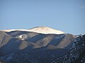
.jpg) East aspect | |
| Highest point | |
| Elevation | 12,716 ft (3,876 m) [1] [2] |
| Prominence | 1,811 ft (552 m) [3] |
| Parent peak | Wheeler Peak [3] |
| Isolation | 6.34 mi (10.20 km) [3] |
| Listing |
Mountains of New Mexico Highest major summits of the US |
| Coordinates | 36°38′35″N 105°27′21″W / 36.6430785°N 105.4558295°W [4] |
| Geography | |
 Gold Hill Location in New Mexico  Gold Hill Gold Hill (the United States) | |
| Country | United States of America |
| State | New Mexico |
| County | Taos |
| Protected area | Columbine–Hondo Wilderness |
| Parent range |
Taos Mountains
[1] Sangre de Cristo Mountains Rocky Mountains |
| Topo map | USGS Red River |
| Climbing | |
| Easiest route | class 1 hiking trail [3] |
Gold Hill is a 12,716-foot elevation (3,876 m) mountain summit in Taos County, New Mexico, United States.
Description
Gold Hill is part of the Taos Mountains which are a subset of the Sangre de Cristo Mountains. It is the highest point in the Columbine–Hondo Wilderness and ranks as the 11th-highest summit in New Mexico. [1] [3] The mountain is located within the Carson National Forest, 18.5 miles north-northeast of the town of Taos and 6.5 miles north-northwest of Wheeler Peak, the highest point in the state. Precipitation runoff from the mountain drains to Red River and Rio Hondo which are tributaries the Rio Grande. Topographic relief is significant as the west aspect rises 1,700 feet (520 meters) in 0.75 mile (1.2 km). An ascent of the peak involves 3,261 feet of elevation gain over 10.6 miles (round-trip) of hiking the Gold Hill Trail which crosses over the summit. [5] This mountain's toponym has been officially adopted by the United States Board on Geographic Names, [4] and the name refers to gold mining that took place here in the late 1800s. [6]
Climate
According to the Köppen climate classification system, Gold Hill has an alpine climate with cold, snowy winters, and cool to warm summers. [7] Due to its altitude, it receives precipitation all year, as snow in winter and as thunderstorms in summer. Climbers can expect afternoon rain, hail, and lightning from the seasonal monsoon in late July and August. This climate supports the Taos Ski Valley area immediately south of Gold Hill.
Gallery
-
 East aspect
 -
 Northwest aspect
 -
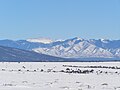 Gold Hill (left) and Flag Mountain (right) from the northwest
.jpg)
.jpg)

See also
References
- ^ a b c "Gold Hill, New Mexico". Peakbagger.com. Retrieved 2023-06-02.
- ^ Robert Julyan (2006), The Mountains of New Mexico, University of New Mexico Press, ISBN 9780826335166, p. 323.
- ^ a b c d e "Gold Hill - 12,711' NM". listsofjohn.com. Retrieved 2023-06-02.
- ^ a b "Gold Hill". Geographic Names Information System. United States Geological Survey, United States Department of the Interior. Retrieved 2023-06-02.
- ^ Laurence Parent (2018), Hiking New Mexico: A Guide to the State's Greatest Hiking Adventures, Falcon Guides, ISBN 9781493031092, p. 86.
- ^ Robert Julyan (1996), The Place Names of New Mexico, University of New Mexico Press, ISBN 9780826351142, p. 151.
- ^ Peel, M. C.; Finlayson, B. L.; McMahon, T. A. (2007). "Updated world map of the Köppen−Geiger climate classification". Hydrol. Earth Syst. Sci. 11. ISSN 1027-5606.
External links
| Gold Hill | |
|---|---|
|
East aspect | |
| Highest point | |
| Elevation | 12,716 ft (3,876 m) [1] [2] |
| Prominence | 1,811 ft (552 m) [3] |
| Parent peak | Wheeler Peak [3] |
| Isolation | 6.34 mi (10.20 km) [3] |
| Listing |
Mountains of New Mexico Highest major summits of the US |
| Coordinates | 36°38′35″N 105°27′21″W / 36.6430785°N 105.4558295°W [4] |
| Geography | |
Gold Hill Location in New Mexico Gold Hill Gold Hill (the United States) | |
| Country | United States of America |
| State | New Mexico |
| County | Taos |
| Protected area | Columbine–Hondo Wilderness |
| Parent range |
Taos Mountains
[1] Sangre de Cristo Mountains Rocky Mountains |
| Topo map | USGS Red River |
| Climbing | |
| Easiest route | class 1 hiking trail [3] |
Gold Hill is a 12,716-foot elevation (3,876 m) mountain summit in Taos County, New Mexico, United States.
Description
Gold Hill is part of the Taos Mountains which are a subset of the Sangre de Cristo Mountains. It is the highest point in the Columbine–Hondo Wilderness and ranks as the 11th-highest summit in New Mexico. [1] [3] The mountain is located within the Carson National Forest, 18.5 miles north-northeast of the town of Taos and 6.5 miles north-northwest of Wheeler Peak, the highest point in the state. Precipitation runoff from the mountain drains to Red River and Rio Hondo which are tributaries the Rio Grande. Topographic relief is significant as the west aspect rises 1,700 feet (520 meters) in 0.75 mile (1.2 km). An ascent of the peak involves 3,261 feet of elevation gain over 10.6 miles (round-trip) of hiking the Gold Hill Trail which crosses over the summit. [5] This mountain's toponym has been officially adopted by the United States Board on Geographic Names, [4] and the name refers to gold mining that took place here in the late 1800s. [6]
Climate
According to the Köppen climate classification system, Gold Hill has an alpine climate with cold, snowy winters, and cool to warm summers. [7] Due to its altitude, it receives precipitation all year, as snow in winter and as thunderstorms in summer. Climbers can expect afternoon rain, hail, and lightning from the seasonal monsoon in late July and August. This climate supports the Taos Ski Valley area immediately south of Gold Hill.
Gallery
-
East aspect
-
Northwest aspect
-
Gold Hill (left) and Flag Mountain (right) from the northwest
See also
References
- ^ a b c "Gold Hill, New Mexico". Peakbagger.com. Retrieved 2023-06-02.
- ^ Robert Julyan (2006), The Mountains of New Mexico, University of New Mexico Press, ISBN 9780826335166, p. 323.
- ^ a b c d e "Gold Hill - 12,711' NM". listsofjohn.com. Retrieved 2023-06-02.
- ^ a b "Gold Hill". Geographic Names Information System. United States Geological Survey, United States Department of the Interior. Retrieved 2023-06-02.
- ^ Laurence Parent (2018), Hiking New Mexico: A Guide to the State's Greatest Hiking Adventures, Falcon Guides, ISBN 9781493031092, p. 86.
- ^ Robert Julyan (1996), The Place Names of New Mexico, University of New Mexico Press, ISBN 9780826351142, p. 151.
- ^ Peel, M. C.; Finlayson, B. L.; McMahon, T. A. (2007). "Updated world map of the Köppen−Geiger climate classification". Hydrol. Earth Syst. Sci. 11. ISSN 1027-5606.