Glasau | |
|---|---|
 Coat of arms | |
Location of Glasau within Segeberg district 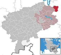 | |
 Glasau  Glasau | |
| Coordinates: 54°03′N 10°31′E / 54.050°N 10.517°E | |
| Country | Germany |
| State | Schleswig-Holstein |
| District | Segeberg |
| Municipal assoc. | Trave-Land |
| Government | |
| • Mayor | Henning Frahm |
| Area | |
| • Total | 18.82 km2 (7.27 sq mi) |
| Elevation | 42 m (138 ft) |
| Population (2022-12-31)
[1] | |
| • Total | 879 |
| • Density | 47/km2 (120/sq mi) |
| Time zone | UTC+01:00 ( CET) |
| • Summer ( DST) | UTC+02:00 ( CEST) |
| Postal codes | 23719 |
| Dialling codes | 04525 |
| Vehicle registration | SE |
| Website |
www.amt-trave- land.de |
Glasau is a municipality in the district of Segeberg, in Schleswig-Holstein, Germany. It is named after the estate and the manor house of the same name. Sarau is the largest village in the municipality; about half of the population lives there.
History
From March 29, 1945 until May 5, 1945 a concentration camp was established near Glasau. It was a subcamp to the Neuengamme concentration camp. [2]
See also
Notes
- ^ "Bevölkerung der Gemeinden in Schleswig-Holstein 4. Quartal 2022" (XLS) (in German). Statistisches Amt für Hamburg und Schleswig-Holstein.
- ^ The camp is listed as No. 466 Glasau bei Sarau, Kreis Segeberg, in the official German list Archived April 23, 2009, at the Wayback Machine (in German)
|
| This Segeberg location article is a stub. You can help Wikipedia by expanding it. |
Glasau | |
|---|---|
|
Coat of arms | |
Location of Glasau within Segeberg district | |
Glasau Glasau | |
| Coordinates: 54°03′N 10°31′E / 54.050°N 10.517°E | |
| Country | Germany |
| State | Schleswig-Holstein |
| District | Segeberg |
| Municipal assoc. | Trave-Land |
| Government | |
| • Mayor | Henning Frahm |
| Area | |
| • Total | 18.82 km2 (7.27 sq mi) |
| Elevation | 42 m (138 ft) |
| Population (2022-12-31)
[1] | |
| • Total | 879 |
| • Density | 47/km2 (120/sq mi) |
| Time zone | UTC+01:00 ( CET) |
| • Summer ( DST) | UTC+02:00 ( CEST) |
| Postal codes | 23719 |
| Dialling codes | 04525 |
| Vehicle registration | SE |
| Website |
www.amt-trave- land.de |
Glasau is a municipality in the district of Segeberg, in Schleswig-Holstein, Germany. It is named after the estate and the manor house of the same name. Sarau is the largest village in the municipality; about half of the population lives there.
History
From March 29, 1945 until May 5, 1945 a concentration camp was established near Glasau. It was a subcamp to the Neuengamme concentration camp. [2]
See also
Notes
- ^ "Bevölkerung der Gemeinden in Schleswig-Holstein 4. Quartal 2022" (XLS) (in German). Statistisches Amt für Hamburg und Schleswig-Holstein.
- ^ The camp is listed as No. 466 Glasau bei Sarau, Kreis Segeberg, in the official German list Archived April 23, 2009, at the Wayback Machine (in German)
|
| This Segeberg location article is a stub. You can help Wikipedia by expanding it. |