| Glandieu Fall | |
|---|---|
 Glandieu Fall | |
 | |
|
| |
| Location | Glandieu, Ain (France) |
| Coordinates | 45°39′55″N 5°36′50″E / 45.665167647489746°N 5.613862825547643°E |
| Elevation | ~ 210 m |
| Total height | 60 m |
| Number of drops | 2 |
| Longest drop | 210 m |
| Watercourse | Gland |
The Glandieu Fall ( French: Cascade de Glandieu) is a small waterfall in France. The fall is situated in Glandieu, in the Ain Department, between the villages of Brégnier-Cordon and Saint-Benoît. [1] [2]
It consists of two consecutive waterfall steps, for a total height of 60 metres, which carry the water of the Gland into the Rhône basin.
Until few time ago there was a marble quarry near the waterfall, in Brégnier-Cordon area, which used its hydroelectric energy. Two small hydroelectric power stations are still in operation, one for each municipality. [3]
Gallery
-
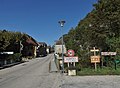 The limit between Brégnier-Cordon and Saint-Benoît with, right side, the label to the Fall.
 -
 Other view of the Fall.
.JPG)

References
- ^ "Cascade de Glandieu". europeanwaterfalls.com. Retrieved 25 April 2023.
- ^ "Cascade de Glandieu à Brégnier-Cordon - Patrimoine(s) de l'Ain". patrimoines.ain.fr. Retrieved 25 April 2023.
- ^ "Cascade de Glandieu". ain-tourisme.com. Retrieved 25 April 2023.
External links
|
| This Ain geographical article is a stub. You can help Wikipedia by expanding it. |
| Glandieu Fall | |
|---|---|
|
Glandieu Fall | |
| |
|
| |
| Location | Glandieu, Ain (France) |
| Coordinates | 45°39′55″N 5°36′50″E / 45.665167647489746°N 5.613862825547643°E |
| Elevation | ~ 210 m |
| Total height | 60 m |
| Number of drops | 2 |
| Longest drop | 210 m |
| Watercourse | Gland |
The Glandieu Fall ( French: Cascade de Glandieu) is a small waterfall in France. The fall is situated in Glandieu, in the Ain Department, between the villages of Brégnier-Cordon and Saint-Benoît. [1] [2]
It consists of two consecutive waterfall steps, for a total height of 60 metres, which carry the water of the Gland into the Rhône basin.
Until few time ago there was a marble quarry near the waterfall, in Brégnier-Cordon area, which used its hydroelectric energy. Two small hydroelectric power stations are still in operation, one for each municipality. [3]
Gallery
-
The limit between Brégnier-Cordon and Saint-Benoît with, right side, the label to the Fall.
-
Other view of the Fall.
References
- ^ "Cascade de Glandieu". europeanwaterfalls.com. Retrieved 25 April 2023.
- ^ "Cascade de Glandieu à Brégnier-Cordon - Patrimoine(s) de l'Ain". patrimoines.ain.fr. Retrieved 25 April 2023.
- ^ "Cascade de Glandieu". ain-tourisme.com. Retrieved 25 April 2023.
External links
|
| This Ain geographical article is a stub. You can help Wikipedia by expanding it. |