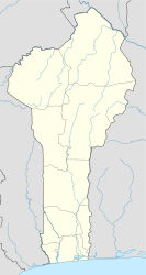
Photos • Location
Gbabiré | |
|---|---|
Arrondissement and town | |
| Coordinates: 9°40′28″N 3°11′38″E / 09.674546°N 03.193825°E | |
| Country | |
| Department | Borgou Department |
| Commune | Nikki |
| Population (2013) | |
| • Total | 2,282 |
| Time zone | UTC+1 ( WAT) |
Gbabiré is a town in the Tasso arrondissement in the Borgou Department of Benin. It is an administrative division under the jurisdiction of the commune of Nikki. According to the population census in 2013, the village had a total population of 2,282. [1]
- ^ "Données Recensement 2013 - Bénin - Benin Data Portal". benin.opendataforafrica.org. Retrieved 2020-02-17.
