Gümüşhane Örenşar Airport Gümüşhane Örenşar Havalimanı | |||||||||||
|---|---|---|---|---|---|---|---|---|---|---|---|
| Summary | |||||||||||
| Airport type | Public/civil | ||||||||||
| Owner | DHMI | ||||||||||
| Operator | State Airports Administration ( Turkish: Devlet Hava Meydanları İşletmesi (DHMİ)) | ||||||||||
| Serves | Gümüşhane | ||||||||||
| Location | Örenşar | ||||||||||
| Elevation AMSL | 519 m / 1,704 ft | ||||||||||
| Coordinates | 40°15′25″N 39°48′35″E / 40.25694°N 39.80972°E | ||||||||||
| Map | |||||||||||
 Gümüşhane Örenşar Airport Location of airport in Turkey | |||||||||||
| Runways | |||||||||||
| |||||||||||
Gümüşhane Örenşar Airport ( IATA: ?, ICAO: ?) ( Turkish: Gümüşhane Örenşar Havalimanı) is a planned public airport at Örenşar village of Köse district in Gümüşhane, Türkiye. [1] The airport is located 64 km (40 mi) away from Gümüşhane city centre.
The Gümüşhane Örenşar Airport is being re-developed on its current STOLport location that was built back in 1995. The runway is being extended from 1,113 m × 30 m (3,652 ft × 98 ft) to 3,000 m × 60 m (9,840 ft × 200 ft) on 07/25 direction. Despite the finished feasibility plans, the tender to build the airport has not been issued yet. [2] [3]
Geography and transport
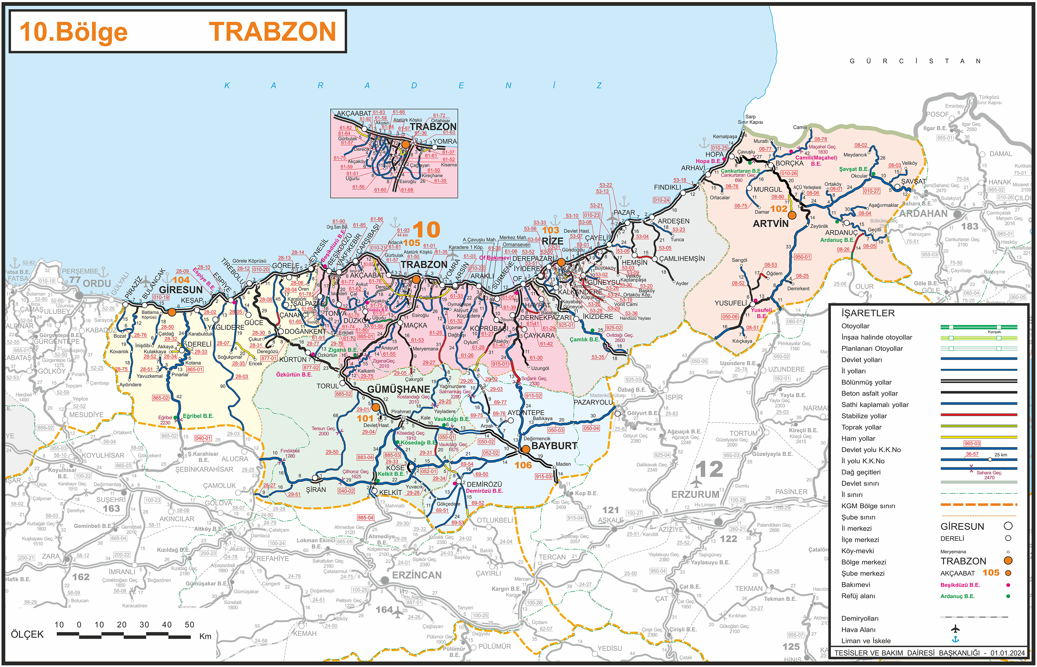
Airport is close to Örenşar, Salyazı, Bizgili, Gökçeköy, Yaylım, Bayrampaşa, Oylumdere, Çakıröz, Altıntaş, Özbeyli, Çatalçeşme, Kabaktepe, Eymür, Yuvacık, Çayıryolu, Yenice, Kitre, Manas, Tomlacık, Beyçam, Kocayokuş, Karayaşmak, Övünce, Nazlıçayır, Güvercindere, Çalık, and Çerçi villages; Gökçedere, Öbektaş, Arzularkabaköy, Tekke, Arpalı, and Ünlüpınar towns; Demirözü, Köse, Kelkit, Otlukbeli, and Aydıntepe district centers. [4]
The routes from the airport to nearby cities are these:
To Bayburt (based on the Bayburt University Bâberti Complex) [5] [6] [7]
- (38 km., 41 min.) D052 ( Bayburt direction)
- (40 km., 50 min.) D052 ( Bayburt direction) - Çayıryolu - Tomlacık - Rüştü - 69-50 ( Bayburt direction) - D052 ( Bayburt direction)
- (41 km., 53 min.) D052 ( Bayburt direction) - Kırkpınar locality - Danişment - D052 ( Bayburt direction)
- (48 km., 57 min.) D052 ( Bayburt direction) - 29-34 ( Demirözü direction) - 69-54 ( Demirözü direction) - Çatalçeşme - Demirözü - 69-50 ( Bayburt direction) - D052 ( Bayburt direction)
- (60 km., 63 min.) D052 ( Bayburt direction) - Salyazı Pond - Salyazı - Kırklar Cave ( Altıntaş) - Kocayokuş - D050 ( Bayburt direction) - Korgan Bridge ( Akşar) - D052 ( Köse direction)
- (61 km., 61 min.) D052 ( Bayburt direction) - 29-31 ( Kitre, Çerçi direction) - D050 ( Bayburt direction) - Korgan Bridge ( Akşar) - D052 ( Köse direction)
To Gümüşhane (based on the Gümüşhane University Library) [7] [8] [6]
- (48 km., 58 min.) D052 ( Bayburt direction) - Salyazı Pond - Salyazı - Kırklar Cave ( Altıntaş) - Yenice - Beyçam - D050 ( Gümüşhane direction, opposite side) - Tohumoğlu Bridge ( Yeniyol) - D885 ( Gümüşhane direction) - Çağırgan Baba Tomb ( Tekke) - 29-01 ( city center direction)
- (51 km., 59 min.) D052 ( Bayburt direction) - Salyazı Pond - Salyazı - Kırklar Cave ( Altıntaş) - Yenice - Nazlıçayır - Sargınkaya - D050 ( Gümüşhane direction, opposite side) - Keçi Castle ( Kale) - Tohumoğlu Bridge ( Yeniyol) - D885 ( Gümüşhane direction) - Çağırgan Baba Tomb ( Tekke) - 29-01 ( city center direction)
- (52 km., 63 min.) D052 ( Köse direction) - Yaylım Church - Beyçam - D050 ( Gümüşhane direction, opposite side) - Tohumoğlu Bridge ( Yeniyol) - D885 ( Gümüşhane direction) - Çağırgan Baba Tomb ( Tekke) - 29-01 ( city center direction)
- (52 km., 73 min.) D052 ( Bayburt direction) - Salyazı Pond - Salyazı - Kırklar Cave ( Altıntaş) - Yenice - Nazlıçayır - Tamzı - Keçikaya - Kale - D050 ( Gümüşhane direction, opposite side) - Keçi Castle ( Kale) - 29-25 ( Yağmurdere direction) - Harmancık - D885 ( Gümüşhane direction) - Çağırgan Baba Tomb ( Tekke) - 29-01 ( city center direction)
- (53 km., 58 min.) D052 ( Köse direction) - Köse - D885 ( Gümüşhane direction) - Köse Dam Lake - Sungurbeyli Plateau - Pirahmet Tomb - Çağırgan Baba Tomb ( Tekke) - 29-01 ( city center direction)
- (54 km., 61 min.) D052 ( Bayburt direction) - Salyazı Pond - Salyazı - Kırklar Cave ( Altıntaş) - Kocayokuş - D050 ( Gümüşhane direction, opposite side) - Keçi Castle ( Kale) - Tohumoğlu Bridge ( Yeniyol) - D885 ( Gümüşhane direction) - Çağırgan Baba Tomb ( Tekke) - 29-01 ( city center direction)
- (60 km., 62 min.) D052 ( Bayburt direction) - 29-31 ( Kitre, Çerçi direction) - D050 ( Gümüşhane direction, opposite side) - Keçi Castle ( Kale) - Tohumoğlu Bridge ( Yeniyol) - D885 ( Gümüşhane direction) - Çağırgan Baba Tomb ( Tekke) - 29-01 ( city center direction)
References
- ^ "Google Maps". Google Maps. Retrieved 2022-05-06.
- ^ "Gümüşhane Salyazı Havaalanı Ulaştırma Bakanlığı Planları Arasında". Gümüşhane Ekspres (in Turkish). 2012-12-17. Retrieved 2013-07-21.
- ^ "Havacılık ve UzayTeknolojileri-Etüt Proje Aşamasında Olan Havalimanı Projeleri-Gümüşhane Salyazı Havalimanı" (PDF) (in Turkish). Ulaştırma, Denizcilik ve Haberleşme Bakanlığı. p. 22. Archived from the original (PDF) on 2013-08-10. Retrieved 2013-07-21.
- ^ "Google Earth". earth.google.com. Archived from the original on 24 August 2022. Retrieved 12 December 2022.
- ^ "Gezilecek Yerler BAYBURT Türkiye". Kültür ve Turizm Bakanlığı. Archived from the original on 6 May 2014.
- ^ a b "Kara Yolları 10. Bölge Haritası". Kara Yolları Genel Müdürlüğü. Archived from the original on 7 January 2011.
- ^ a b "Yandex Haritalar". Yandex. Archived from the original on 13 April 2016.
- ^ "Gümüşhane Turizm Haritası". Kültür ve Turizm Bakanlığı. Archived from the original on 24 November 2020.
External links
- Salyazı Havaalanı Ulaştırma Bakanlığı PlanlarıArasına Girdi at gumushane.gen.tr (in Turkish)
- Gümüşhane Havaalanı Projesi at ucuyorum.com (in Turkish)
- Köse Havaalanı İçin Teknik Heyet Gümüşhane'de at gumushane.gen.tr (in Turkish)
- Havaalanı için Teknik Heyet geldi at Gümüşhane Kuşakkaya (in Turkish)
|
| This Turkish airport-related article is a stub. You can help Wikipedia by expanding it. |
Gümüşhane Örenşar Airport Gümüşhane Örenşar Havalimanı | |||||||||||
|---|---|---|---|---|---|---|---|---|---|---|---|
| Summary | |||||||||||
| Airport type | Public/civil | ||||||||||
| Owner | DHMI | ||||||||||
| Operator | State Airports Administration ( Turkish: Devlet Hava Meydanları İşletmesi (DHMİ)) | ||||||||||
| Serves | Gümüşhane | ||||||||||
| Location | Örenşar | ||||||||||
| Elevation AMSL | 519 m / 1,704 ft | ||||||||||
| Coordinates | 40°15′25″N 39°48′35″E / 40.25694°N 39.80972°E | ||||||||||
| Map | |||||||||||
Gümüşhane Örenşar Airport Location of airport in Turkey | |||||||||||
| Runways | |||||||||||
| |||||||||||
Gümüşhane Örenşar Airport ( IATA: ?, ICAO: ?) ( Turkish: Gümüşhane Örenşar Havalimanı) is a planned public airport at Örenşar village of Köse district in Gümüşhane, Türkiye. [1] The airport is located 64 km (40 mi) away from Gümüşhane city centre.
The Gümüşhane Örenşar Airport is being re-developed on its current STOLport location that was built back in 1995. The runway is being extended from 1,113 m × 30 m (3,652 ft × 98 ft) to 3,000 m × 60 m (9,840 ft × 200 ft) on 07/25 direction. Despite the finished feasibility plans, the tender to build the airport has not been issued yet. [2] [3]
Geography and transport
Airport is close to Örenşar, Salyazı, Bizgili, Gökçeköy, Yaylım, Bayrampaşa, Oylumdere, Çakıröz, Altıntaş, Özbeyli, Çatalçeşme, Kabaktepe, Eymür, Yuvacık, Çayıryolu, Yenice, Kitre, Manas, Tomlacık, Beyçam, Kocayokuş, Karayaşmak, Övünce, Nazlıçayır, Güvercindere, Çalık, and Çerçi villages; Gökçedere, Öbektaş, Arzularkabaköy, Tekke, Arpalı, and Ünlüpınar towns; Demirözü, Köse, Kelkit, Otlukbeli, and Aydıntepe district centers. [4]
The routes from the airport to nearby cities are these:
To Bayburt (based on the Bayburt University Bâberti Complex) [5] [6] [7]
- (38 km., 41 min.) D052 ( Bayburt direction)
- (40 km., 50 min.) D052 ( Bayburt direction) - Çayıryolu - Tomlacık - Rüştü - 69-50 ( Bayburt direction) - D052 ( Bayburt direction)
- (41 km., 53 min.) D052 ( Bayburt direction) - Kırkpınar locality - Danişment - D052 ( Bayburt direction)
- (48 km., 57 min.) D052 ( Bayburt direction) - 29-34 ( Demirözü direction) - 69-54 ( Demirözü direction) - Çatalçeşme - Demirözü - 69-50 ( Bayburt direction) - D052 ( Bayburt direction)
- (60 km., 63 min.) D052 ( Bayburt direction) - Salyazı Pond - Salyazı - Kırklar Cave ( Altıntaş) - Kocayokuş - D050 ( Bayburt direction) - Korgan Bridge ( Akşar) - D052 ( Köse direction)
- (61 km., 61 min.) D052 ( Bayburt direction) - 29-31 ( Kitre, Çerçi direction) - D050 ( Bayburt direction) - Korgan Bridge ( Akşar) - D052 ( Köse direction)
To Gümüşhane (based on the Gümüşhane University Library) [7] [8] [6]
- (48 km., 58 min.) D052 ( Bayburt direction) - Salyazı Pond - Salyazı - Kırklar Cave ( Altıntaş) - Yenice - Beyçam - D050 ( Gümüşhane direction, opposite side) - Tohumoğlu Bridge ( Yeniyol) - D885 ( Gümüşhane direction) - Çağırgan Baba Tomb ( Tekke) - 29-01 ( city center direction)
- (51 km., 59 min.) D052 ( Bayburt direction) - Salyazı Pond - Salyazı - Kırklar Cave ( Altıntaş) - Yenice - Nazlıçayır - Sargınkaya - D050 ( Gümüşhane direction, opposite side) - Keçi Castle ( Kale) - Tohumoğlu Bridge ( Yeniyol) - D885 ( Gümüşhane direction) - Çağırgan Baba Tomb ( Tekke) - 29-01 ( city center direction)
- (52 km., 63 min.) D052 ( Köse direction) - Yaylım Church - Beyçam - D050 ( Gümüşhane direction, opposite side) - Tohumoğlu Bridge ( Yeniyol) - D885 ( Gümüşhane direction) - Çağırgan Baba Tomb ( Tekke) - 29-01 ( city center direction)
- (52 km., 73 min.) D052 ( Bayburt direction) - Salyazı Pond - Salyazı - Kırklar Cave ( Altıntaş) - Yenice - Nazlıçayır - Tamzı - Keçikaya - Kale - D050 ( Gümüşhane direction, opposite side) - Keçi Castle ( Kale) - 29-25 ( Yağmurdere direction) - Harmancık - D885 ( Gümüşhane direction) - Çağırgan Baba Tomb ( Tekke) - 29-01 ( city center direction)
- (53 km., 58 min.) D052 ( Köse direction) - Köse - D885 ( Gümüşhane direction) - Köse Dam Lake - Sungurbeyli Plateau - Pirahmet Tomb - Çağırgan Baba Tomb ( Tekke) - 29-01 ( city center direction)
- (54 km., 61 min.) D052 ( Bayburt direction) - Salyazı Pond - Salyazı - Kırklar Cave ( Altıntaş) - Kocayokuş - D050 ( Gümüşhane direction, opposite side) - Keçi Castle ( Kale) - Tohumoğlu Bridge ( Yeniyol) - D885 ( Gümüşhane direction) - Çağırgan Baba Tomb ( Tekke) - 29-01 ( city center direction)
- (60 km., 62 min.) D052 ( Bayburt direction) - 29-31 ( Kitre, Çerçi direction) - D050 ( Gümüşhane direction, opposite side) - Keçi Castle ( Kale) - Tohumoğlu Bridge ( Yeniyol) - D885 ( Gümüşhane direction) - Çağırgan Baba Tomb ( Tekke) - 29-01 ( city center direction)
References
- ^ "Google Maps". Google Maps. Retrieved 2022-05-06.
- ^ "Gümüşhane Salyazı Havaalanı Ulaştırma Bakanlığı Planları Arasında". Gümüşhane Ekspres (in Turkish). 2012-12-17. Retrieved 2013-07-21.
- ^ "Havacılık ve UzayTeknolojileri-Etüt Proje Aşamasında Olan Havalimanı Projeleri-Gümüşhane Salyazı Havalimanı" (PDF) (in Turkish). Ulaştırma, Denizcilik ve Haberleşme Bakanlığı. p. 22. Archived from the original (PDF) on 2013-08-10. Retrieved 2013-07-21.
- ^ "Google Earth". earth.google.com. Archived from the original on 24 August 2022. Retrieved 12 December 2022.
- ^ "Gezilecek Yerler BAYBURT Türkiye". Kültür ve Turizm Bakanlığı. Archived from the original on 6 May 2014.
- ^ a b "Kara Yolları 10. Bölge Haritası". Kara Yolları Genel Müdürlüğü. Archived from the original on 7 January 2011.
- ^ a b "Yandex Haritalar". Yandex. Archived from the original on 13 April 2016.
- ^ "Gümüşhane Turizm Haritası". Kültür ve Turizm Bakanlığı. Archived from the original on 24 November 2020.
External links
- Salyazı Havaalanı Ulaştırma Bakanlığı PlanlarıArasına Girdi at gumushane.gen.tr (in Turkish)
- Gümüşhane Havaalanı Projesi at ucuyorum.com (in Turkish)
- Köse Havaalanı İçin Teknik Heyet Gümüşhane'de at gumushane.gen.tr (in Turkish)
- Havaalanı için Teknik Heyet geldi at Gümüşhane Kuşakkaya (in Turkish)
|
| This Turkish airport-related article is a stub. You can help Wikipedia by expanding it. |