Photos • Location
You can help expand this article with text translated from
the corresponding article in German. (October 2011) Click [show] for important translation instructions.
|
| Frieda | |
|---|---|
 | |
| Location | |
| Country | Germany |
| States | Thuringia and Hesse |
| Physical characteristics | |
| Mouth | |
• location | Werra |
• coordinates | 51°11′17″N 10°07′44″E / 51.1880°N 10.1289°E |
| Basin size | 173 km2 (67 sq mi) [1] |
| Basin features | |
| Progression | Werra→ Weser→ North Sea |
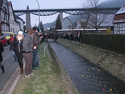
Frieda is a river of Thuringia and Hesse, Germany. It joins the Werra in the village Frieda.
See also
References
You can help expand this article with text translated from
the corresponding article in German. (October 2011) Click [show] for important translation instructions.
|
| Frieda | |
|---|---|
 | |
| Location | |
| Country | Germany |
| States | Thuringia and Hesse |
| Physical characteristics | |
| Mouth | |
• location | Werra |
• coordinates | 51°11′17″N 10°07′44″E / 51.1880°N 10.1289°E |
| Basin size | 173 km2 (67 sq mi) [1] |
| Basin features | |
| Progression | Werra→ Weser→ North Sea |
Frieda is a river of Thuringia and Hesse, Germany. It joins the Werra in the village Frieda.
See also
References