| French Bay / Otitori Bay | |
|---|---|
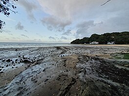
 French Bay / Otitori Bay at low tide | |
| Location | Auckland Region, New Zealand |
| Coordinates | 36°57′00″S 174°40′01″E / 36.95°S 174.667°E |
| Ocean/sea sources | Manukau Harbour |
French Bay / Otitori Bay is a bay in the Auckland Region of New Zealand's North Island. It is located in Titirangi on the Manukau Harbour, between Wood Bay to the north and Paturoa Bay to the south.
History
The bay was traditionally called Opou by Tāmaki Māori, literally meaning "the place of posts". The bay became known as French Bay in the 1920s, however the reason for this is unknown. [1] In the early 20th century, the bay became a popular destination for Aucklanders, undertaking day trips. [2] Painter Colin McCahon lived close to French Bay from 1953 to 1960, [3] and many of his works depict the bay. [4] McCahon's home later became McCahon House, a museum and gallery space. [3]
The beach has variable water quality, [5] and in 2020 was listed as one of the 10 least safe beaches for swimming in the Auckland Region. [6]
Amenities
The French Bay Yacht Club is located on the beach. [7] The yacht club facilities were severely damaged during the 2023 Auckland Anniversary Weekend floods. [8] [9]
References
- ^ "French Bay". New Zealand Gazetteer. Land Information New Zealand. Retrieved 9 February 2023.
- ^ Harvey, Bruce; Harvey, Trixie (2009). "That Noble Sheet of Water". In Macdonald, Finlay; Kerr, Ruth (eds.). West: The History of Waitakere. Random House. p. 93. ISBN 9781869790080.
- ^ a b Edmond, Martin (2020). "A family plot". Journal of New Zealand Studies (31): 148–153. ISSN 1176-306X.
- ^ Smythe, Luke (2020). "Let us possess one world: McCahon, abstraction and transversal art history". Journal of New Zealand Studies (31): 128–147. ISSN 1176-306X.
- ^ Tokalau, Torika (21 December 2017). "Where to find the cleanest beaches in West Auckland". Stuff. Retrieved 9 February 2023.
- ^ Dillane, Tom (16 January 2021). "Auckland's worst beaches: Urgent rates rise required, worst-polluted sites ranked". The New Zealand Herald. Retrieved 9 February 2023.
- ^ Sadler, Rachel (3 January 2021). "Five secluded Auckland beaches to visit this summer". Newshub. Retrieved 9 February 2023.
- ^ Dirga, Nik (30 January 2023). "Slips, slides and no water - Titirangi suburb battered by storm fallout". Radio New Zealand. Retrieved 9 February 2023.
- ^ "Heartbreak as West Auckland man's tiny home destroyed after flood damaged real home in 2021". The New Zealand Herald. 29 January 2023. Retrieved 9 February 2023.
| French Bay / Otitori Bay | |
|---|---|
 French Bay / Otitori Bay at low tide | |
| Location | Auckland Region, New Zealand |
| Coordinates | 36°57′00″S 174°40′01″E / 36.95°S 174.667°E |
| Ocean/sea sources | Manukau Harbour |
French Bay / Otitori Bay is a bay in the Auckland Region of New Zealand's North Island. It is located in Titirangi on the Manukau Harbour, between Wood Bay to the north and Paturoa Bay to the south.
History
The bay was traditionally called Opou by Tāmaki Māori, literally meaning "the place of posts". The bay became known as French Bay in the 1920s, however the reason for this is unknown. [1] In the early 20th century, the bay became a popular destination for Aucklanders, undertaking day trips. [2] Painter Colin McCahon lived close to French Bay from 1953 to 1960, [3] and many of his works depict the bay. [4] McCahon's home later became McCahon House, a museum and gallery space. [3]
The beach has variable water quality, [5] and in 2020 was listed as one of the 10 least safe beaches for swimming in the Auckland Region. [6]
Amenities
The French Bay Yacht Club is located on the beach. [7] The yacht club facilities were severely damaged during the 2023 Auckland Anniversary Weekend floods. [8] [9]
References
- ^ "French Bay". New Zealand Gazetteer. Land Information New Zealand. Retrieved 9 February 2023.
- ^ Harvey, Bruce; Harvey, Trixie (2009). "That Noble Sheet of Water". In Macdonald, Finlay; Kerr, Ruth (eds.). West: The History of Waitakere. Random House. p. 93. ISBN 9781869790080.
- ^ a b Edmond, Martin (2020). "A family plot". Journal of New Zealand Studies (31): 148–153. ISSN 1176-306X.
- ^ Smythe, Luke (2020). "Let us possess one world: McCahon, abstraction and transversal art history". Journal of New Zealand Studies (31): 128–147. ISSN 1176-306X.
- ^ Tokalau, Torika (21 December 2017). "Where to find the cleanest beaches in West Auckland". Stuff. Retrieved 9 February 2023.
- ^ Dillane, Tom (16 January 2021). "Auckland's worst beaches: Urgent rates rise required, worst-polluted sites ranked". The New Zealand Herald. Retrieved 9 February 2023.
- ^ Sadler, Rachel (3 January 2021). "Five secluded Auckland beaches to visit this summer". Newshub. Retrieved 9 February 2023.
- ^ Dirga, Nik (30 January 2023). "Slips, slides and no water - Titirangi suburb battered by storm fallout". Radio New Zealand. Retrieved 9 February 2023.
- ^ "Heartbreak as West Auckland man's tiny home destroyed after flood damaged real home in 2021". The New Zealand Herald. 29 January 2023. Retrieved 9 February 2023.
