Photos • Location

Fordstreet

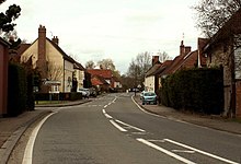
Fordstreet or Ford Street is a village on the A1124 road, in the civil parish of Aldham in the Colchester district in Essex, England. [1] [2] It is located on the River Colne and is near the city of Colchester. Artist Damon Albarn lived there as a child. [3]
References
- ^ Ordnance Survey: Landranger map sheet 168 Colchester (Halstead & Maldon) (Map). Ordnance Survey. 2009. ISBN 9780319229224.
- ^ "Ordnance Survey: 1:50,000 Scale Gazetteer" (csv (download)). www.ordnancesurvey.co.uk. Ordnance Survey. 1 January 2016. Retrieved 18 February 2016.
- ^ "54 locations that defined Britpop". The Daily Telegraph. 24 February 2016. Retrieved 8 May 2018.
51°54′27″N 0°47′27″E / 51.9074°N 0.7908°E