Fitzpatrick, Alabama | |
|---|---|
 Location of Fitzpatrick in Bullock County, Alabama. | |
 Fitzpatrick, Alabama | |
| Coordinates: 32°13′00″N 85°53′20″W / 32.21667°N 85.88889°W | |
| Country | United States |
| State | Alabama |
| County | Bullock |
| Area | |
| • Total | 4.20 sq mi (10.87 km2) |
| • Land | 4.16 sq mi (10.78 km2) |
| • Water | 0.04 sq mi (0.09 km2) |
| Elevation | 262 ft (80 m) |
| Population (
2020) | |
| • Total | 79 |
| • Density | 18.98/sq mi (7.33/km2) |
| Time zone | UTC-6 ( Central (CST)) |
| • Summer ( DST) | UTC-5 (CDT) |
| ZIP code | 36029 |
| Area code | 334 |
| FIPS code | 01-26152 |
| GNIS feature ID | 157952 [2] |
Fitzpatrick is an unincorporated community and census-designated place in Bullock County, Alabama, United States. It first appeared as a CDP in the 2010 census with a population of 83. [3] The community is served by Alabama State Route 110.
Demographics
| Census | Pop. | Note | %± |
|---|---|---|---|
| 1890 | 357 | — | |
| 1900 | 447 | 25.2% | |
| 1910 | 398 | −11.0% | |
| 1920 | 339 | −14.8% | |
| 2010 | 83 | — | |
| 2020 | 79 | −4.8% | |
| U.S. Decennial Census [4] | |||
| Race / Ethnicity | Pop 2010 [5] | Pop 2020 [6] | % 2010 | % 2020 |
|---|---|---|---|---|
| White alone (NH) | 63 | 59 | 75.90% | 74.68% |
| Black or African American alone (NH) | 18 | 15 | 21.69% | 18.99% |
| Native American or Alaska Native alone (NH) | 0 | 0 | 0.00% | 0.00% |
| Asian alone (NH) | 0 | 0 | 0.00% | 0.00% |
| Pacific Islander alone (NH) | 0 | 1 | 0.00% | 1.27% |
| Some Other Race alone (NH) | 0 | 2 | 0.00% | 2.53% |
| Mixed Race/Multi-Racial (NH) | 0 | 0 | 0.00% | 0.00% |
| Hispanic or Latino (any race) | 2 | 2 | 2.41% | 2.53% |
| Total | 83 | 79 | 100.00% | 100.00% |
References
- ^ "2020 U.S. Gazetteer Files". United States Census Bureau. Retrieved October 29, 2021.
- ^ U.S. Geological Survey Geographic Names Information System: Fitzpatrick, Alabama
- ^ "U.S. Census website". United States Census Bureau. Retrieved May 14, 2011.
- ^ "U.S. Decennial Census". Census.gov. Retrieved June 6, 2013.
- ^ "P2 HISPANIC OR LATINO, AND NOT HISPANIC OR LATINO BY RACE – 2010: DEC Redistricting Data (PL 94-171) – Fitzpatrick CDP, Alabama". United States Census Bureau.
- ^ "P2 HISPANIC OR LATINO, AND NOT HISPANIC OR LATINO BY RACE - 2020: DEC Redistricting Data (PL 94-171) - Fitzpatrick CDP, Alabama". United States Census Bureau.
Municipalities and communities of
Bullock County, Alabama, United States | ||
|---|---|---|
| Cities | 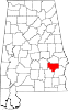 | |
| Towns | ||
| CDP | ||
|
Unincorporated communities | ||
| Ghost towns | ||
|
| This Bullock County, Alabama state location article is a stub. You can help Wikipedia by expanding it. |
Fitzpatrick, Alabama | |
|---|---|
|
Location of Fitzpatrick in Bullock County, Alabama. | |
Fitzpatrick, Alabama | |
| Coordinates: 32°13′00″N 85°53′20″W / 32.21667°N 85.88889°W | |
| Country | United States |
| State | Alabama |
| County | Bullock |
| Area | |
| • Total | 4.20 sq mi (10.87 km2) |
| • Land | 4.16 sq mi (10.78 km2) |
| • Water | 0.04 sq mi (0.09 km2) |
| Elevation | 262 ft (80 m) |
| Population (
2020) | |
| • Total | 79 |
| • Density | 18.98/sq mi (7.33/km2) |
| Time zone | UTC-6 ( Central (CST)) |
| • Summer ( DST) | UTC-5 (CDT) |
| ZIP code | 36029 |
| Area code | 334 |
| FIPS code | 01-26152 |
| GNIS feature ID | 157952 [2] |
Fitzpatrick is an unincorporated community and census-designated place in Bullock County, Alabama, United States. It first appeared as a CDP in the 2010 census with a population of 83. [3] The community is served by Alabama State Route 110.
Demographics
| Census | Pop. | Note | %± |
|---|---|---|---|
| 1890 | 357 | — | |
| 1900 | 447 | 25.2% | |
| 1910 | 398 | −11.0% | |
| 1920 | 339 | −14.8% | |
| 2010 | 83 | — | |
| 2020 | 79 | −4.8% | |
| U.S. Decennial Census [4] | |||
| Race / Ethnicity | Pop 2010 [5] | Pop 2020 [6] | % 2010 | % 2020 |
|---|---|---|---|---|
| White alone (NH) | 63 | 59 | 75.90% | 74.68% |
| Black or African American alone (NH) | 18 | 15 | 21.69% | 18.99% |
| Native American or Alaska Native alone (NH) | 0 | 0 | 0.00% | 0.00% |
| Asian alone (NH) | 0 | 0 | 0.00% | 0.00% |
| Pacific Islander alone (NH) | 0 | 1 | 0.00% | 1.27% |
| Some Other Race alone (NH) | 0 | 2 | 0.00% | 2.53% |
| Mixed Race/Multi-Racial (NH) | 0 | 0 | 0.00% | 0.00% |
| Hispanic or Latino (any race) | 2 | 2 | 2.41% | 2.53% |
| Total | 83 | 79 | 100.00% | 100.00% |
References
- ^ "2020 U.S. Gazetteer Files". United States Census Bureau. Retrieved October 29, 2021.
- ^ U.S. Geological Survey Geographic Names Information System: Fitzpatrick, Alabama
- ^ "U.S. Census website". United States Census Bureau. Retrieved May 14, 2011.
- ^ "U.S. Decennial Census". Census.gov. Retrieved June 6, 2013.
- ^ "P2 HISPANIC OR LATINO, AND NOT HISPANIC OR LATINO BY RACE – 2010: DEC Redistricting Data (PL 94-171) – Fitzpatrick CDP, Alabama". United States Census Bureau.
- ^ "P2 HISPANIC OR LATINO, AND NOT HISPANIC OR LATINO BY RACE - 2020: DEC Redistricting Data (PL 94-171) - Fitzpatrick CDP, Alabama". United States Census Bureau.
Municipalities and communities of
Bullock County, Alabama, United States | ||
|---|---|---|
| Cities | | |
| Towns | ||
| CDP | ||
|
Unincorporated communities | ||
| Ghost towns | ||
|
| This Bullock County, Alabama state location article is a stub. You can help Wikipedia by expanding it. |