Size of this preview:
774 × 599 pixels. Other resolutions:
310 × 240 pixels |
620 × 480 pixels |
992 × 768 pixels |
1,280 × 991 pixels |
2,560 × 1,982 pixels |
6,587 × 5,100 pixels.
Original file (6,587 × 5,100 pixels, file size: 6.4 MB, MIME type: image/png)
| This is a file from the
Wikimedia Commons. Information from its
description page there is shown below. Commons is a freely licensed media file repository. You can help. |

|
This election map image could be re-created using
vector graphics as an
SVG file. This has several advantages; see
Commons:Media for cleanup for more information. If an SVG form of this image is available, please upload it and afterwards replace this template with
{{
vector version available|new image name}}
.
It is recommended to name the SVG file “Wvmapagain.svg”—then the template Vector version available (or Vva) does not need the new image name parameter. |
Summary
| Description |
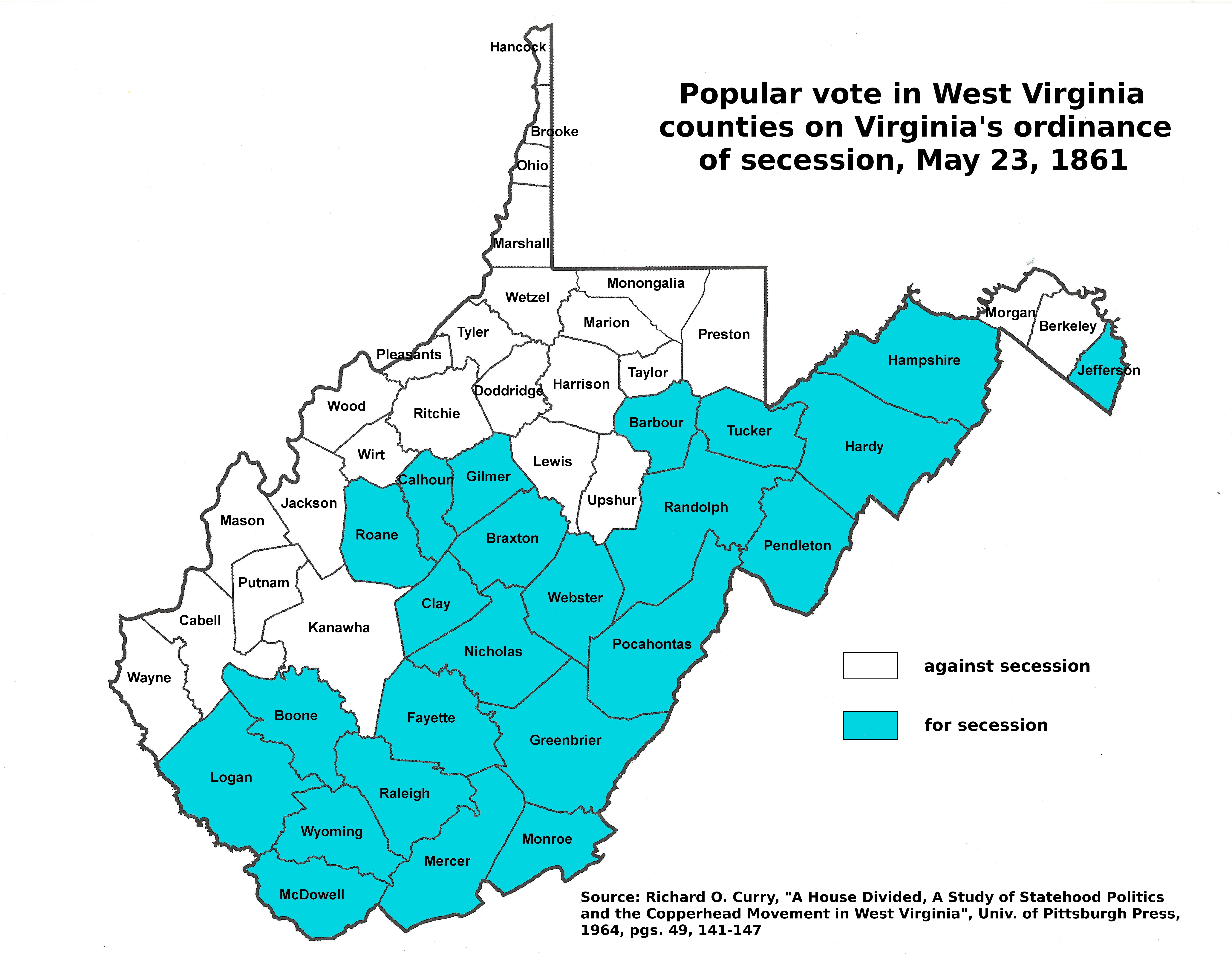
English: West Virginia Counties which ratified the Virginia ordinance of Secession on May 23, 1861. |
||
| Date | 05/30/08 | ||
| Source | Data from Image:Wvmapagain.png by Dubyavee, with county shapes derived from Image:Map_of_West_Virginia_highlighting_Monongalia_County.svg | ||
| Author | User:brianski cleaned up Dubyavee's earlier version | ||
| Permission ( Reusing this file) |
|
Licensing
| I, the copyright holder of this work, release this work into the
public domain. This applies worldwide. In some countries this may not be legally possible; if so: I grant anyone the right to use this work for any purpose, without any conditions, unless such conditions are required by law. |
File history
Click on a date/time to view the file as it appeared at that time.
| Date/Time | Thumbnail | Dimensions | User | Comment | |
|---|---|---|---|---|---|
| current | 07:07, 30 November 2016 |
| 6,587 × 5,100 (6.4 MB) | Dubyavee | updated map with source and county names |
| 03:32, 31 May 2008 |
 | 2,136 × 1,906 (342 KB) | Brianski | thumbnailable | |
| 03:28, 31 May 2008 |
 | 4,270 × 3,810 (553 KB) | Brianski | {{Information |Description={{en|1=West Virginia Counties which ratified the Virginia ordinance of Secession on May 23, 1861.}} |Source=Data from Image:Wvmapagain.png by Dubyavee, with county shapes derived from [[:Image:Map_of_West_ |
File usage
The following pages on the English Wikipedia use this file (pages on other projects are not listed):
Global file usage
The following other wikis use this file:
- Usage on ja.wikipedia.org
- Usage on ru.wikipedia.org
Metadata
Size of this preview:
774 × 599 pixels. Other resolutions:
310 × 240 pixels |
620 × 480 pixels |
992 × 768 pixels |
1,280 × 991 pixels |
2,560 × 1,982 pixels |
6,587 × 5,100 pixels.
Original file (6,587 × 5,100 pixels, file size: 6.4 MB, MIME type: image/png)
| This is a file from the
Wikimedia Commons. Information from its
description page there is shown below. Commons is a freely licensed media file repository. You can help. |
|
|
This election map image could be re-created using
vector graphics as an
SVG file. This has several advantages; see
Commons:Media for cleanup for more information. If an SVG form of this image is available, please upload it and afterwards replace this template with
{{
vector version available|new image name}}
.
It is recommended to name the SVG file “Wvmapagain.svg”—then the template Vector version available (or Vva) does not need the new image name parameter. |
Summary
| Description |
English: West Virginia Counties which ratified the Virginia ordinance of Secession on May 23, 1861. |
||
| Date | 05/30/08 | ||
| Source | Data from Image:Wvmapagain.png by Dubyavee, with county shapes derived from Image:Map_of_West_Virginia_highlighting_Monongalia_County.svg | ||
| Author | User:brianski cleaned up Dubyavee's earlier version | ||
| Permission ( Reusing this file) |
|
Licensing
| I, the copyright holder of this work, release this work into the
public domain. This applies worldwide. In some countries this may not be legally possible; if so: I grant anyone the right to use this work for any purpose, without any conditions, unless such conditions are required by law. |
File history
Click on a date/time to view the file as it appeared at that time.
| Date/Time | Thumbnail | Dimensions | User | Comment | |
|---|---|---|---|---|---|
| current | 07:07, 30 November 2016 |
| 6,587 × 5,100 (6.4 MB) | Dubyavee | updated map with source and county names |
| 03:32, 31 May 2008 |
| 2,136 × 1,906 (342 KB) | Brianski | thumbnailable | |
| 03:28, 31 May 2008 |
| 4,270 × 3,810 (553 KB) | Brianski | {{Information |Description={{en|1=West Virginia Counties which ratified the Virginia ordinance of Secession on May 23, 1861.}} |Source=Data from Image:Wvmapagain.png by Dubyavee, with county shapes derived from [[:Image:Map_of_West_ |
File usage
The following pages on the English Wikipedia use this file (pages on other projects are not listed):
Global file usage
The following other wikis use this file:
- Usage on ja.wikipedia.org
- Usage on ru.wikipedia.org