Photos • Location


Size of this preview:
750 × 600 pixels. Other resolutions:
300 × 240 pixels |
600 × 480 pixels |
960 × 768 pixels |
1,280 × 1,024 pixels |
1,500 × 1,200 pixels.
Original file (1,500 × 1,200 pixels, file size: 1.29 MB, MIME type: image/jpeg)
| This is a file from the
Wikimedia Commons. Information from its
description page there is shown below. Commons is a freely licensed media file repository. You can help. |
_aground_on_San_Miguel_Island,_California_(USA),_in_1987_(EDA67373).jpg)
Summary
| Description |
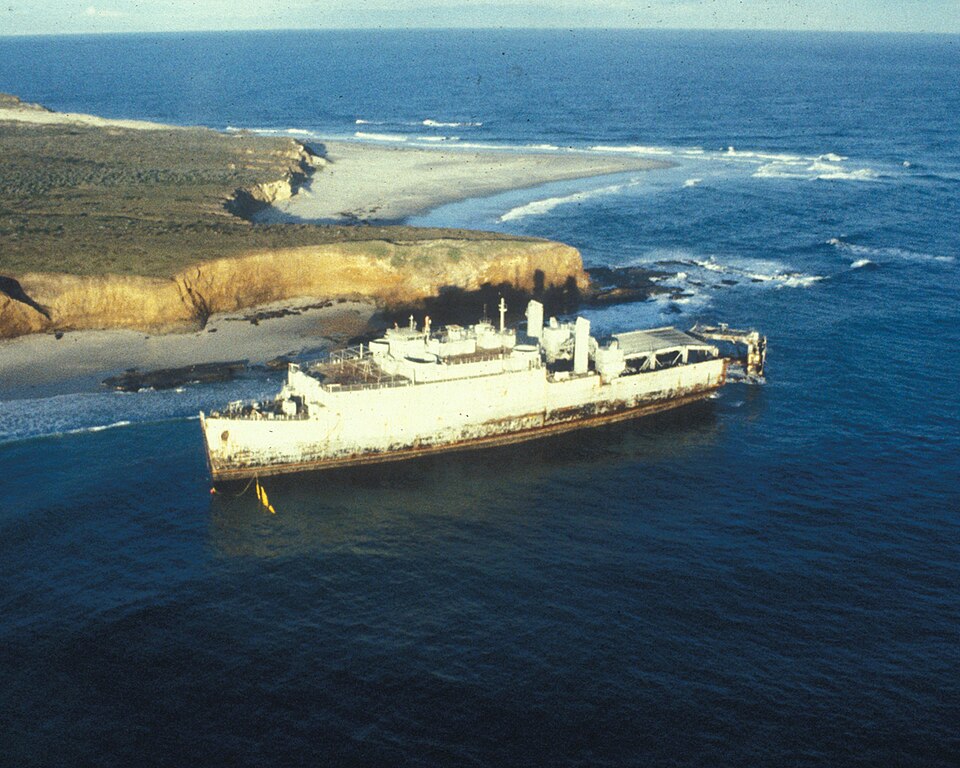
English: Foul weather and submerged rock and shoals had led to a large number of shipwrecks around San Miguel Island, California (USA), such as the former dock landing ship USS Tortuga (LSD-26) in 1987 near Cardwell Point. The ship was eventually towed out to sea and sunk. |
| Date | |
| Source | U.S. National Park Service San Miguel Island Photo Gallery photo EDA67373 |
| Author | U.S. National Park Service |
| Camera location |
| View this and other nearby images on: OpenStreetMap |
|
|---|
_aground_on_San_Miguel_Island,_California_(USA),_in_1987_(EDA67373).jpg¶ms=034.018360_N_-120.311920_E_globe:Earth_type:camera__&language=en)
Licensing
| This image or media file contains material based on a work of a National Park Service employee, created as part of that person's official duties. As a work of the U.S. federal government, such work is in the public domain in the United States. See the NPS website and NPS copyright policy for more information. |
File history
Click on a date/time to view the file as it appeared at that time.
| Date/Time | Thumbnail | Dimensions | User | Comment | |
|---|---|---|---|---|---|
| current | 22:38, 7 October 2015 |
| 1,500 × 1,200 (1.29 MB) | Holly Cheng | {{Information |Description ={{en|1=Foul weather and submerged rock and shoals have led to a large number of shipwrecks around en:San Miguel Island, such as the EX ''Tortuga'' in 1987 near Cardwell Point. The ship was eventually towed out to se... |
File usage
The following pages on the English Wikipedia use this file (pages on other projects are not listed):
Global file usage
The following other wikis use this file:
- Usage on ceb.wikipedia.org
- Usage on www.wikidata.org
Metadata
_aground_on_San_Miguel_Island,_California_(USA),_in_1987_(EDA67373).jpg)
Size of this preview:
750 × 600 pixels. Other resolutions:
300 × 240 pixels |
600 × 480 pixels |
960 × 768 pixels |
1,280 × 1,024 pixels |
1,500 × 1,200 pixels.
Original file (1,500 × 1,200 pixels, file size: 1.29 MB, MIME type: image/jpeg)
| This is a file from the
Wikimedia Commons. Information from its
description page there is shown below. Commons is a freely licensed media file repository. You can help. |
Summary
| Description |
English: Foul weather and submerged rock and shoals had led to a large number of shipwrecks around San Miguel Island, California (USA), such as the former dock landing ship USS Tortuga (LSD-26) in 1987 near Cardwell Point. The ship was eventually towed out to sea and sunk. |
| Date | |
| Source | U.S. National Park Service San Miguel Island Photo Gallery photo EDA67373 |
| Author | U.S. National Park Service |
| Camera location |
| View this and other nearby images on: OpenStreetMap |
|
|---|
Licensing
| This image or media file contains material based on a work of a National Park Service employee, created as part of that person's official duties. As a work of the U.S. federal government, such work is in the public domain in the United States. See the NPS website and NPS copyright policy for more information. |
File history
Click on a date/time to view the file as it appeared at that time.
| Date/Time | Thumbnail | Dimensions | User | Comment | |
|---|---|---|---|---|---|
| current | 22:38, 7 October 2015 |
| 1,500 × 1,200 (1.29 MB) | Holly Cheng | {{Information |Description ={{en|1=Foul weather and submerged rock and shoals have led to a large number of shipwrecks around en:San Miguel Island, such as the EX ''Tortuga'' in 1987 near Cardwell Point. The ship was eventually towed out to se... |
File usage
The following pages on the English Wikipedia use this file (pages on other projects are not listed):
Global file usage
The following other wikis use this file:
- Usage on ceb.wikipedia.org
- Usage on www.wikidata.org