
Size of this PNG preview of this SVG file:
327 × 293 pixels. Other resolutions:
268 × 240 pixels |
536 × 480 pixels |
857 × 768 pixels |
1,143 × 1,024 pixels |
2,286 × 2,048 pixels.
Original file (SVG file, nominally 327 × 293 pixels, file size: 3 KB)
| This is a file from the
Wikimedia Commons. Information from its
description page there is shown below. Commons is a freely licensed media file repository. You can help. |
Summary
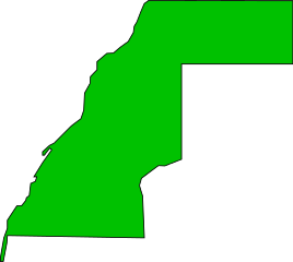
| Description | Outline of Western Sahara |
| Date | |
| Source | Own work |
| Author | Kimon Berlin, user:Gribeco |
| Other versions | Based on Image:Western Sahara-CIA WFB Map.png (public domain work of the US federal government) |
Licensing
| I, the copyright holder of this work, release this work into the
public domain. This applies worldwide. In some countries this may not be legally possible; if so: I grant anyone the right to use this work for any purpose, without any conditions, unless such conditions are required by law. |
File history
Click on a date/time to view the file as it appeared at that time.
| Date/Time | Thumbnail | Dimensions | User | Comment | |
|---|---|---|---|---|---|
| current | 03:17, 26 January 2007 |
| 327 × 293 (3 KB) | Gribeco | |
| 03:15, 26 January 2007 |
 | 744 × 1,052 (3 KB) | Gribeco | {{Information |Description=Outline of Western Sahara |Source=own work |Date=25 January 2007 |Author=Kimon Berlin, user:Gribeco |Permission= |other_versions=Based on Image:Western Sahara-CIA WFB Map.png (public domain work of the US federal govern |
File usage
The following pages on the English Wikipedia use this file (pages on other projects are not listed):
- 1975 in Spanish Sahara
- 2008 Sahrawi legislative election
- 2012 Sahrawi legislative election
- Al Ga'da
- Al Mahbes
- Algeria–Sahrawi Arab Democratic Republic relations
- As-Sakn
- Battle of Amgala (1989)
- Bir Gandus
- Bou Craa
- COVID-19 pandemic in Western Sahara
- Constitutional Council (Sahrawi Arab Democratic Republic)
- Cuba–Sahrawi Arab Democratic Republic relations
- Districts of Western Sahara
- Dougaj
- East Timor–Sahrawi Arab Democratic Republic relations
- El Argoub
- El Marsa, Western Sahara
- El Wali (band)
- Farsia
- Gleibat El Foula
- Guelmim-Es Semara
- Guerguerat
- Haouza
- Hassane
- Imlili
- International Bureau for the Respect of Human Rights in Western Sahara
- Islam in Western Sahara
- Jdiriya
- Khadijetou El Mokhtar
- Laaroussien
- Laayoune TV
- Laâyoune-Boujdour-Sakia El Hamra
- Mallemin
- Mohamed Wali Akeik
- Moulay Rachid Stadium
- Nigeria–Sahrawi Arab Democratic Republic relations
- Oulad Bou Sbaa
- Oulad Delim
- Oum Dreyga
- Oum Dreyga Airport
- Prime Minister of the Sahrawi Arab Democratic Republic
- Punta Durnford
- Ras el-Khanfra
- Río de Oro Peninsula
- Saguia el-Hamra
- Sahrauis: The Music of the Western Sahara
- Sahrawi Arab Democratic Republic–Venezuela relations
- Sahrawi Republic Cup
- Sahrawi nationalism
- Sandtracks
- Sheikh Mohamed Laghdaf Stadium
- Sidi Ahmed Laaroussi
- Special Representative of the Secretary-General for Western Sahara
- Starry Nights in Western Sahara
- Supreme Court of the Sahrawi Arab Democratic Republic
- Tajakant
- Tichla
- Western Saharan literature in Spanish
- User:Mseyed.d/New sandbox
- User:Mseyed.d/sandbox
- Wikipedia:WikiProject Western Sahara
- Template:WSWP-Member3
- Template:WesternSahara-geo-stub
- Template:WesternSahara-struct-stub
- Template:WesternSahara-stub
- Template talk:Country data Western Sahara
Global file usage
The following other wikis use this file:
- Usage on ar.wikipedia.org
- موريتانيا
- المغرب العربي
- الوادي الذهبي
- الصحراء الغربية
- اللغة الإسبانية
- الحسن الثاني بن محمد
- بنو معقل
- الحالة السياسية للصحراء الغربية
- الجمهورية العربية الصحراوية الديمقراطية
- لهجات عربية مغاربية
- أراك
- اتحاد المغرب العربي
- الحماية الإسبانية على المغرب
- إقليم بوجدور
- إقليم كلميم
- إقليم وادي الذهب
- لهجة حسانية
- إقليم آسا الزاك
- بوابة:الجزائر
- .eh
- جبهة البوليساريو
- قالب:الصحراء الغربية
- العالم الإسلامي
- الساقية الحمراء
- الجيش الوطني التونسي
- المجلس الملكي الاستشاري للشؤون الصحراوية
- مفاوضات مانهاست
- الحروب المغربية الإسبانية
- قائمة الأديان حسب البلد
- مطار العيون الحسن الأول
- بعثة الأمم المتحدة للاستفتاء في الصحراء الغربية
- الأقاليم الجنوبية (المغرب)
- بوجدور
- إفني
- اتفاقية مدريد
- المرسى (الصحراء الغربية)
- مغاربيون
- هصبوية
- تفاريتي
- حرب إفني
- تصنيف:اتحاد المغرب العربي
- مبادرة الحكم الذاتي في الصحراء الغربية
- قائمة الدول حسب معدل الوفيات
- الجدار الرملي المغربي في الصحراء الغربية
- أبو منجل ناسك
- بئر لحلو
- قائمة رؤساء الدول والحكومات الحاليين
- تصنيف:الصحراء الكبرى
- لهجة مغربية
- اجديرية
View more global usage of this file.
Size of this PNG preview of this SVG file:
327 × 293 pixels. Other resolutions:
268 × 240 pixels |
536 × 480 pixels |
857 × 768 pixels |
1,143 × 1,024 pixels |
2,286 × 2,048 pixels.
Original file (SVG file, nominally 327 × 293 pixels, file size: 3 KB)
| This is a file from the
Wikimedia Commons. Information from its
description page there is shown below. Commons is a freely licensed media file repository. You can help. |
Summary
| Description | Outline of Western Sahara |
| Date | |
| Source | Own work |
| Author | Kimon Berlin, user:Gribeco |
| Other versions | Based on Image:Western Sahara-CIA WFB Map.png (public domain work of the US federal government) |
Licensing
| I, the copyright holder of this work, release this work into the
public domain. This applies worldwide. In some countries this may not be legally possible; if so: I grant anyone the right to use this work for any purpose, without any conditions, unless such conditions are required by law. |
File history
Click on a date/time to view the file as it appeared at that time.
| Date/Time | Thumbnail | Dimensions | User | Comment | |
|---|---|---|---|---|---|
| current | 03:17, 26 January 2007 |
| 327 × 293 (3 KB) | Gribeco | |
| 03:15, 26 January 2007 |
| 744 × 1,052 (3 KB) | Gribeco | {{Information |Description=Outline of Western Sahara |Source=own work |Date=25 January 2007 |Author=Kimon Berlin, user:Gribeco |Permission= |other_versions=Based on Image:Western Sahara-CIA WFB Map.png (public domain work of the US federal govern |
File usage
The following pages on the English Wikipedia use this file (pages on other projects are not listed):
- 1975 in Spanish Sahara
- 2008 Sahrawi legislative election
- 2012 Sahrawi legislative election
- Al Ga'da
- Al Mahbes
- Algeria–Sahrawi Arab Democratic Republic relations
- As-Sakn
- Battle of Amgala (1989)
- Bir Gandus
- Bou Craa
- COVID-19 pandemic in Western Sahara
- Constitutional Council (Sahrawi Arab Democratic Republic)
- Cuba–Sahrawi Arab Democratic Republic relations
- Districts of Western Sahara
- Dougaj
- East Timor–Sahrawi Arab Democratic Republic relations
- El Argoub
- El Marsa, Western Sahara
- El Wali (band)
- Farsia
- Gleibat El Foula
- Guelmim-Es Semara
- Guerguerat
- Haouza
- Hassane
- Imlili
- International Bureau for the Respect of Human Rights in Western Sahara
- Islam in Western Sahara
- Jdiriya
- Khadijetou El Mokhtar
- Laaroussien
- Laayoune TV
- Laâyoune-Boujdour-Sakia El Hamra
- Mallemin
- Mohamed Wali Akeik
- Moulay Rachid Stadium
- Nigeria–Sahrawi Arab Democratic Republic relations
- Oulad Bou Sbaa
- Oulad Delim
- Oum Dreyga
- Oum Dreyga Airport
- Prime Minister of the Sahrawi Arab Democratic Republic
- Punta Durnford
- Ras el-Khanfra
- Río de Oro Peninsula
- Saguia el-Hamra
- Sahrauis: The Music of the Western Sahara
- Sahrawi Arab Democratic Republic–Venezuela relations
- Sahrawi Republic Cup
- Sahrawi nationalism
- Sandtracks
- Sheikh Mohamed Laghdaf Stadium
- Sidi Ahmed Laaroussi
- Special Representative of the Secretary-General for Western Sahara
- Starry Nights in Western Sahara
- Supreme Court of the Sahrawi Arab Democratic Republic
- Tajakant
- Tichla
- Western Saharan literature in Spanish
- User:Mseyed.d/New sandbox
- User:Mseyed.d/sandbox
- Wikipedia:WikiProject Western Sahara
- Template:WSWP-Member3
- Template:WesternSahara-geo-stub
- Template:WesternSahara-struct-stub
- Template:WesternSahara-stub
- Template talk:Country data Western Sahara
Global file usage
The following other wikis use this file:
- Usage on ar.wikipedia.org
- موريتانيا
- المغرب العربي
- الوادي الذهبي
- الصحراء الغربية
- اللغة الإسبانية
- الحسن الثاني بن محمد
- بنو معقل
- الحالة السياسية للصحراء الغربية
- الجمهورية العربية الصحراوية الديمقراطية
- لهجات عربية مغاربية
- أراك
- اتحاد المغرب العربي
- الحماية الإسبانية على المغرب
- إقليم بوجدور
- إقليم كلميم
- إقليم وادي الذهب
- لهجة حسانية
- إقليم آسا الزاك
- بوابة:الجزائر
- .eh
- جبهة البوليساريو
- قالب:الصحراء الغربية
- العالم الإسلامي
- الساقية الحمراء
- الجيش الوطني التونسي
- المجلس الملكي الاستشاري للشؤون الصحراوية
- مفاوضات مانهاست
- الحروب المغربية الإسبانية
- قائمة الأديان حسب البلد
- مطار العيون الحسن الأول
- بعثة الأمم المتحدة للاستفتاء في الصحراء الغربية
- الأقاليم الجنوبية (المغرب)
- بوجدور
- إفني
- اتفاقية مدريد
- المرسى (الصحراء الغربية)
- مغاربيون
- هصبوية
- تفاريتي
- حرب إفني
- تصنيف:اتحاد المغرب العربي
- مبادرة الحكم الذاتي في الصحراء الغربية
- قائمة الدول حسب معدل الوفيات
- الجدار الرملي المغربي في الصحراء الغربية
- أبو منجل ناسك
- بئر لحلو
- قائمة رؤساء الدول والحكومات الحاليين
- تصنيف:الصحراء الكبرى
- لهجة مغربية
- اجديرية
View more global usage of this file.