Photos • Location


Size of this preview:
480 × 600 pixels. Other resolutions:
192 × 240 pixels |
384 × 480 pixels |
614 × 768 pixels |
1,200 × 1,500 pixels.
Original file (1,200 × 1,500 pixels, file size: 3.5 MB, MIME type: image/png)
| This is a file from the
Wikimedia Commons. Information from its
description page there is shown below. Commons is a freely licensed media file repository. You can help. |
.png)
Summary
| Camera location | | View this and other nearby images on: OpenStreetMap |
|
|---|
.png¶ms=040.592722_N_-086.678722_E_globe:Earth_type:camera_region:US-IN_heading:30.00&language=en)
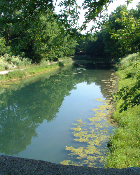
| Description | A restored section of the Wabash and Erie Canal in the town of Delphi in Carroll County, Indiana. Photo looks northeast from Washington Street. |
| Date | Taken on 2 June 2007 |
| Source | Own work |
| Author | Huw Williams ( Huwmanbeing) |
Licensing
| I, the copyright holder of this work, release this work into the
public domain. This applies worldwide. In some countries this may not be legally possible; if so: I grant anyone the right to use this work for any purpose, without any conditions, unless such conditions are required by law. |
File history
Click on a date/time to view the file as it appeared at that time.
| Date/Time | Thumbnail | Dimensions | User | Comment | |
|---|---|---|---|---|---|
| current | 18:01, 2 June 2007 |
| 1,200 × 1,500 (3.5 MB) | Huwmanbeing | {{Information |Description=A restored section of the Wabash and Erie Canal in the town of Delphi in Carroll County, Indiana. Photo looks northeast from Washington Street. |Source=self-made |Date=2007-06-02 |Author= User:Huwmanbeing }} |
File usage
The following pages on the English Wikipedia use this file (pages on other projects are not listed):
Global file usage
The following other wikis use this file:
- Usage on arz.wikipedia.org
Metadata
.png)
Size of this preview:
480 × 600 pixels. Other resolutions:
192 × 240 pixels |
384 × 480 pixels |
614 × 768 pixels |
1,200 × 1,500 pixels.
Original file (1,200 × 1,500 pixels, file size: 3.5 MB, MIME type: image/png)
| This is a file from the
Wikimedia Commons. Information from its
description page there is shown below. Commons is a freely licensed media file repository. You can help. |
Summary
| Camera location | | View this and other nearby images on: OpenStreetMap |
|
|---|
| Description | A restored section of the Wabash and Erie Canal in the town of Delphi in Carroll County, Indiana. Photo looks northeast from Washington Street. |
| Date | Taken on 2 June 2007 |
| Source | Own work |
| Author | Huw Williams ( Huwmanbeing) |
Licensing
| I, the copyright holder of this work, release this work into the
public domain. This applies worldwide. In some countries this may not be legally possible; if so: I grant anyone the right to use this work for any purpose, without any conditions, unless such conditions are required by law. |
File history
Click on a date/time to view the file as it appeared at that time.
| Date/Time | Thumbnail | Dimensions | User | Comment | |
|---|---|---|---|---|---|
| current | 18:01, 2 June 2007 |
| 1,200 × 1,500 (3.5 MB) | Huwmanbeing | {{Information |Description=A restored section of the Wabash and Erie Canal in the town of Delphi in Carroll County, Indiana. Photo looks northeast from Washington Street. |Source=self-made |Date=2007-06-02 |Author= User:Huwmanbeing }} |
File usage
The following pages on the English Wikipedia use this file (pages on other projects are not listed):
Global file usage
The following other wikis use this file:
- Usage on arz.wikipedia.org