Size of this preview:
750 × 600 pixels. Other resolutions:
300 × 240 pixels |
600 × 480 pixels |
1,000 × 800 pixels.
Original file (1,000 × 800 pixels, file size: 457 KB, MIME type: image/jpeg)
| This is a file from the
Wikimedia Commons. Information from its
description page there is shown below. Commons is a freely licensed media file repository. You can help. |
Summary
| Description |
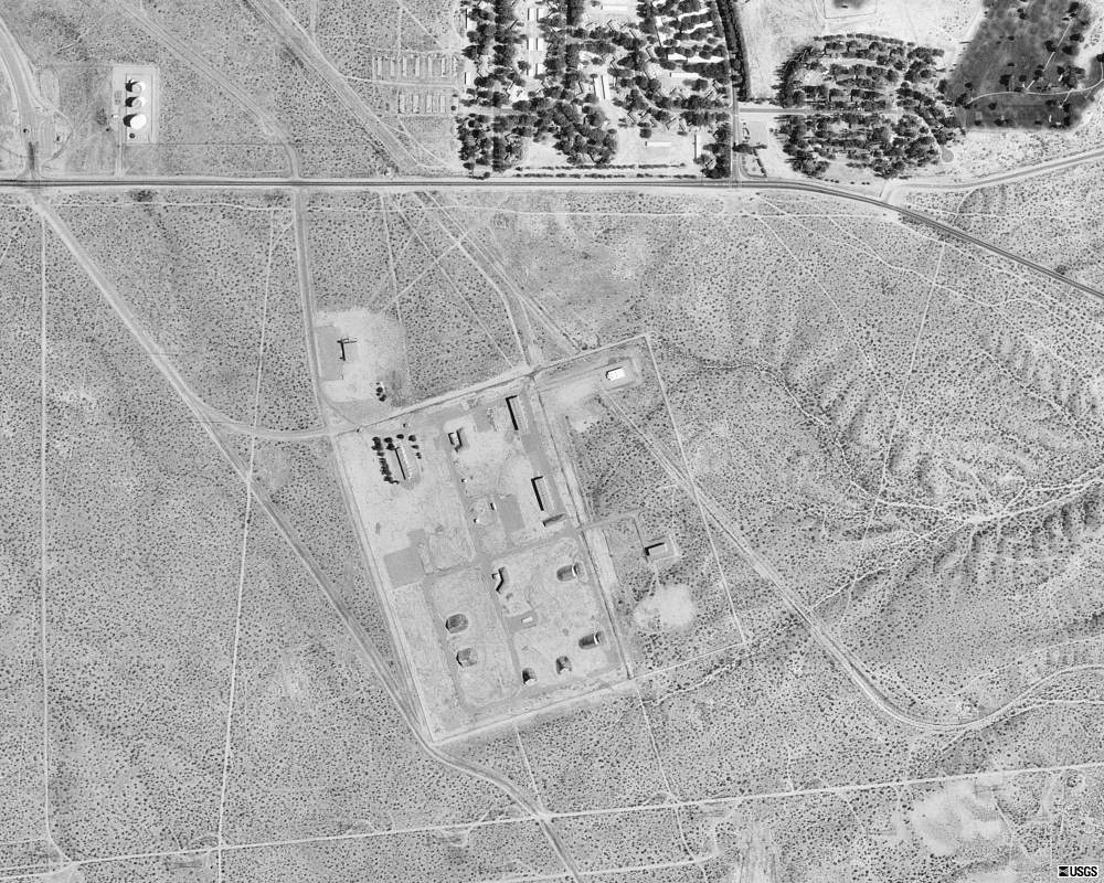
English: Future site of
United States Penitentiary, Victorville on the grounds of the former
George Air Force Base in
San Bernardino County, California, ten years before the prison was opened in 2004. |
| Date | |
| Source | Microsoft Research Maps |
| Author | The National Map, United States Geological Survey |
Licensing
This image is in the
public domain in the United States because it only contains materials that originally came from the
United States Geological Survey, an agency of the
United States Department of the Interior. For more information, see
the official USGS copyright policy.
|
File history
Click on a date/time to view the file as it appeared at that time.
| Date/Time | Thumbnail | Dimensions | User | Comment | |
|---|---|---|---|---|---|
| current | 10:00, 9 November 2010 |
| 1,000 × 800 (457 KB) | KimChee | {{Information |Description={{en|1=Future site of {{w|United States Penitentiary, Victorville}} on the grounds of the former {{w|George Air Force Base}} in {{w|San Bernardino County, California}}, ten years before the prison was opened in 2004.}} |Source=[ |
File usage
The following pages on the English Wikipedia use this file (pages on other projects are not listed):
Metadata
Size of this preview:
750 × 600 pixels. Other resolutions:
300 × 240 pixels |
600 × 480 pixels |
1,000 × 800 pixels.
Original file (1,000 × 800 pixels, file size: 457 KB, MIME type: image/jpeg)
| This is a file from the
Wikimedia Commons. Information from its
description page there is shown below. Commons is a freely licensed media file repository. You can help. |
Summary
| Description |
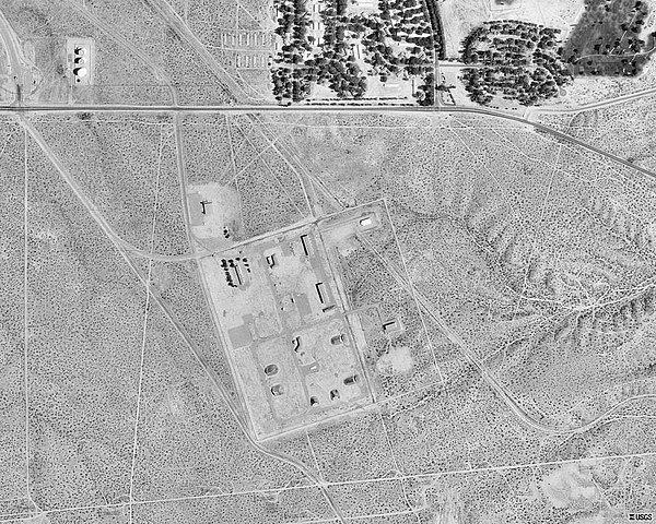
English: Future site of
United States Penitentiary, Victorville on the grounds of the former
George Air Force Base in
San Bernardino County, California, ten years before the prison was opened in 2004. |
| Date | |
| Source | Microsoft Research Maps |
| Author | The National Map, United States Geological Survey |
Licensing
This image is in the
public domain in the United States because it only contains materials that originally came from the
United States Geological Survey, an agency of the
United States Department of the Interior. For more information, see
the official USGS copyright policy.
|
File history
Click on a date/time to view the file as it appeared at that time.
| Date/Time | Thumbnail | Dimensions | User | Comment | |
|---|---|---|---|---|---|
| current | 10:00, 9 November 2010 |
| 1,000 × 800 (457 KB) | KimChee | {{Information |Description={{en|1=Future site of {{w|United States Penitentiary, Victorville}} on the grounds of the former {{w|George Air Force Base}} in {{w|San Bernardino County, California}}, ten years before the prison was opened in 2004.}} |Source=[ |
File usage
The following pages on the English Wikipedia use this file (pages on other projects are not listed):