
Size of this preview:
800 × 497 pixels. Other resolutions:
320 × 199 pixels |
640 × 398 pixels |
1,024 × 637 pixels |
1,280 × 796 pixels |
2,672 × 1,661 pixels.
Original file (2,672 × 1,661 pixels, file size: 3.5 MB, MIME type: image/jpeg)
| This is a file from the
Wikimedia Commons. Information from its
description page there is shown below. Commons is a freely licensed media file repository. You can help. |
Summary
| Description |
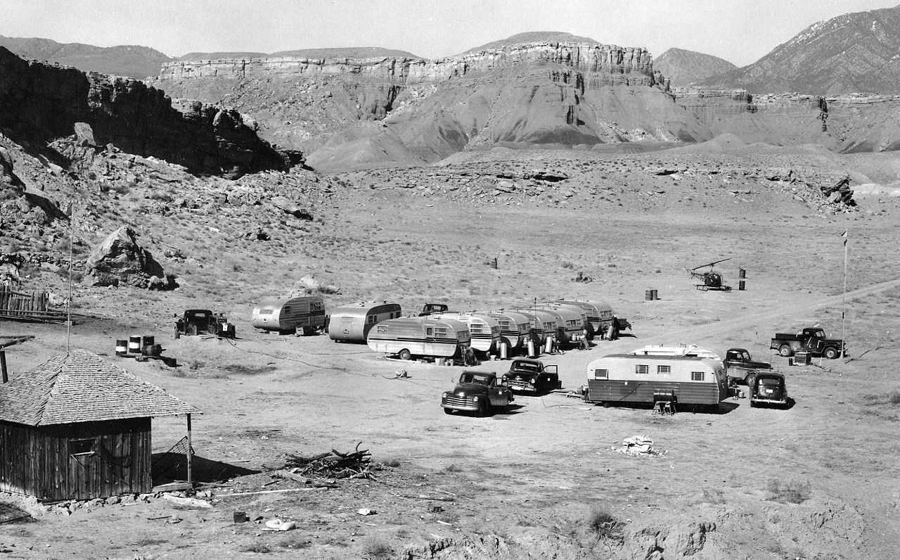
English: A typical USGS mapping field camp. Note the helicopter parked near the trailers. Helicopters were first used by the USGS for topographic mapping in Death Valley in 1948. (Description from USGS.) |
| Date | between circa 1950 and circa 1955 |
| Source | USGS Historical Photographs: Mapping Field Camp: http://online.wr.usgs.gov/outreach/historicPhotos/enlarged/mapping_camp_1950.html |
| Author | US Geological Survey |
Licensing
This image is in the
public domain in the United States because it only contains materials that originally came from the
United States Geological Survey, an agency of the
United States Department of the Interior. For more information, see
the official USGS copyright policy.
|
File history
Click on a date/time to view the file as it appeared at that time.
| Date/Time | Thumbnail | Dimensions | User | Comment | |
|---|---|---|---|---|---|
| current | 20:50, 30 January 2009 |
| 2,672 × 1,661 (3.5 MB) | Awickert | {{Information |Description={{en|1=A typical USGS mapping field camp. Note the helicopter parked near the trailers. Helicopters were first used by the USGS for topographic mapping in Death Valley in 1948. (Description from USGS.)}} |Source=USGS Historical |
File usage
The following pages on the English Wikipedia use this file (pages on other projects are not listed):
Global file usage
The following other wikis use this file:
- Usage on la.wikipedia.org
- Usage on sv.wikipedia.org
- Usage on vi.wikipedia.org
Metadata
Size of this preview:
800 × 497 pixels. Other resolutions:
320 × 199 pixels |
640 × 398 pixels |
1,024 × 637 pixels |
1,280 × 796 pixels |
2,672 × 1,661 pixels.
Original file (2,672 × 1,661 pixels, file size: 3.5 MB, MIME type: image/jpeg)
| This is a file from the
Wikimedia Commons. Information from its
description page there is shown below. Commons is a freely licensed media file repository. You can help. |
Summary
| Description |
English: A typical USGS mapping field camp. Note the helicopter parked near the trailers. Helicopters were first used by the USGS for topographic mapping in Death Valley in 1948. (Description from USGS.) |
| Date | between circa 1950 and circa 1955 |
| Source | USGS Historical Photographs: Mapping Field Camp: http://online.wr.usgs.gov/outreach/historicPhotos/enlarged/mapping_camp_1950.html |
| Author | US Geological Survey |
Licensing
This image is in the
public domain in the United States because it only contains materials that originally came from the
United States Geological Survey, an agency of the
United States Department of the Interior. For more information, see
the official USGS copyright policy.
|
File history
Click on a date/time to view the file as it appeared at that time.
| Date/Time | Thumbnail | Dimensions | User | Comment | |
|---|---|---|---|---|---|
| current | 20:50, 30 January 2009 |
| 2,672 × 1,661 (3.5 MB) | Awickert | {{Information |Description={{en|1=A typical USGS mapping field camp. Note the helicopter parked near the trailers. Helicopters were first used by the USGS for topographic mapping in Death Valley in 1948. (Description from USGS.)}} |Source=USGS Historical |
File usage
The following pages on the English Wikipedia use this file (pages on other projects are not listed):
Global file usage
The following other wikis use this file:
- Usage on la.wikipedia.org
- Usage on sv.wikipedia.org
- Usage on vi.wikipedia.org