Photos • Location


Size of this preview:
800 × 600 pixels. Other resolutions:
320 × 240 pixels |
640 × 480 pixels |
1,024 × 768 pixels.
Original file (1,024 × 768 pixels, file size: 146 KB, MIME type: image/jpeg)
| This is a file from the
Wikimedia Commons. Information from its
description page there is shown below. Commons is a freely licensed media file repository. You can help. |
| Description |
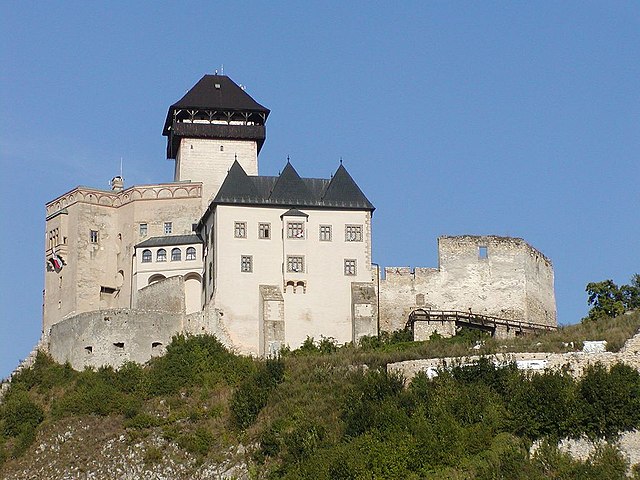
English: The
Trenčín Castle in Slovakia
Esperanto: La kastelo
Trenčín en Slovakio
Slovenčina:
Trenčiansky hrad, Trenčín, Slovensko.
Magyar: A
Trencséni vár Szlovákiában |
|||
| Date | ||||
| Source | Own work | |||
| Author | Martin Hlauka (Pescan) 16:32, 23 August 2007 (UTC) | |||
| Permission ( Reusing this file) |
|

.jpg)
| Camera location |
| View this and other nearby images on: OpenStreetMap |
|
|---|
.jpg¶ms=048.893742_N_0018.044271_E_globe:Earth_type:camera__&language=en)
| Annotations | This image is annotated: View the annotations at Commons |
File history
Click on a date/time to view the file as it appeared at that time.
| Date/Time | Thumbnail | Dimensions | User | Comment | |
|---|---|---|---|---|---|
| current | 16:32, 23 August 2007 |
| 1,024 × 768 (146 KB) | Pescan | {{Information |Description= {{sk|Trenčiansky hrad, Trenčín, Slovensko.}} |Source=self-made |Date= |Author= --~~~~ |Permission={{PD-user|Pescan}} }} Category:Trenčiansky hrad |
File usage
The following pages on the English Wikipedia use this file (pages on other projects are not listed):
Global file usage
The following other wikis use this file:
- Usage on af.wikipedia.org
- Usage on be-tarask.wikipedia.org
- Usage on br.wikipedia.org
- Usage on ca.wikipedia.org
- Usage on cs.wikipedia.org
- Usage on de.wikiversity.org
- Usage on el.wikipedia.org
- Usage on eo.wikipedia.org
- Usage on es.wikipedia.org
- Usage on hu.wikipedia.org
- Usage on it.wikipedia.org
- Usage on it.wikivoyage.org
- Usage on sk.wikipedia.org
- Usage on sr.wikipedia.org
- Usage on uk.wikipedia.org
- Usage on uz.wikipedia.org
- Usage on vi.wikipedia.org
- Usage on www.wikidata.org
.jpg)
Size of this preview:
800 × 600 pixels. Other resolutions:
320 × 240 pixels |
640 × 480 pixels |
1,024 × 768 pixels.
Original file (1,024 × 768 pixels, file size: 146 KB, MIME type: image/jpeg)
| This is a file from the
Wikimedia Commons. Information from its
description page there is shown below. Commons is a freely licensed media file repository. You can help. |
| Description |
English: The
Trenčín Castle in Slovakia
Esperanto: La kastelo
Trenčín en Slovakio
Slovenčina:
Trenčiansky hrad, Trenčín, Slovensko.
Magyar: A
Trencséni vár Szlovákiában |
|||
| Date | ||||
| Source | Own work | |||
| Author | Martin Hlauka (Pescan) 16:32, 23 August 2007 (UTC) | |||
| Permission ( Reusing this file) |
|
| Camera location |
| View this and other nearby images on: OpenStreetMap |
|
|---|
| Annotations | This image is annotated: View the annotations at Commons |
File history
Click on a date/time to view the file as it appeared at that time.
| Date/Time | Thumbnail | Dimensions | User | Comment | |
|---|---|---|---|---|---|
| current | 16:32, 23 August 2007 |
| 1,024 × 768 (146 KB) | Pescan | {{Information |Description= {{sk|Trenčiansky hrad, Trenčín, Slovensko.}} |Source=self-made |Date= |Author= --~~~~ |Permission={{PD-user|Pescan}} }} Category:Trenčiansky hrad |
File usage
The following pages on the English Wikipedia use this file (pages on other projects are not listed):
Global file usage
The following other wikis use this file:
- Usage on af.wikipedia.org
- Usage on be-tarask.wikipedia.org
- Usage on br.wikipedia.org
- Usage on ca.wikipedia.org
- Usage on cs.wikipedia.org
- Usage on de.wikiversity.org
- Usage on el.wikipedia.org
- Usage on eo.wikipedia.org
- Usage on es.wikipedia.org
- Usage on hu.wikipedia.org
- Usage on it.wikipedia.org
- Usage on it.wikivoyage.org
- Usage on sk.wikipedia.org
- Usage on sr.wikipedia.org
- Usage on uk.wikipedia.org
- Usage on uz.wikipedia.org
- Usage on vi.wikipedia.org
- Usage on www.wikidata.org