Photos • Location


Size of this preview:
800 × 600 pixels. Other resolutions:
320 × 240 pixels |
640 × 480 pixels |
1,024 × 768 pixels.
Original file (1,024 × 768 pixels, file size: 236 KB, MIME type: image/jpeg)
| This is a file from the
Wikimedia Commons. Information from its
description page there is shown below. Commons is a freely licensed media file repository. You can help. |
Summary
| Description |
English:
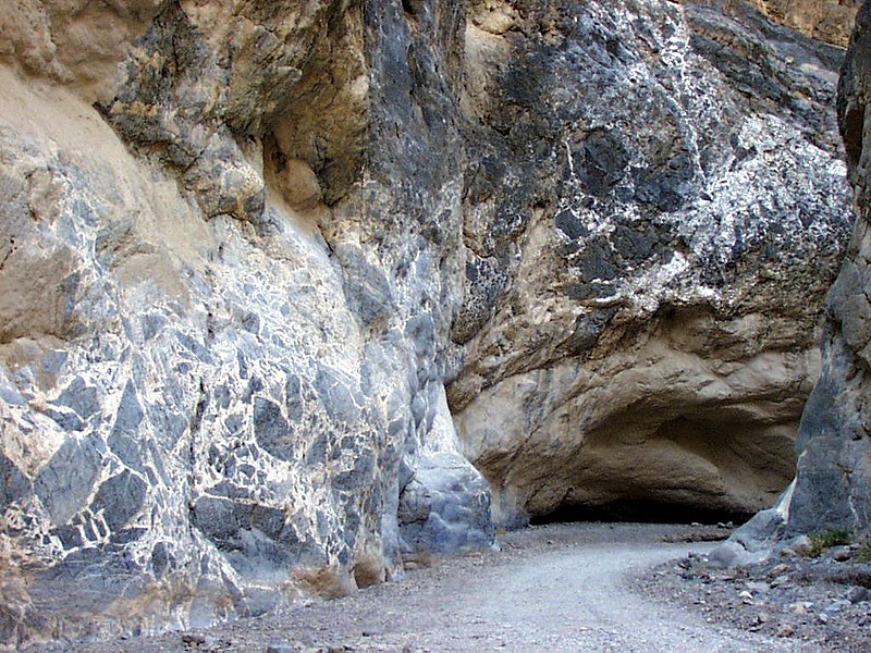
Fault breccia of grey limestone blocks in white calcite at Titus Canyon,
Death Valley National Park, California, USA. |
| Date | Unknown date |
| Source | http://www.fhwa.dot.gov/byways/photos/53564 |
| Author | National Park Service |
| Object location |
| View this and other nearby images on: OpenStreetMap |
|
|---|
Licensing
| This image or media file contains material based on a work of a National Park Service employee, created as part of that person's official duties. As a work of the U.S. federal government, such work is in the public domain in the United States. See the NPS website and NPS copyright policy for more information. |
File history
Click on a date/time to view the file as it appeared at that time.
| Date/Time | Thumbnail | Dimensions | User | Comment | |
|---|---|---|---|---|---|
| current | 00:13, 30 March 2006 |
| 1,024 × 768 (236 KB) | Holly Cheng | Titus Canyon, w:Death Valley National Park. Source: http://library.byways.org/download.html?DOWNLOAD_ID=1143677520&FILE_ID= |
File usage
The following pages on the English Wikipedia use this file (pages on other projects are not listed):
Global file usage
The following other wikis use this file:
- Usage on an.wikipedia.org
- Usage on bg.wikipedia.org
- Usage on ca.wikipedia.org
- Usage on en.wikivoyage.org
- Usage on fr.wikipedia.org
- Usage on id.wikipedia.org
- Usage on it.wikipedia.org
- Usage on ka.wikipedia.org
- Usage on nn.wikipedia.org
- Usage on tr.wikipedia.org
Metadata
Size of this preview:
800 × 600 pixels. Other resolutions:
320 × 240 pixels |
640 × 480 pixels |
1,024 × 768 pixels.
Original file (1,024 × 768 pixels, file size: 236 KB, MIME type: image/jpeg)
| This is a file from the
Wikimedia Commons. Information from its
description page there is shown below. Commons is a freely licensed media file repository. You can help. |
Summary
| Description |
English:
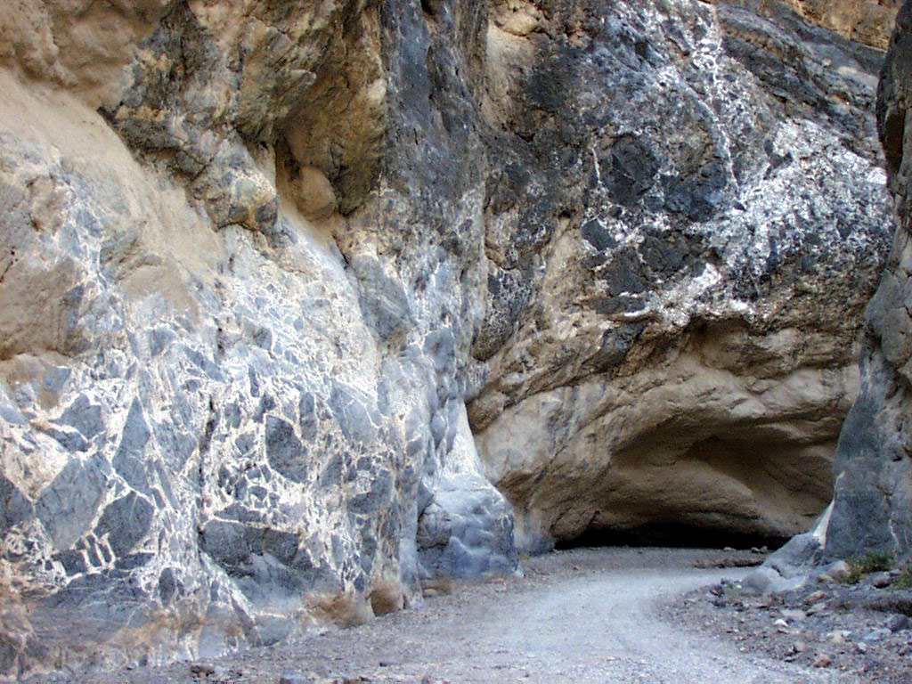
Fault breccia of grey limestone blocks in white calcite at Titus Canyon,
Death Valley National Park, California, USA. |
| Date | Unknown date |
| Source | http://www.fhwa.dot.gov/byways/photos/53564 |
| Author | National Park Service |
| Object location |
| View this and other nearby images on: OpenStreetMap |
|
|---|
Licensing
| This image or media file contains material based on a work of a National Park Service employee, created as part of that person's official duties. As a work of the U.S. federal government, such work is in the public domain in the United States. See the NPS website and NPS copyright policy for more information. |
File history
Click on a date/time to view the file as it appeared at that time.
| Date/Time | Thumbnail | Dimensions | User | Comment | |
|---|---|---|---|---|---|
| current | 00:13, 30 March 2006 |
| 1,024 × 768 (236 KB) | Holly Cheng | Titus Canyon, w:Death Valley National Park. Source: http://library.byways.org/download.html?DOWNLOAD_ID=1143677520&FILE_ID= |
File usage
The following pages on the English Wikipedia use this file (pages on other projects are not listed):
Global file usage
The following other wikis use this file:
- Usage on an.wikipedia.org
- Usage on bg.wikipedia.org
- Usage on ca.wikipedia.org
- Usage on en.wikivoyage.org
- Usage on fr.wikipedia.org
- Usage on id.wikipedia.org
- Usage on it.wikipedia.org
- Usage on ka.wikipedia.org
- Usage on nn.wikipedia.org
- Usage on tr.wikipedia.org