
Original file (3,680 × 2,019 pixels, file size: 578 KB, MIME type: image/jpeg)
| This is a file from the
Wikimedia Commons. Information from its
description page there is shown below. Commons is a freely licensed media file repository. You can help. |
Summary
| Description |
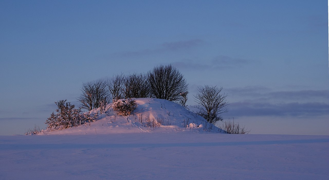
Dansk: Tinghøjen, en
rundhøj fra oldtiden fotograferet fra parkeringsplads ved
A16 mellem
Hammershøj og
Kvorning.
English: The
tumulus Tinghøjen near road A16 between the towns Hammershøj and Kvorning,
Central Denmark Region, Denmark.
Español: El
túmulo Tinghøjen cerca de la carretera A16, entre las localidades de Hammershøj y Kvorning,
Jutlandia Central, Dinamarca.
Français : Le
tumulus de Hammershøj près de la route A16, entre les villes de Hammershøj et Kvorning, au Danemark. |
| Date | |
| Source | Own work, Tinghøjen |
| Author | Kim Hansen |
| Other versions |
|


| Camera location | | View this and other nearby images on: OpenStreetMap |
|
|---|
| This is a
retouched picture, which means that it has been digitally altered from its original version. Modifications: Rotated, cropped, curves in GIMP. Noise reduced in NoiseWare.
|
This image was selected as
picture of the day on Wikimedia Commons for
8 January 2015. It was captioned as follows: English: The
tumulus Tinghøjen located between
Randers and
Viborg in
Denmark. Photographed
January 8, 2010. Other languages:
Bosanski: Nadgrobna humka Tinghøjen nalazi se između
Randersa i
Viborga u kraljevini
Danskoj. Fotografirano 8. januara 2010. English: The
tumulus Tinghøjen located between
Randers and
Viborg in
Denmark. Photographed
January 8, 2010. Español: El
túmulo Tinghøjen cerca de la carretera A16, entre las localidades de Hammershøj y Kvorning,
Jutlandia Central, Dinamarca. Français : Le
tumulus de Tinghøjen près de la route A16, entre les villes de
Hammershøj et
Kvorning, au Danemark. |
|

This image has been assessed using the
Quality image guidelines and is considered a
Quality image.
|
 |
This picture was selected in February 2010 for picture of the month at the Portal Denmark at German Wikipedia. |
Licensing
- You are free:
- to share – to copy, distribute and transmit the work
- to remix – to adapt the work
- Under the following conditions:
- attribution – You must give appropriate credit, provide a link to the license, and indicate if changes were made. You may do so in any reasonable manner, but not in any way that suggests the licensor endorses you or your use.
- share alike – If you remix, transform, or build upon the material, you must distribute your contributions under the same or compatible license as the original.

|
Permission is granted to copy, distribute and/or modify this document under the terms of the GNU Free Documentation License, Version 1.2 or any later version published by the Free Software Foundation; with no Invariant Sections, no Front-Cover Texts, and no Back-Cover Texts. A copy of the license is included in the section entitled GNU Free Documentation License. |
File history
Click on a date/time to view the file as it appeared at that time.
| Date/Time | Thumbnail | Dimensions | User | Comment | |
|---|---|---|---|---|---|
| current | 08:18, 9 January 2010 |
| 3,680 × 2,019 (578 KB) | Slaunger | Removed dust spot |
| 18:06, 8 January 2010 |
 | 3,680 × 2,019 (2.85 MB) | Slaunger | {{Information |Description= {{da|Tinghøjen, en rundhøj fra oldtiden fotograferet fra parkeringsplads ved rute A16 mellem Hammershøj og Kvorning.}} {{en|The tumuli Tinghøjen near road A16 between the towns Hammershøj and Kvorning, Denmark}} |Source={{ |
File usage
Global file usage
The following other wikis use this file:
- Usage on be-tarask.wikipedia.org
- Usage on bn.wikipedia.org
- Usage on crh.wikipedia.org
- Usage on cv.wikipedia.org
- Usage on da.wikipedia.org
- Usage on de.wikipedia.org
- Usage on fa.wikipedia.org
- Usage on fr.wikipedia.org
- Usage on hu.wikipedia.org
- Usage on it.wiktionary.org
- Usage on ka.wikipedia.org
- Usage on ko.wikipedia.org
- Usage on krc.wikipedia.org
- Usage on lbe.wikipedia.org
- Usage on nl.wikipedia.org
- Usage on os.wikipedia.org
- Usage on pl.wikipedia.org
- Usage on pl.wikivoyage.org
- Usage on pt.wikipedia.org
- Usage on ru.wikipedia.org
- Usage on ru.wikinews.org
- Usage on sah.wikipedia.org
- Usage on sv.wikipedia.org
- Usage on tt.wikipedia.org
- Usage on uk.wikipedia.org
- Usage on vi.wikipedia.org
- Usage on www.wikidata.org
- Usage on xal.wikipedia.org
- Usage on zh.wikipedia.org
Metadata
Original file (3,680 × 2,019 pixels, file size: 578 KB, MIME type: image/jpeg)
| This is a file from the
Wikimedia Commons. Information from its
description page there is shown below. Commons is a freely licensed media file repository. You can help. |
Summary
| Description |
Dansk: Tinghøjen, en
rundhøj fra oldtiden fotograferet fra parkeringsplads ved
A16 mellem
Hammershøj og
Kvorning.
English: The
tumulus Tinghøjen near road A16 between the towns Hammershøj and Kvorning,
Central Denmark Region, Denmark.
Español: El
túmulo Tinghøjen cerca de la carretera A16, entre las localidades de Hammershøj y Kvorning,
Jutlandia Central, Dinamarca.
Français : Le
tumulus de Hammershøj près de la route A16, entre les villes de Hammershøj et Kvorning, au Danemark. |
| Date | |
| Source | Own work, Tinghøjen |
| Author | Kim Hansen |
| Other versions |
|
| Camera location | | View this and other nearby images on: OpenStreetMap |
|
|---|
| This is a
retouched picture, which means that it has been digitally altered from its original version. Modifications: Rotated, cropped, curves in GIMP. Noise reduced in NoiseWare.
|
This image was selected as
picture of the day on Wikimedia Commons for
8 January 2015. It was captioned as follows: English: The
tumulus Tinghøjen located between
Randers and
Viborg in
Denmark. Photographed
January 8, 2010. Other languages:
Bosanski: Nadgrobna humka Tinghøjen nalazi se između
Randersa i
Viborga u kraljevini
Danskoj. Fotografirano 8. januara 2010. English: The
tumulus Tinghøjen located between
Randers and
Viborg in
Denmark. Photographed
January 8, 2010. Español: El
túmulo Tinghøjen cerca de la carretera A16, entre las localidades de Hammershøj y Kvorning,
Jutlandia Central, Dinamarca. Français : Le
tumulus de Tinghøjen près de la route A16, entre les villes de
Hammershøj et
Kvorning, au Danemark. |
|
This image has been assessed using the
Quality image guidelines and is considered a
Quality image.
|
|
This picture was selected in February 2010 for picture of the month at the Portal Denmark at German Wikipedia. |
Licensing
- You are free:
- to share – to copy, distribute and transmit the work
- to remix – to adapt the work
- Under the following conditions:
- attribution – You must give appropriate credit, provide a link to the license, and indicate if changes were made. You may do so in any reasonable manner, but not in any way that suggests the licensor endorses you or your use.
- share alike – If you remix, transform, or build upon the material, you must distribute your contributions under the same or compatible license as the original.
|
|
Permission is granted to copy, distribute and/or modify this document under the terms of the GNU Free Documentation License, Version 1.2 or any later version published by the Free Software Foundation; with no Invariant Sections, no Front-Cover Texts, and no Back-Cover Texts. A copy of the license is included in the section entitled GNU Free Documentation License. |
File history
Click on a date/time to view the file as it appeared at that time.
| Date/Time | Thumbnail | Dimensions | User | Comment | |
|---|---|---|---|---|---|
| current | 08:18, 9 January 2010 |
| 3,680 × 2,019 (578 KB) | Slaunger | Removed dust spot |
| 18:06, 8 January 2010 |
| 3,680 × 2,019 (2.85 MB) | Slaunger | {{Information |Description= {{da|Tinghøjen, en rundhøj fra oldtiden fotograferet fra parkeringsplads ved rute A16 mellem Hammershøj og Kvorning.}} {{en|The tumuli Tinghøjen near road A16 between the towns Hammershøj and Kvorning, Denmark}} |Source={{ |
File usage
Global file usage
The following other wikis use this file:
- Usage on be-tarask.wikipedia.org
- Usage on bn.wikipedia.org
- Usage on crh.wikipedia.org
- Usage on cv.wikipedia.org
- Usage on da.wikipedia.org
- Usage on de.wikipedia.org
- Usage on fa.wikipedia.org
- Usage on fr.wikipedia.org
- Usage on hu.wikipedia.org
- Usage on it.wiktionary.org
- Usage on ka.wikipedia.org
- Usage on ko.wikipedia.org
- Usage on krc.wikipedia.org
- Usage on lbe.wikipedia.org
- Usage on nl.wikipedia.org
- Usage on os.wikipedia.org
- Usage on pl.wikipedia.org
- Usage on pl.wikivoyage.org
- Usage on pt.wikipedia.org
- Usage on ru.wikipedia.org
- Usage on ru.wikinews.org
- Usage on sah.wikipedia.org
- Usage on sv.wikipedia.org
- Usage on tt.wikipedia.org
- Usage on uk.wikipedia.org
- Usage on vi.wikipedia.org
- Usage on www.wikidata.org
- Usage on xal.wikipedia.org
- Usage on zh.wikipedia.org