Photos • Location


Size of this preview:
800 × 535 pixels. Other resolutions:
320 × 214 pixels |
640 × 428 pixels |
1,024 × 685 pixels |
1,280 × 856 pixels |
2,560 × 1,711 pixels |
4,272 × 2,856 pixels.
Original file (4,272 × 2,856 pixels, file size: 4.95 MB, MIME type: image/jpeg)
| This is a file from the
Wikimedia Commons. Information from its
description page there is shown below. Commons is a freely licensed media file repository. You can help. |
Summary
| Description |
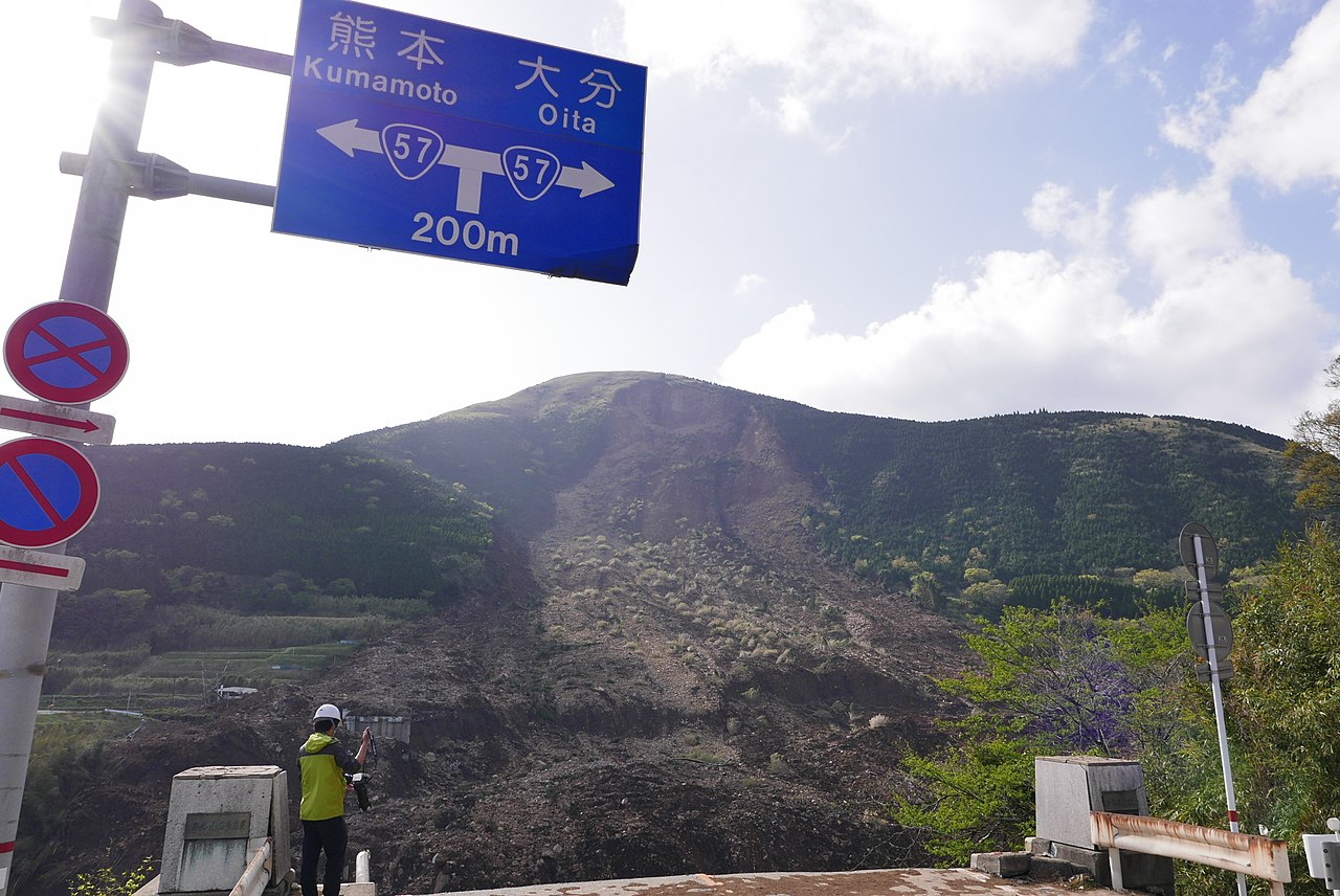
日本語: 平成28年熊本地震の地滑りで崩落した阿蘇大橋
English: The Aso-Ohashi bridge fallen by a landslip of the 2016 Kumamoto earthquakes |
| Date | |
| Source | Own work |
| Author | Hideki Kimura |
| Camera location |
| View this and other nearby images on: OpenStreetMap |
|
|---|
Licensing
I, the copyright holder of this work, hereby publish it under the following license:
This file is licensed under the
Creative Commons
Attribution-Share Alike 4.0 International license.
- You are free:
- to share – to copy, distribute and transmit the work
- to remix – to adapt the work
- Under the following conditions:
- attribution – You must give appropriate credit, provide a link to the license, and indicate if changes were made. You may do so in any reasonable manner, but not in any way that suggests the licensor endorses you or your use.
- share alike – If you remix, transform, or build upon the material, you must distribute your contributions under the same or compatible license as the original.
File history
Click on a date/time to view the file as it appeared at that time.
| Date/Time | Thumbnail | Dimensions | User | Comment | |
|---|---|---|---|---|---|
| current | 11:07, 19 April 2016 |
| 4,272 × 2,856 (4.95 MB) | Onhide | User created page with UploadWizard |
File usage
The following pages on the English Wikipedia use this file (pages on other projects are not listed):
Global file usage
The following other wikis use this file:
- Usage on ar.wikipedia.org
- Usage on de.wikipedia.org
- Usage on fi.wikipedia.org
- Usage on id.wikipedia.org
- Usage on ja.wikipedia.org
- Usage on ko.wikipedia.org
- Usage on ms.wikipedia.org
- Usage on nl.wikipedia.org
- Usage on ru.wikipedia.org
- Usage on th.wikipedia.org
- Usage on zh.wikipedia.org
Metadata
Size of this preview:
800 × 535 pixels. Other resolutions:
320 × 214 pixels |
640 × 428 pixels |
1,024 × 685 pixels |
1,280 × 856 pixels |
2,560 × 1,711 pixels |
4,272 × 2,856 pixels.
Original file (4,272 × 2,856 pixels, file size: 4.95 MB, MIME type: image/jpeg)
| This is a file from the
Wikimedia Commons. Information from its
description page there is shown below. Commons is a freely licensed media file repository. You can help. |
Summary
| Description |
日本語: 平成28年熊本地震の地滑りで崩落した阿蘇大橋
English: The Aso-Ohashi bridge fallen by a landslip of the 2016 Kumamoto earthquakes |
| Date | |
| Source | Own work |
| Author | Hideki Kimura |
| Camera location |
| View this and other nearby images on: OpenStreetMap |
|
|---|
Licensing
I, the copyright holder of this work, hereby publish it under the following license:
This file is licensed under the
Creative Commons
Attribution-Share Alike 4.0 International license.
- You are free:
- to share – to copy, distribute and transmit the work
- to remix – to adapt the work
- Under the following conditions:
- attribution – You must give appropriate credit, provide a link to the license, and indicate if changes were made. You may do so in any reasonable manner, but not in any way that suggests the licensor endorses you or your use.
- share alike – If you remix, transform, or build upon the material, you must distribute your contributions under the same or compatible license as the original.
File history
Click on a date/time to view the file as it appeared at that time.
| Date/Time | Thumbnail | Dimensions | User | Comment | |
|---|---|---|---|---|---|
| current | 11:07, 19 April 2016 |
| 4,272 × 2,856 (4.95 MB) | Onhide | User created page with UploadWizard |
File usage
The following pages on the English Wikipedia use this file (pages on other projects are not listed):
Global file usage
The following other wikis use this file:
- Usage on ar.wikipedia.org
- Usage on de.wikipedia.org
- Usage on fi.wikipedia.org
- Usage on id.wikipedia.org
- Usage on ja.wikipedia.org
- Usage on ko.wikipedia.org
- Usage on ms.wikipedia.org
- Usage on nl.wikipedia.org
- Usage on ru.wikipedia.org
- Usage on th.wikipedia.org
- Usage on zh.wikipedia.org