
Size of this preview:
794 × 600 pixels. Other resolutions:
318 × 240 pixels |
636 × 480 pixels |
1,017 × 768 pixels |
1,104 × 834 pixels.
Original file (1,104 × 834 pixels, file size: 399 KB, MIME type: image/jpeg)
| This is a file from the
Wikimedia Commons. Information from its
description page there is shown below. Commons is a freely licensed media file repository. You can help. |
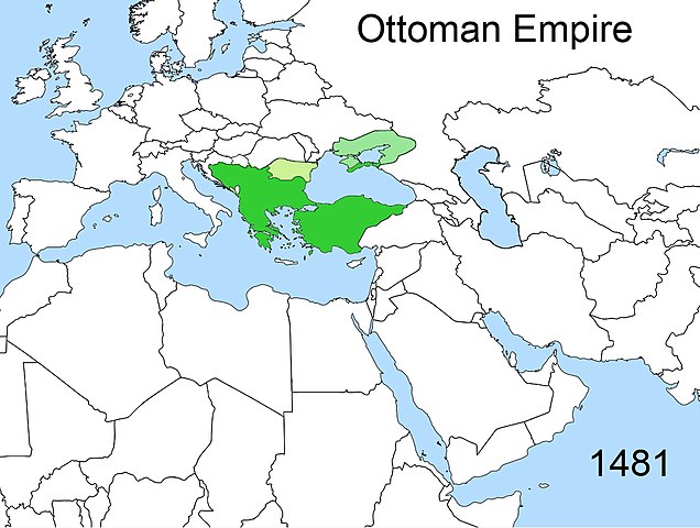
| Description | Territorial changes of the Ottoman Empire |
| Date | |
| Source | Own work |
| Author | Esemono |
| Permission ( Reusing this file) |
Own work, all rights released (Public domain) |
| I, the copyright holder of this work, release this work into the
public domain. This applies worldwide. In some countries this may not be legally possible; if so: I grant anyone the right to use this work for any purpose, without any conditions, unless such conditions are required by law. |
File history
Click on a date/time to view the file as it appeared at that time.
| Date/Time | Thumbnail | Dimensions | User | Comment | |
|---|---|---|---|---|---|
| current | 00:30, 18 February 2020 |
| 1,104 × 834 (399 KB) | Claude Zygiel | Mistakes corrected |
| 12:45, 23 April 2009 |
 | 1,104 × 834 (389 KB) | Esemono | {{Information |Description=Territorial changes of the Ottoman Empire |Source=Self made |Date=April, 2009 |Author= Esemono |Permission=Own work, all rights released (Public domain) |other_versions= }} {{PD-self}} [[Category:Maps of the B |
File usage
The following pages on the English Wikipedia use this file (pages on other projects are not listed):
Global file usage
The following other wikis use this file:
- Usage on azb.wikipedia.org
- Usage on ca.wikipedia.org
- Usage on id.wikipedia.org
- Usage on ja.wikipedia.org
- Usage on ka.wikipedia.org
- Usage on kk.wikipedia.org
- Usage on pt.wikipedia.org
- Usage on ru.wikipedia.org
- Usage on tr.wikipedia.org
- Usage on uk.wikipedia.org
Metadata
Size of this preview:
794 × 600 pixels. Other resolutions:
318 × 240 pixels |
636 × 480 pixels |
1,017 × 768 pixels |
1,104 × 834 pixels.
Original file (1,104 × 834 pixels, file size: 399 KB, MIME type: image/jpeg)
| This is a file from the
Wikimedia Commons. Information from its
description page there is shown below. Commons is a freely licensed media file repository. You can help. |
| Description | Territorial changes of the Ottoman Empire |
| Date | |
| Source | Own work |
| Author | Esemono |
| Permission ( Reusing this file) |
Own work, all rights released (Public domain) |
| I, the copyright holder of this work, release this work into the
public domain. This applies worldwide. In some countries this may not be legally possible; if so: I grant anyone the right to use this work for any purpose, without any conditions, unless such conditions are required by law. |
File history
Click on a date/time to view the file as it appeared at that time.
| Date/Time | Thumbnail | Dimensions | User | Comment | |
|---|---|---|---|---|---|
| current | 00:30, 18 February 2020 |
| 1,104 × 834 (399 KB) | Claude Zygiel | Mistakes corrected |
| 12:45, 23 April 2009 |
| 1,104 × 834 (389 KB) | Esemono | {{Information |Description=Territorial changes of the Ottoman Empire |Source=Self made |Date=April, 2009 |Author= Esemono |Permission=Own work, all rights released (Public domain) |other_versions= }} {{PD-self}} [[Category:Maps of the B |
File usage
The following pages on the English Wikipedia use this file (pages on other projects are not listed):
Global file usage
The following other wikis use this file:
- Usage on azb.wikipedia.org
- Usage on ca.wikipedia.org
- Usage on id.wikipedia.org
- Usage on ja.wikipedia.org
- Usage on ka.wikipedia.org
- Usage on kk.wikipedia.org
- Usage on pt.wikipedia.org
- Usage on ru.wikipedia.org
- Usage on tr.wikipedia.org
- Usage on uk.wikipedia.org