
Original file (SVG file, nominally 1,191 × 903 pixels, file size: 5.56 MB)
| This is a file from the
Wikimedia Commons. Information from its
description page there is shown below. Commons is a freely licensed media file repository. You can help. |
Summary
| Description |
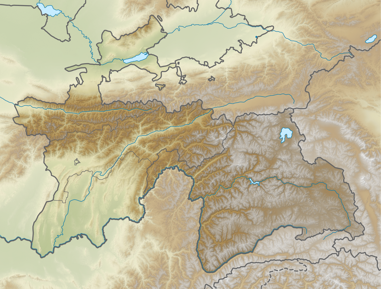
English: Relief map of Tajikistan. Elevation from STRM30. |
| Date | |
| Source | Derivative of File:Tajikistan adm location map.svg |
| Author | Own work based on User:NordNordWest |
Licensing
- You are free:
- to share – to copy, distribute and transmit the work
- to remix – to adapt the work
- Under the following conditions:
- attribution – You must give appropriate credit, provide a link to the license, and indicate if changes were made. You may do so in any reasonable manner, but not in any way that suggests the licensor endorses you or your use.
- share alike – If you remix, transform, or build upon the material, you must distribute your contributions under the same or compatible license as the original.
File history
Click on a date/time to view the file as it appeared at that time.
| Date/Time | Thumbnail | Dimensions | User | Comment | |
|---|---|---|---|---|---|
| current | 05:32, 22 November 2020 |
| 1,191 × 903 (5.56 MB) | C1MM | Increased boundary width of GB autonomous region, separate status from other administrative divisions |
| 05:20, 22 November 2020 |
 | 1,191 × 903 (5.56 MB) | C1MM | Uploaded a work by Own work based on User:NordNordWest from Derivative of File:Tajikistan adm location map.svg with UploadWizard |
File usage
More than 100 pages use this file. The following list shows the first 100 pages that use this file only. A full list is available.
- 1907 Qaratog earthquake
- 1911 Sarez earthquake
- 1949 Khait earthquake
- 1989 Gissar earthquake
- 2006 Tajikistan earthquake
- 2011 Fergana Valley earthquake
- 2015 Tajikistan earthquake
- 2021 Rasht earthquake
- Ajina Tepe
- Ak-Baital Pass
- Alexandria Eschate
- Baipaza Dam
- Beyik Pass
- Bulunkul
- Bunjikat (archeological site)
- Concord Peak
- Cyropolis
- Darvoz Range
- Drumkul
- Dushanbe
- Engels Peak
- Fann Mountains
- Farkhad Dam
- Golovnaya Dam
- Hisar Range
- Hulbuk
- Independence Peak
- Ishkoshim Range
- Iskanderkul
- Ismoil Somoni Peak
- Istaravshan
- Kafir-kala (Tajikistan)
- Kalai Kafirnigan
- Karakul (Tajikistan)
- Karl Marx Peak
- Kayrakkum Dam
- Khujand
- Kulma Pass
- Kulob
- Lenin Peak
- Lenin Peak disaster
- Luchak Formation
- Mayakovsky Peak
- Medvezhiy Glacier
- Mount Garmo
- Murghob
- Nezatash Pass
- Nurek Dam
- Osrushana
- Pamir-Alay
- Patkhor Peak
- Peak Ozodi
- Penjikent murals
- Peter I Range
- Pik Skalisty
- Qubodiyon
- Rogun Dam
- Rushan Range
- Saksanokhur
- Sangtuda 1 Hydroelectric Power Plant
- Sangtuda 2 Hydroelectric Power Plant
- Sarazm
- Sarez Lake
- Sarikol Range
- Shahriston
- Shakhdara Range
- Shirabad Formation
- Shughnon Range
- Simiganj
- Tajik National Park
- Takht-i Kuwad
- Takht-i Sangin
- Tartu Ülikool 350
- Tigrovaya Balka Nature Reserve
- Torbulok
- Trans-Alay Range
- Turkestan Range
- Turumtaykul
- Vakhsh (river)
- Vanj Range
- Yashilkul
- Yazgulem Range
- Zarafshan Range
- Zarbuz Formation
- Zorkul
- User:Ty654/List of earthquakes from 1900-1949 exceeding magnitude 7+
- User:Ty654/List of earthquakes from 1910-1919 exceeding magnitude 6+
- User:Ty654/List of earthquakes from 1920-1929 exceeding magnitude 6+
- User:Ty654/List of earthquakes from 1930-1939 exceeding magnitude 6+
- User:Ty654/List of earthquakes from 1940-1949 exceeding magnitude 6+
- User:Ty654/List of earthquakes from 1950-1954 exceeding magnitude 6+
- User:Ty654/List of earthquakes from 1955-1959 exceeding magnitude 6+
- User:Ty654/List of earthquakes from 1960-1964 exceeding magnitude 6+
- User:Ty654/List of earthquakes from 1965-1969 exceeding magnitude 6+
- User:Ty654/List of earthquakes from 1970-1974 exceeding magnitude 6+
- User:Ty654/List of earthquakes from 1975-1979 exceeding magnitude 6+
- User:Ty654/List of earthquakes from 1980-1984 exceeding magnitude 6+
- User:Ty654/List of earthquakes from 2000-present exceeding magnitude 7+
- User:Ty654/List of earthquakes from 2010-2014 exceeding magnitude 6+
- User:Ty654/List of earthquakes from 2015-2019 exceeding magnitude 6+
View more links to this file.
Global file usage
The following other wikis use this file:
- Usage on ca.wikipedia.org
- Usage on hr.wikipedia.org
- Usage on mn.wikipedia.org
- Usage on ms.wikipedia.org
- Usage on ru.wikipedia.org
- Бобокух
- Пяндж
- Кафирниган
- Вахш
- Памиро-Алай
- Фанские горы
- Гунт
- Сарезское озеро
- Яшилькуль
- Шахдара
- Шаблон:ПозКарта Таджикистан
- Бартанг
- Тигровая балка
- Пик Исмоила Сомони
- Пик Озоди
- Искандеркуль
- Яхоб
- Гиссарский хребет
- Пик Революции
- Гиссарская долина
- Каракуль (озеро, Таджикистан)
- Пик Маяковского
- Ледник Федченко
- Ганджи Помир
- Таджикское Море
- Акбайтал (перевал)
- Исфара (река)
- Ваханский хребет
- Туркестанский хребет
- Чимтарга
- Хребет Национальной академии наук Таджикистана
- Сурхоб (приток Пянджа)
- Мугоб
- Зеравшанский хребет
- Язгулем
- Участник:Prospector/Черновик 1
- Участник:Зелёный Кошак/Список наблюдения/Для проекта Гидрография.СПб
- Язгулемский хребет
- Ванчский хребет
- Маркансу
View more global usage of this file.
Metadata
Original file (SVG file, nominally 1,191 × 903 pixels, file size: 5.56 MB)
| This is a file from the
Wikimedia Commons. Information from its
description page there is shown below. Commons is a freely licensed media file repository. You can help. |
Summary
| Description |
English: Relief map of Tajikistan. Elevation from STRM30. |
| Date | |
| Source | Derivative of File:Tajikistan adm location map.svg |
| Author | Own work based on User:NordNordWest |
Licensing
- You are free:
- to share – to copy, distribute and transmit the work
- to remix – to adapt the work
- Under the following conditions:
- attribution – You must give appropriate credit, provide a link to the license, and indicate if changes were made. You may do so in any reasonable manner, but not in any way that suggests the licensor endorses you or your use.
- share alike – If you remix, transform, or build upon the material, you must distribute your contributions under the same or compatible license as the original.
File history
Click on a date/time to view the file as it appeared at that time.
| Date/Time | Thumbnail | Dimensions | User | Comment | |
|---|---|---|---|---|---|
| current | 05:32, 22 November 2020 |
| 1,191 × 903 (5.56 MB) | C1MM | Increased boundary width of GB autonomous region, separate status from other administrative divisions |
| 05:20, 22 November 2020 |
| 1,191 × 903 (5.56 MB) | C1MM | Uploaded a work by Own work based on User:NordNordWest from Derivative of File:Tajikistan adm location map.svg with UploadWizard |
File usage
More than 100 pages use this file. The following list shows the first 100 pages that use this file only. A full list is available.
- 1907 Qaratog earthquake
- 1911 Sarez earthquake
- 1949 Khait earthquake
- 1989 Gissar earthquake
- 2006 Tajikistan earthquake
- 2011 Fergana Valley earthquake
- 2015 Tajikistan earthquake
- 2021 Rasht earthquake
- Ajina Tepe
- Ak-Baital Pass
- Alexandria Eschate
- Baipaza Dam
- Beyik Pass
- Bulunkul
- Bunjikat (archeological site)
- Concord Peak
- Cyropolis
- Darvoz Range
- Drumkul
- Dushanbe
- Engels Peak
- Fann Mountains
- Farkhad Dam
- Golovnaya Dam
- Hisar Range
- Hulbuk
- Independence Peak
- Ishkoshim Range
- Iskanderkul
- Ismoil Somoni Peak
- Istaravshan
- Kafir-kala (Tajikistan)
- Kalai Kafirnigan
- Karakul (Tajikistan)
- Karl Marx Peak
- Kayrakkum Dam
- Khujand
- Kulma Pass
- Kulob
- Lenin Peak
- Lenin Peak disaster
- Luchak Formation
- Mayakovsky Peak
- Medvezhiy Glacier
- Mount Garmo
- Murghob
- Nezatash Pass
- Nurek Dam
- Osrushana
- Pamir-Alay
- Patkhor Peak
- Peak Ozodi
- Penjikent murals
- Peter I Range
- Pik Skalisty
- Qubodiyon
- Rogun Dam
- Rushan Range
- Saksanokhur
- Sangtuda 1 Hydroelectric Power Plant
- Sangtuda 2 Hydroelectric Power Plant
- Sarazm
- Sarez Lake
- Sarikol Range
- Shahriston
- Shakhdara Range
- Shirabad Formation
- Shughnon Range
- Simiganj
- Tajik National Park
- Takht-i Kuwad
- Takht-i Sangin
- Tartu Ülikool 350
- Tigrovaya Balka Nature Reserve
- Torbulok
- Trans-Alay Range
- Turkestan Range
- Turumtaykul
- Vakhsh (river)
- Vanj Range
- Yashilkul
- Yazgulem Range
- Zarafshan Range
- Zarbuz Formation
- Zorkul
- User:Ty654/List of earthquakes from 1900-1949 exceeding magnitude 7+
- User:Ty654/List of earthquakes from 1910-1919 exceeding magnitude 6+
- User:Ty654/List of earthquakes from 1920-1929 exceeding magnitude 6+
- User:Ty654/List of earthquakes from 1930-1939 exceeding magnitude 6+
- User:Ty654/List of earthquakes from 1940-1949 exceeding magnitude 6+
- User:Ty654/List of earthquakes from 1950-1954 exceeding magnitude 6+
- User:Ty654/List of earthquakes from 1955-1959 exceeding magnitude 6+
- User:Ty654/List of earthquakes from 1960-1964 exceeding magnitude 6+
- User:Ty654/List of earthquakes from 1965-1969 exceeding magnitude 6+
- User:Ty654/List of earthquakes from 1970-1974 exceeding magnitude 6+
- User:Ty654/List of earthquakes from 1975-1979 exceeding magnitude 6+
- User:Ty654/List of earthquakes from 1980-1984 exceeding magnitude 6+
- User:Ty654/List of earthquakes from 2000-present exceeding magnitude 7+
- User:Ty654/List of earthquakes from 2010-2014 exceeding magnitude 6+
- User:Ty654/List of earthquakes from 2015-2019 exceeding magnitude 6+
View more links to this file.
Global file usage
The following other wikis use this file:
- Usage on ca.wikipedia.org
- Usage on hr.wikipedia.org
- Usage on mn.wikipedia.org
- Usage on ms.wikipedia.org
- Usage on ru.wikipedia.org
- Бобокух
- Пяндж
- Кафирниган
- Вахш
- Памиро-Алай
- Фанские горы
- Гунт
- Сарезское озеро
- Яшилькуль
- Шахдара
- Шаблон:ПозКарта Таджикистан
- Бартанг
- Тигровая балка
- Пик Исмоила Сомони
- Пик Озоди
- Искандеркуль
- Яхоб
- Гиссарский хребет
- Пик Революции
- Гиссарская долина
- Каракуль (озеро, Таджикистан)
- Пик Маяковского
- Ледник Федченко
- Ганджи Помир
- Таджикское Море
- Акбайтал (перевал)
- Исфара (река)
- Ваханский хребет
- Туркестанский хребет
- Чимтарга
- Хребет Национальной академии наук Таджикистана
- Сурхоб (приток Пянджа)
- Мугоб
- Зеравшанский хребет
- Язгулем
- Участник:Prospector/Черновик 1
- Участник:Зелёный Кошак/Список наблюдения/Для проекта Гидрография.СПб
- Язгулемский хребет
- Ванчский хребет
- Маркансу
View more global usage of this file.