Photos • Location


Size of this preview:
800 × 533 pixels. Other resolutions:
320 × 213 pixels |
640 × 427 pixels |
1,024 × 683 pixels |
1,280 × 853 pixels |
2,560 × 1,707 pixels |
4,608 × 3,072 pixels.
Original file (4,608 × 3,072 pixels, file size: 4.49 MB, MIME type: image/jpeg)
| This is a file from the
Wikimedia Commons. Information from its
description page there is shown below. Commons is a freely licensed media file repository. You can help. |
Summary
| Description |
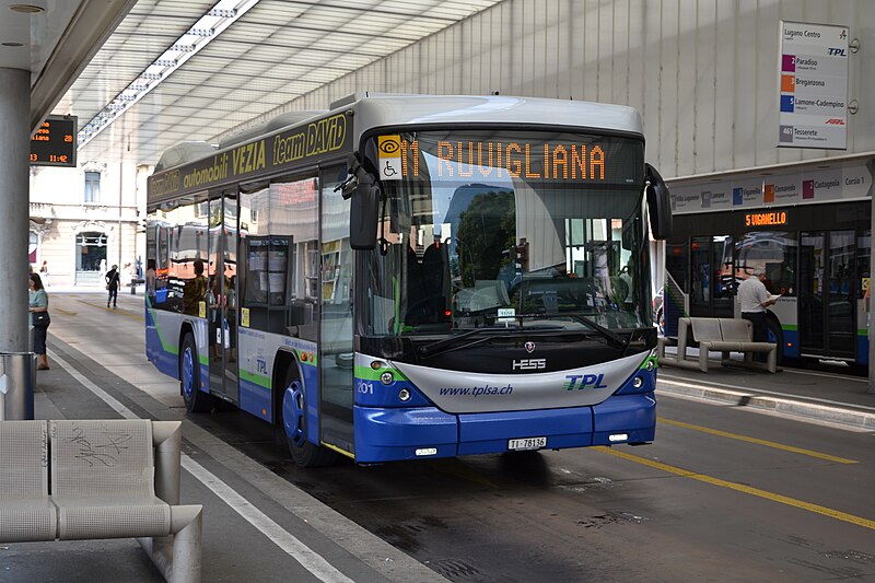
English: Warempel, variatie in het TPL-park! TPL 201, een Hess O2583, als lijn 11 naar de Luganese wijk Ruvigliana, aan de voet van de Monte Brè, bij het busstation van Lugano, Lugano Centro. De bus is het vieze kleine broertje van de Arnhemse trolleybussen. |
| Date | |
| Source | https://www.flickr.com/photos/alfenaar/9570281900/ |
| Author | Alfenaar |
| Camera location |
| View this and other nearby images on: OpenStreetMap |
|
|---|
Licensing
This file is licensed under the
Creative Commons
Attribution-Share Alike 2.0 Generic license.
- You are free:
- to share – to copy, distribute and transmit the work
- to remix – to adapt the work
- Under the following conditions:
- attribution – You must give appropriate credit, provide a link to the license, and indicate if changes were made. You may do so in any reasonable manner, but not in any way that suggests the licensor endorses you or your use.
- share alike – If you remix, transform, or build upon the material, you must distribute your contributions under the same or compatible license as the original.
| This image was originally posted to Flickr by Alfenaar at https://flickr.com/photos/63399716@N03/9570281900. It was reviewed on 14 February 2022 by FlickreviewR 2 and was confirmed to be licensed under the terms of the cc-by-sa-2.0. |
File history
Click on a date/time to view the file as it appeared at that time.
| Date/Time | Thumbnail | Dimensions | User | Comment | |
|---|---|---|---|---|---|
| current | 18:50, 14 February 2022 |
| 4,608 × 3,072 (4.49 MB) | Zacharie Grossen | Uploaded a work by Alfenaar from https://www.flickr.com/photos/alfenaar/9570281900/ with UploadWizard |
File usage
The following pages on the English Wikipedia use this file (pages on other projects are not listed):
Global file usage
The following other wikis use this file:
- Usage on uk.wikipedia.org
Metadata
Size of this preview:
800 × 533 pixels. Other resolutions:
320 × 213 pixels |
640 × 427 pixels |
1,024 × 683 pixels |
1,280 × 853 pixels |
2,560 × 1,707 pixels |
4,608 × 3,072 pixels.
Original file (4,608 × 3,072 pixels, file size: 4.49 MB, MIME type: image/jpeg)
| This is a file from the
Wikimedia Commons. Information from its
description page there is shown below. Commons is a freely licensed media file repository. You can help. |
Summary
| Description |
English: Warempel, variatie in het TPL-park! TPL 201, een Hess O2583, als lijn 11 naar de Luganese wijk Ruvigliana, aan de voet van de Monte Brè, bij het busstation van Lugano, Lugano Centro. De bus is het vieze kleine broertje van de Arnhemse trolleybussen. |
| Date | |
| Source | https://www.flickr.com/photos/alfenaar/9570281900/ |
| Author | Alfenaar |
| Camera location |
| View this and other nearby images on: OpenStreetMap |
|
|---|
Licensing
This file is licensed under the
Creative Commons
Attribution-Share Alike 2.0 Generic license.
- You are free:
- to share – to copy, distribute and transmit the work
- to remix – to adapt the work
- Under the following conditions:
- attribution – You must give appropriate credit, provide a link to the license, and indicate if changes were made. You may do so in any reasonable manner, but not in any way that suggests the licensor endorses you or your use.
- share alike – If you remix, transform, or build upon the material, you must distribute your contributions under the same or compatible license as the original.
| This image was originally posted to Flickr by Alfenaar at https://flickr.com/photos/63399716@N03/9570281900. It was reviewed on 14 February 2022 by FlickreviewR 2 and was confirmed to be licensed under the terms of the cc-by-sa-2.0. |
File history
Click on a date/time to view the file as it appeared at that time.
| Date/Time | Thumbnail | Dimensions | User | Comment | |
|---|---|---|---|---|---|
| current | 18:50, 14 February 2022 |
| 4,608 × 3,072 (4.49 MB) | Zacharie Grossen | Uploaded a work by Alfenaar from https://www.flickr.com/photos/alfenaar/9570281900/ with UploadWizard |
File usage
The following pages on the English Wikipedia use this file (pages on other projects are not listed):
Global file usage
The following other wikis use this file:
- Usage on uk.wikipedia.org