
Size of this preview:
800 × 489 pixels. Other resolutions:
320 × 196 pixels |
640 × 391 pixels |
1,052 × 643 pixels.
Original file (1,052 × 643 pixels, file size: 56 KB, MIME type: image/png)
| This is a file from the
Wikimedia Commons. Information from its
description page there is shown below. Commons is a freely licensed media file repository. You can help. |
| Description |
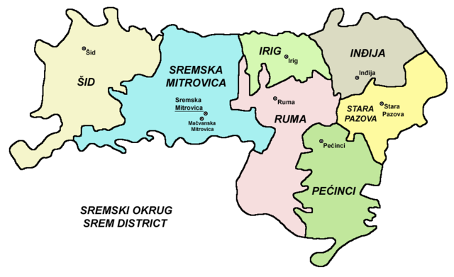
English: Map of
Syrmia District.
Српски / srpski: Мапа
Сремског округа.
Čeština: Mapa
Sremského okruhu. |
||
| Date | 14 December 2005 (original upload date) | ||
| Source | Transferred from en.wikipedia; Transfer was stated to be made by User:sevela.p. | ||
| Author | Original uploader and author was PANONIAN at en.wikipedia | ||
| Permission ( Reusing this file) |
|
References
- Slobodan Radovanović, Geografski atlas, Magic Map, Smederevska Palanka, 2001.
- Školski geografski atlas, Intersistem Kartografija, Beograd, 2004.
- Denis Šehić - Demir Šehić, Geografski atlas Srbije, Beograd, 2007.
- Popis stanovništva, domaćinstava i stanova u 2002., Stanovništvo, nacionalna ili etnička pripadnost - Podaci po naseljima, knjiga 1, Republika Srbija - Republički zavod za statistiku, Beograd, februar 2003.
Original upload log
The original description page was
here. All following user names refer to en.wikipedia.
- 2005-12-14 12:49 PANONIAN 800×485×8 (13935 bytes)
File history
Click on a date/time to view the file as it appeared at that time.
| Date/Time | Thumbnail | Dimensions | User | Comment | |
|---|---|---|---|---|---|
| current | 21:49, 13 September 2009 |
| 1,052 × 643 (56 KB) | PANONIAN | |
| 11:52, 19 February 2008 |
 | 800 × 485 (14 KB) | File Upload Bot (Magnus Manske) | {{BotMoveToCommons|en.wikipedia}} {{Information |Description={{en|map of en:Srem District (self made) en:Category:Maps of Vojvodina}} |Source=Transferred from [http://en.wikipedia.org en.wikipedia]; Transfer was stated to be made by [[User:sev |
File usage
The following pages on the English Wikipedia use this file (pages on other projects are not listed):
Global file usage
The following other wikis use this file:
- Usage on ca.wikipedia.org
- Usage on cs.wikipedia.org
- Usage on de.wikipedia.org
- Usage on el.wikipedia.org
- Usage on es.wikipedia.org
- Usage on et.wikipedia.org
- Usage on hr.wikipedia.org
- Usage on it.wikipedia.org
- Usage on ja.wikipedia.org
- Usage on ko.wikipedia.org
- Usage on mk.wikipedia.org
- Usage on nl.wikipedia.org
- Usage on pnb.wikipedia.org
- Usage on ro.wikipedia.org
- Usage on sco.wikipedia.org
- Usage on sr.wikipedia.org
- Usage on tr.wikipedia.org
- Usage on uk.wikipedia.org
- Usage on vi.wikipedia.org
- Usage on zh.wikipedia.org
Size of this preview:
800 × 489 pixels. Other resolutions:
320 × 196 pixels |
640 × 391 pixels |
1,052 × 643 pixels.
Original file (1,052 × 643 pixels, file size: 56 KB, MIME type: image/png)
| This is a file from the
Wikimedia Commons. Information from its
description page there is shown below. Commons is a freely licensed media file repository. You can help. |
| Description |
English: Map of
Syrmia District.
Српски / srpski: Мапа
Сремског округа.
Čeština: Mapa
Sremského okruhu. |
||
| Date | 14 December 2005 (original upload date) | ||
| Source | Transferred from en.wikipedia; Transfer was stated to be made by User:sevela.p. | ||
| Author | Original uploader and author was PANONIAN at en.wikipedia | ||
| Permission ( Reusing this file) |
|
References
- Slobodan Radovanović, Geografski atlas, Magic Map, Smederevska Palanka, 2001.
- Školski geografski atlas, Intersistem Kartografija, Beograd, 2004.
- Denis Šehić - Demir Šehić, Geografski atlas Srbije, Beograd, 2007.
- Popis stanovništva, domaćinstava i stanova u 2002., Stanovništvo, nacionalna ili etnička pripadnost - Podaci po naseljima, knjiga 1, Republika Srbija - Republički zavod za statistiku, Beograd, februar 2003.
Original upload log
The original description page was
here. All following user names refer to en.wikipedia.
- 2005-12-14 12:49 PANONIAN 800×485×8 (13935 bytes)
File history
Click on a date/time to view the file as it appeared at that time.
| Date/Time | Thumbnail | Dimensions | User | Comment | |
|---|---|---|---|---|---|
| current | 21:49, 13 September 2009 |
| 1,052 × 643 (56 KB) | PANONIAN | |
| 11:52, 19 February 2008 |
| 800 × 485 (14 KB) | File Upload Bot (Magnus Manske) | {{BotMoveToCommons|en.wikipedia}} {{Information |Description={{en|map of en:Srem District (self made) en:Category:Maps of Vojvodina}} |Source=Transferred from [http://en.wikipedia.org en.wikipedia]; Transfer was stated to be made by [[User:sev |
File usage
The following pages on the English Wikipedia use this file (pages on other projects are not listed):
Global file usage
The following other wikis use this file:
- Usage on ca.wikipedia.org
- Usage on cs.wikipedia.org
- Usage on de.wikipedia.org
- Usage on el.wikipedia.org
- Usage on es.wikipedia.org
- Usage on et.wikipedia.org
- Usage on hr.wikipedia.org
- Usage on it.wikipedia.org
- Usage on ja.wikipedia.org
- Usage on ko.wikipedia.org
- Usage on mk.wikipedia.org
- Usage on nl.wikipedia.org
- Usage on pnb.wikipedia.org
- Usage on ro.wikipedia.org
- Usage on sco.wikipedia.org
- Usage on sr.wikipedia.org
- Usage on tr.wikipedia.org
- Usage on uk.wikipedia.org
- Usage on vi.wikipedia.org
- Usage on zh.wikipedia.org