Photos • Location


Size of this preview:
800 × 535 pixels. Other resolutions:
320 × 214 pixels |
640 × 428 pixels |
1,024 × 685 pixels |
1,280 × 856 pixels |
2,560 × 1,712 pixels |
3,708 × 2,480 pixels.
Original file (3,708 × 2,480 pixels, file size: 1.86 MB, MIME type: image/jpeg)
| This is a file from the
Wikimedia Commons. Information from its
description page there is shown below. Commons is a freely licensed media file repository. You can help. |
| Description |
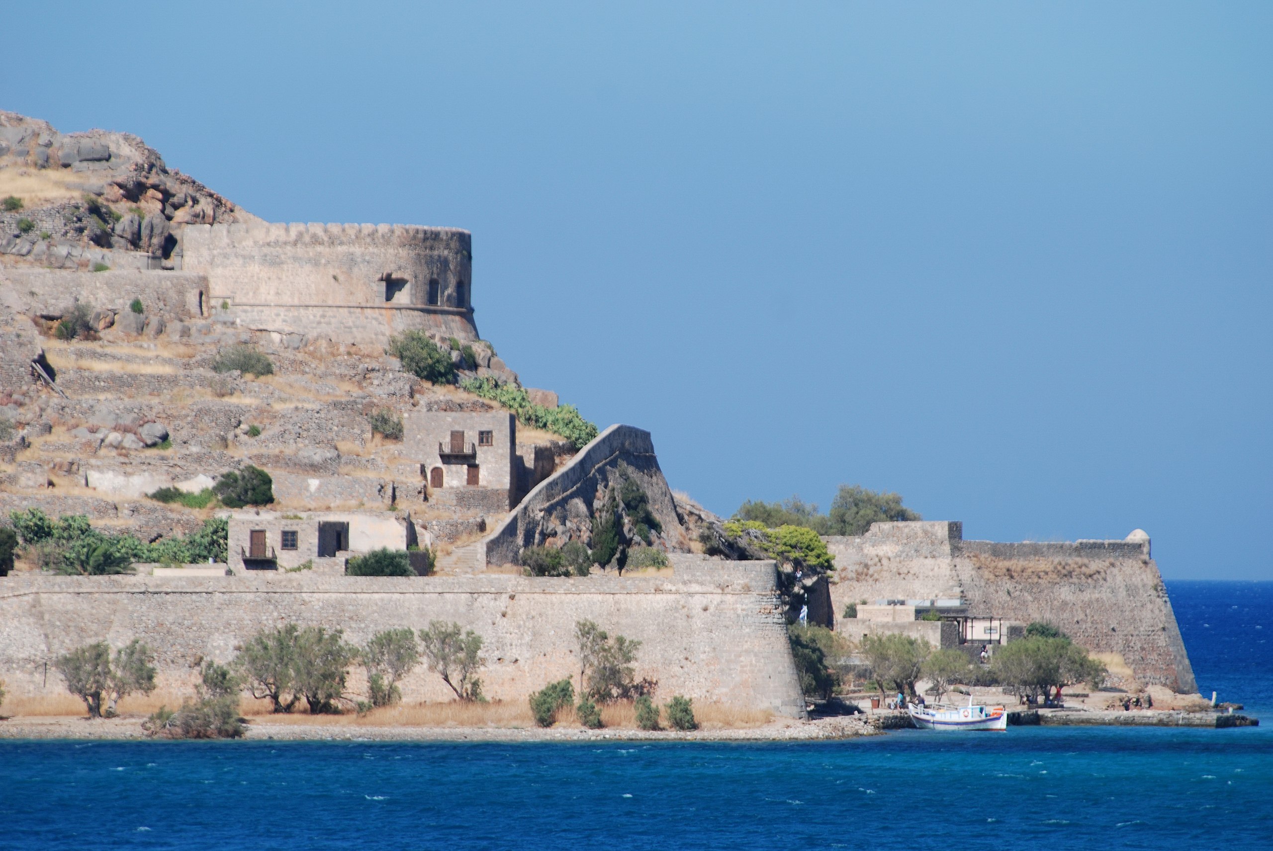
Ελληνικά: Η Σπιναλόγκα είναι ένα μικρό νησάκι το οποίο κλείνει από τα βόρεια τον κόλπο της Ελούντας στην Επαρχία Μεραμπέλλου του νομού Λασιθίου Κρήτης. Το αρχαίο του όνομα ήταν Καλυδών αλλά μετά την κατάληψη του από τους Ενετούς ονομάσθηκε Σπιναλόγκα. Οχυρώθηκε άριστα από τους Ενετούς τόσο από κατασκευαστικής και αρχιτεκτονικής άποψης όσο και από απόψεως αισθητικής του όλου τοπίου που και σήμερα ακόμη διατηρεί την αξεπέραστη ομορφιά του.
English: The island of Spinalonga (official name: Kalidon) is located at the eastern section of Crete, near the town of Elounda. The name of the island, Spinalonga, is Venetian, meaning "long thorn", and has roots in the period of Venetian occupation. This location is also the setting for Victoria Hislop's bestselling novel The Island and Werner Herzog's experimental short film Last Words. |
||||
| Date | |||||
| Source | originally posted to Flickr as Spinalonga, Elounta | ||||
| Author |
|
||||
| Permission ( Reusing this file) |
This file is licensed under the
Creative Commons
Attribution 2.0 Generic license.
|
File history
Click on a date/time to view the file as it appeared at that time.
| Date/Time | Thumbnail | Dimensions | User | Comment | |
|---|---|---|---|---|---|
| current | 09:30, 27 October 2008 |
| 3,708 × 2,480 (1.86 MB) | Flickr upload bot | Uploaded from http://flickr.com/photo/22083482@N03/2700768476 using Flickr upload bot |
| 09:28, 27 October 2008 |
 | 3,820 × 2,556 (2.55 MB) | Flickr upload bot | Uploaded from http://flickr.com/photo/22083482@N03/2699951437 using Flickr upload bot |
File usage
The following pages on the English Wikipedia use this file (pages on other projects are not listed):
Global file usage
The following other wikis use this file:
- Usage on de.wikipedia.org
Metadata
Size of this preview:
800 × 535 pixels. Other resolutions:
320 × 214 pixels |
640 × 428 pixels |
1,024 × 685 pixels |
1,280 × 856 pixels |
2,560 × 1,712 pixels |
3,708 × 2,480 pixels.
Original file (3,708 × 2,480 pixels, file size: 1.86 MB, MIME type: image/jpeg)
| This is a file from the
Wikimedia Commons. Information from its
description page there is shown below. Commons is a freely licensed media file repository. You can help. |
| Description |
Ελληνικά: Η Σπιναλόγκα είναι ένα μικρό νησάκι το οποίο κλείνει από τα βόρεια τον κόλπο της Ελούντας στην Επαρχία Μεραμπέλλου του νομού Λασιθίου Κρήτης. Το αρχαίο του όνομα ήταν Καλυδών αλλά μετά την κατάληψη του από τους Ενετούς ονομάσθηκε Σπιναλόγκα. Οχυρώθηκε άριστα από τους Ενετούς τόσο από κατασκευαστικής και αρχιτεκτονικής άποψης όσο και από απόψεως αισθητικής του όλου τοπίου που και σήμερα ακόμη διατηρεί την αξεπέραστη ομορφιά του.
English: The island of Spinalonga (official name: Kalidon) is located at the eastern section of Crete, near the town of Elounda. The name of the island, Spinalonga, is Venetian, meaning "long thorn", and has roots in the period of Venetian occupation. This location is also the setting for Victoria Hislop's bestselling novel The Island and Werner Herzog's experimental short film Last Words. |
||||
| Date | |||||
| Source | originally posted to Flickr as Spinalonga, Elounta | ||||
| Author |
|
||||
| Permission ( Reusing this file) |
This file is licensed under the
Creative Commons
Attribution 2.0 Generic license.
|
File history
Click on a date/time to view the file as it appeared at that time.
| Date/Time | Thumbnail | Dimensions | User | Comment | |
|---|---|---|---|---|---|
| current | 09:30, 27 October 2008 |
| 3,708 × 2,480 (1.86 MB) | Flickr upload bot | Uploaded from http://flickr.com/photo/22083482@N03/2700768476 using Flickr upload bot |
| 09:28, 27 October 2008 |
| 3,820 × 2,556 (2.55 MB) | Flickr upload bot | Uploaded from http://flickr.com/photo/22083482@N03/2699951437 using Flickr upload bot |
File usage
The following pages on the English Wikipedia use this file (pages on other projects are not listed):
Global file usage
The following other wikis use this file:
- Usage on de.wikipedia.org