Photos • Location


Size of this preview:
800 × 355 pixels. Other resolutions:
320 × 142 pixels |
640 × 284 pixels |
1,024 × 455 pixels |
1,280 × 568 pixels |
3,072 × 1,364 pixels.
Original file (3,072 × 1,364 pixels, file size: 285 KB, MIME type: image/jpeg)
| This is a file from the
Wikimedia Commons. Information from its
description page there is shown below. Commons is a freely licensed media file repository. You can help. |
Summary
| Description |
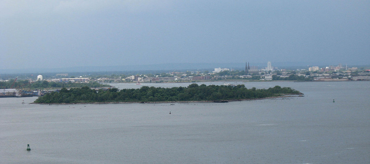
English: Looking west at
Shooters Island on a cloudy afternoon of June 2008 from Bayonne Bridge. Entrance of Arthur Kill at far left.
Français : Vue vers l'ouest en direction de
Shooters Island par un après-midi nuageux de juin 2008 depuis le
pont de Bayonne. L'entrée du
Arthur Kill se trouve à l'extrême gauche. |
| Date | |
| Source | Own work |
| Author | Jim.henderson |
| Camera location | | View this and other nearby images on: OpenStreetMap |
|
|---|
Licensing
| I, the copyright holder of this work, release this work into the
public domain. This applies worldwide. In some countries this may not be legally possible; if so: I grant anyone the right to use this work for any purpose, without any conditions, unless such conditions are required by law. |
File history
Click on a date/time to view the file as it appeared at that time.
| Date/Time | Thumbnail | Dimensions | User | Comment | |
|---|---|---|---|---|---|
| current | 17:52, 3 July 2008 |
| 3,072 × 1,364 (285 KB) | Jim.henderson | Looking west at en:Shooters Island on a cloudy afternoon of June 2008 from Bayonne Bridge. Entrance of Arthur Kill at far left. Category:Islands of New York City Category:Islands of New Jersey |
File usage
The following pages on the English Wikipedia use this file (pages on other projects are not listed):
Global file usage
The following other wikis use this file:
- Usage on ceb.wikipedia.org
- Usage on et.wikipedia.org
- Usage on fr.wikipedia.org
- Usage on he.wikipedia.org
- Usage on ja.wikipedia.org
- Usage on www.wikidata.org
Metadata
Size of this preview:
800 × 355 pixels. Other resolutions:
320 × 142 pixels |
640 × 284 pixels |
1,024 × 455 pixels |
1,280 × 568 pixels |
3,072 × 1,364 pixels.
Original file (3,072 × 1,364 pixels, file size: 285 KB, MIME type: image/jpeg)
| This is a file from the
Wikimedia Commons. Information from its
description page there is shown below. Commons is a freely licensed media file repository. You can help. |
Summary
| Description |
English: Looking west at
Shooters Island on a cloudy afternoon of June 2008 from Bayonne Bridge. Entrance of Arthur Kill at far left.
Français : Vue vers l'ouest en direction de
Shooters Island par un après-midi nuageux de juin 2008 depuis le
pont de Bayonne. L'entrée du
Arthur Kill se trouve à l'extrême gauche. |
| Date | |
| Source | Own work |
| Author | Jim.henderson |
| Camera location | | View this and other nearby images on: OpenStreetMap |
|
|---|
Licensing
| I, the copyright holder of this work, release this work into the
public domain. This applies worldwide. In some countries this may not be legally possible; if so: I grant anyone the right to use this work for any purpose, without any conditions, unless such conditions are required by law. |
File history
Click on a date/time to view the file as it appeared at that time.
| Date/Time | Thumbnail | Dimensions | User | Comment | |
|---|---|---|---|---|---|
| current | 17:52, 3 July 2008 |
| 3,072 × 1,364 (285 KB) | Jim.henderson | Looking west at en:Shooters Island on a cloudy afternoon of June 2008 from Bayonne Bridge. Entrance of Arthur Kill at far left. Category:Islands of New York City Category:Islands of New Jersey |
File usage
The following pages on the English Wikipedia use this file (pages on other projects are not listed):
Global file usage
The following other wikis use this file:
- Usage on ceb.wikipedia.org
- Usage on et.wikipedia.org
- Usage on fr.wikipedia.org
- Usage on he.wikipedia.org
- Usage on ja.wikipedia.org
- Usage on www.wikidata.org