Photos • Location


Size of this preview:
324 × 599 pixels. Other resolutions:
130 × 240 pixels |
638 × 1,180 pixels.
Original file (638 × 1,180 pixels, file size: 187 KB, MIME type: image/jpeg)
| This is a file from the
Wikimedia Commons. Information from its
description page there is shown below. Commons is a freely licensed media file repository. You can help. |
Summary
| Description |
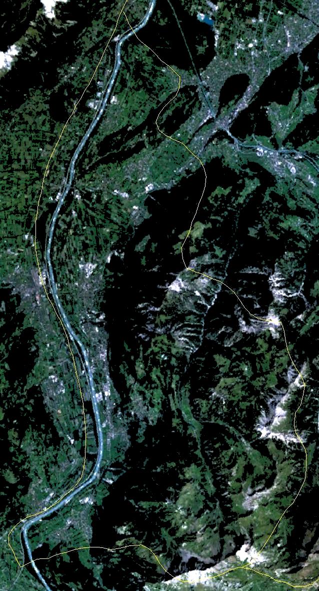
English: Satellite image of Liechtenstein on Landsat 7 with approximate borders. |
| Date | 28 September 2005 (upload date) |
| Source | Satellite imagery taken by screenshot from NASA World Wind software |
| Author | NASA |
| Object location |
| View this and other nearby images on: OpenStreetMap |
|
|---|
Licensing
| This image is in the
public domain because it is a screenshot from
NASA’s globe software
World Wind using a public domain layer, such as Blue Marble, MODIS, Landsat, SRTM, USGS or GLOBE.
|
 |
File history
Click on a date/time to view the file as it appeared at that time.
| Date/Time | Thumbnail | Dimensions | User | Comment | |
|---|---|---|---|---|---|
| current | 17:06, 30 November 2005 |
| 638 × 1,180 (187 KB) | Wiki-vr | lighter image |
| 12:08, 28 September 2005 |
 | 638 × 1,180 (157 KB) | Hautala | forgot to crop, now cropped | |
| 12:02, 28 September 2005 |
 | 1,600 × 1,200 (329 KB) | Hautala | {{PD-USGov-NASA}} Satellite image of Liechtenstein from NASA World Wind on Landsat 7 with approximate borders. World Wind link: worldwind://goto/world=Earth&lat=47.16425&lon=9.54666&alt=34890 |
File usage
The following pages on the English Wikipedia use this file (pages on other projects are not listed):
Global file usage
The following other wikis use this file:
- Usage on af.wikipedia.org
- Usage on cs.wikipedia.org
- Usage on de.wikipedia.org
- Usage on it.wikibooks.org
- Usage on ko.wikipedia.org
Metadata
Size of this preview:
324 × 599 pixels. Other resolutions:
130 × 240 pixels |
638 × 1,180 pixels.
Original file (638 × 1,180 pixels, file size: 187 KB, MIME type: image/jpeg)
| This is a file from the
Wikimedia Commons. Information from its
description page there is shown below. Commons is a freely licensed media file repository. You can help. |
Summary
| Description |
English: Satellite image of Liechtenstein on Landsat 7 with approximate borders. |
| Date | 28 September 2005 (upload date) |
| Source | Satellite imagery taken by screenshot from NASA World Wind software |
| Author | NASA |
| Object location |
| View this and other nearby images on: OpenStreetMap |
|
|---|
Licensing
| This image is in the
public domain because it is a screenshot from
NASA’s globe software
World Wind using a public domain layer, such as Blue Marble, MODIS, Landsat, SRTM, USGS or GLOBE.
|
|
File history
Click on a date/time to view the file as it appeared at that time.
| Date/Time | Thumbnail | Dimensions | User | Comment | |
|---|---|---|---|---|---|
| current | 17:06, 30 November 2005 |
| 638 × 1,180 (187 KB) | Wiki-vr | lighter image |
| 12:08, 28 September 2005 |
| 638 × 1,180 (157 KB) | Hautala | forgot to crop, now cropped | |
| 12:02, 28 September 2005 |
| 1,600 × 1,200 (329 KB) | Hautala | {{PD-USGov-NASA}} Satellite image of Liechtenstein from NASA World Wind on Landsat 7 with approximate borders. World Wind link: worldwind://goto/world=Earth&lat=47.16425&lon=9.54666&alt=34890 |
File usage
The following pages on the English Wikipedia use this file (pages on other projects are not listed):
Global file usage
The following other wikis use this file:
- Usage on af.wikipedia.org
- Usage on cs.wikipedia.org
- Usage on de.wikipedia.org
- Usage on it.wikibooks.org
- Usage on ko.wikipedia.org